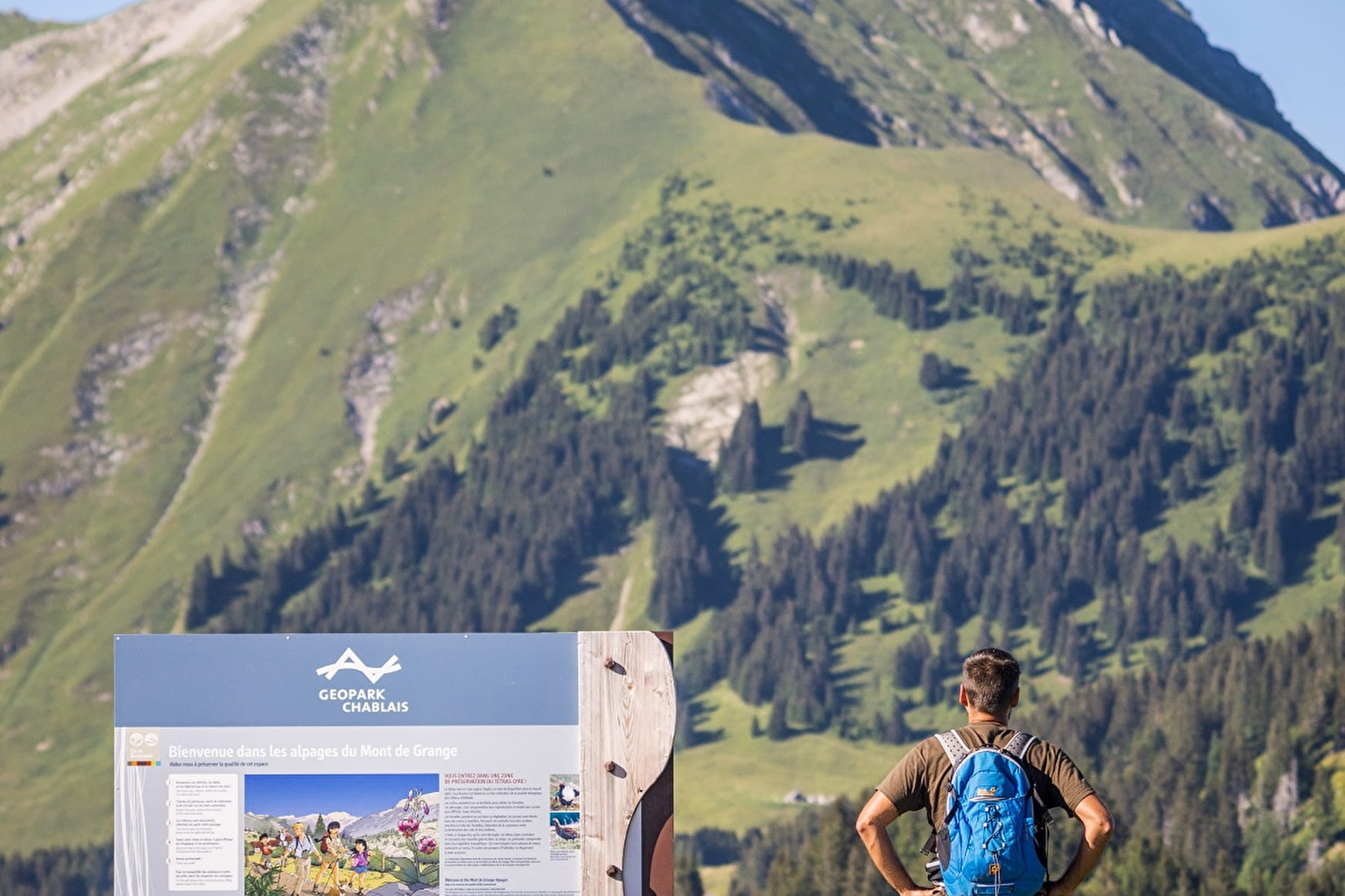
From the Col de Bassachaux (1777 m), a listed Geopark, you'll head for the Col de l'Aup Couti on an easy, fairly level path. From here, you can admire the view over the Aulps valley and Lac de Montriond.
You will then reach the foot of the Pointe de Chavache (1812 m). Here you can meet flocks of sheep. The winding path becomes steeper to reach the Col de l'Aup Couti.
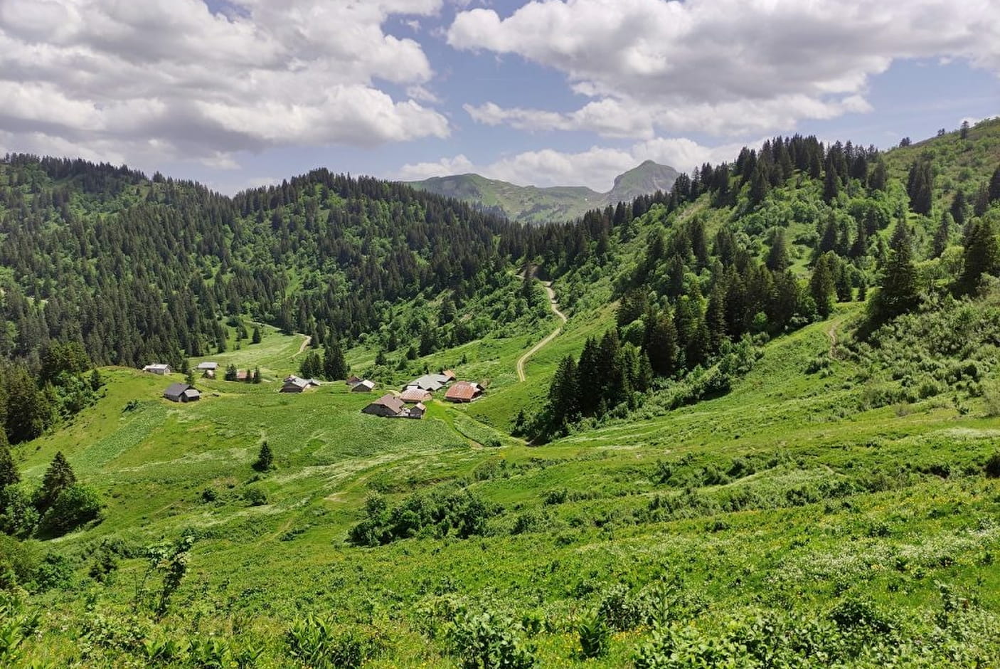
At Col de l'Aup Couti, you can admire Mont de Grange and the cliffs of Pointe d'Ardens. You then descend to the Chalets de Lens mountain pasture.
Then back up to the Col de Bassachaux via part of the GR5, which crosses the Abondance valley.
A great hike to enjoy the mountain scenery in a wild valley setting.
- Sport
Walking route -Col de l'Aup Couti from Bassachaux
A hike that takes you to the Col de l'Aup Couti with a view of Lac de Montriond, then on to the Chalets de Lens.
Sport Walking route -Col de l'Aup Couti from Bassachaux Châtel
About

Signs
Departmental signposting on a beige metal plate with green lettering.
Difficult passages
The return is via a steep passage (secured by a chain).
Map references
Portes du Soleil hiking map in France and Switzerland TOP 25 IGN N°3528 ET Morzine Massif du Chablais Les Portes du Soleil.
Topoguides references
Walking maps on sale at tourist offices in the Vallée d'Abondance.
Further informations
Stone, Ground, Grit
1 2


1 / Departure point: Col de Bassachaux parking lot 2/ Follow signs for "Col de l "Aup Couti" 3/ At the pass, descend towards "Chalets de Lens" 4/ Follow signs for "Col de Bassachaux".
Prices
Free access.
Reception
Whichever walk you choose, we recommend that you :
- Wear appropriate footwear and always take with you: warm clothing, preferably waterproof, plenty of water, sunglasses, sun cream and a small first-aid kit.
- Do not set off alone.
- Inform someone living in the valley of your plans.
- Do not change the planned itinerary indiscriminately. But do not hesitate to shorten it if necessary.
- Carry a map and even a torch.
- Check the weather forecast before setting off.
- In the event of a thunderstorm, move away from ridges, passes and summits as soon as possible and never take shelter under an isolated tree.
Pets accepted on a leash only.
Period of practice
From 01/06 to 30/09.
Accessible except during snow and depending on weather conditions.
Please check with the Tourist Office for the latest information on access conditions. This route is usually suitable for strong walkers during spring, summer, and autumn, except in adverse weather.
Subject to favorable weather.
Services
- Pets welcome
- Parking
- Picnic area
Contacts
Access
Head towards Châtel-Pré La Joux then Col de Bassachaux (mountain road).
- Not accessible in a wheelchair