The path starts at the bottom station of the Super-Châtel cable car.
First take the fairly steep path rising straight ahead to join the downhill ski slope rising on your left towards Le Crêt.
Halfway up this climb, follow the path to the right into a spruce forest and, after a short climb, fork left to reach the wide carriage road leading to Super-Châtel.
This path rises gently past the chalets de Conche, then follow the left-hand path back to Super-Châtel.
Just left after the chalets, take the track to the summit of Morclan. Climb back down to the Col de la Folière and back up to the Pointe des Ombrieux, then continue through the mountain pastures (Portes d'Onnaz) to join the path at the start of the Tour de Don ski lift.
From here, the path ends and takes you to a track leading up to the Chalets du Mouet.
Turn left and continue downhill to the intermediate station of the Barbossine chairlifts. Follow the path to Le Tenne (at the end of the Petit-Châtel road), and then take the footpath towards the top of the hill.
Take the path leading to Le Boude and continue to the village.
- Sport
Walking route - Circuit des Crêtes franco-suisses
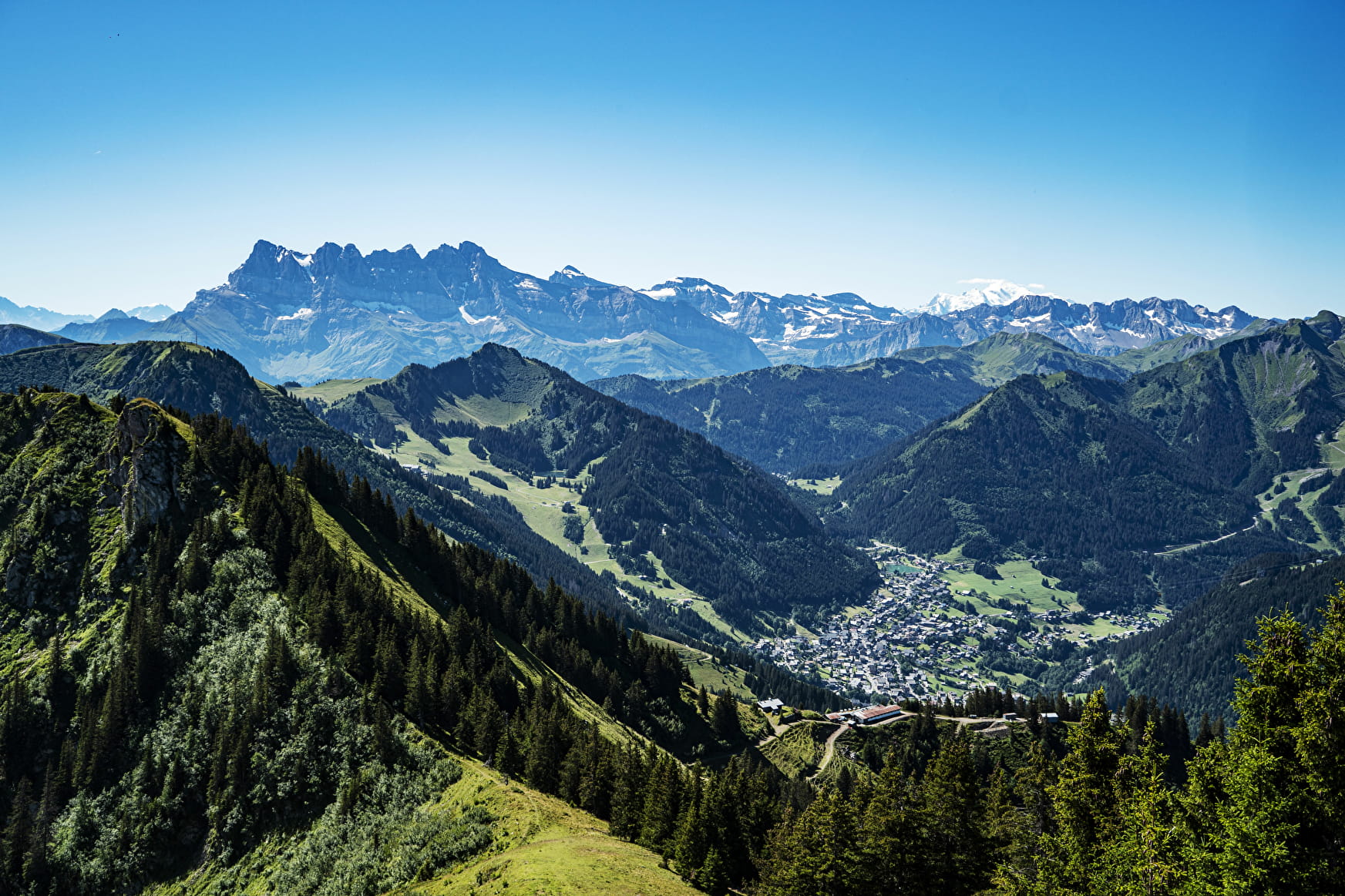
This is a magnificent route in fine weather, as the view from the crests stretches from the Mont Blanc chain to the main Swiss peaks. This area of ridges and passes was once a smuggling route between France and Switzerland.
About

Signs
Departmental signposting on a beige metal plate with green lettering.
Further informations
Stone, Ground
Prices
Free entry but parking fee is compulsory.
Reception
Whichever walk you choose, we recommend that you :
- Wear appropriate footwear and always take with you: warm clothing, preferably waterproof, plenty of water, sunglasses, sun cream and a small first-aid kit.
- Do not set off alone.
- Inform someone living in the valley of your plans.
- Do not change the planned itinerary indiscriminately. But do not hesitate to shorten it if necessary.
- Carry a map and even a torch.
- Check the weather forecast before setting off.
- In the event of a thunderstorm, move away from ridges, passes and summits as soon as possible and never take shelter under an isolated tree.
Dogs must be kept on a lead due to the presence of herds.
Period of practice
From 01/06 to 31/10.
Subject to favorable snow and weather conditions.
- Pets welcome
- Restaurant
- Orientation board
Contacts
Access
Underground car park at Place de l'église, charged in July and August.
Bus stop Place de l'église.
- Not accessible in a wheelchair