It provides a pantry for squirrels and birds and shelters many nests. Its wood is used for the production of carpentry and joinery parts.
Itinerary:
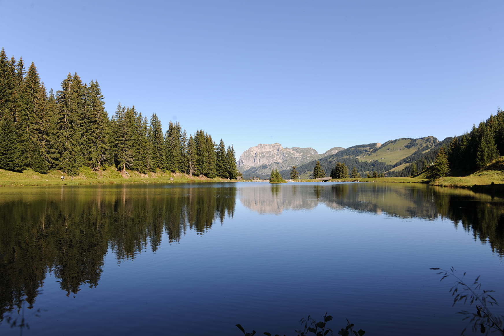
The start of the walk begins with a tour of Lake Vonnes to the fishing guardian's chalet and then slightly uphill towards the departmental road that you cross and take the path leading to Pas de Morgins.
At the pass, cross the departmental road again and take the path leading to the picnic area. Breathtaking view of the Lac de Vonnes.
Take the rising forest track, the view then opens onto the upper Abondance valley (the Linga and the Essert waterfall).
Once at the Sur le Bord chalet, the route crosses a spruce forest. After a short descent, you arrive at Lac de la Mouille, the ideal setting for a picnic. Take the road again, going down towards the chalets of Conche and after a few bends, you arrive at point 1395m where you take on the left the path plunging in the direction of Châtel.
Arriving above the cable car, take the track leading to Lac de Vonnes.
- Sport
Walking route - Boucle sur le Bord
During the ascent to the chalet of Sur le Bord, a beautiful forest of spruces offers itself to you. This conifer, too often confused with its cousin the fir, is essential to the ecosystem of the subalpine layer.

About

Signs
Departmental signposting on a beige metal plate with green lettering.
Difficult passages
Steep climb.
Map references
Top 25 IGN 3528 ET
Topoguides references
Châtel walking map for €3 Topo guide "Balades et randonnées en Vallée d'Abondance" (Walks and hikes in the Abondance Valley) for €5 (Maps for sale at the tourist office)
Further informations
Stone, Ground
Prices
Free access.
Reception
Whichever walk you choose, we recommend that you :
- Wear appropriate footwear and always take with you: warm clothing, preferably waterproof, plenty of water, sunglasses, sun cream and a small first-aid kit.
- Do not set off alone.
- Inform someone living in the valley of your plans.
- Do not change the planned itinerary indiscriminately. But do not hesitate to shorten it if necessary.
- Carry a map and even a torch.
- Check the weather forecast before setting off.
- In the event of a thunderstorm, move away from ridges, passes and summits as soon as possible and never take shelter under an isolated tree.
Dogs must be kept on a lead.
Period of practice
From 01/05 to 31/10.
Subject to favorable weather.
- Pets welcome
- Picnic area
Contacts
Access
Parking at the starting point. Shuttle bus line 4, Vonnes stop (July & August).