Starting point : Champagny Le Haut, parking du Bois
Arrival: idem
Duration: 4:45 hrs (2:50 uphill)
ATTENTION HERDS!
In summer, nearly 200 heifers (cows raised for their meat) are gathered on the Tovet mountain pasture, and several hundred ewes and sheep are scattered on the slopes of the Vélière mountain pasture. The flocks are free to roam under the surveillance of patous dogs, trained to deter them. As soon as it senses a danger, the guard dog barks at the intruder. The intrusion of any element foreign to the herd (wild animal, dog not held on a leash, walker, mountain bike, etc.) can disturb the peace and quiet of the herd, disrupting its proper functioning and the work of the shepherd: it therefore puts the guard dog on the alert. When you approach, the patou will come and sniff you out to identify you. It then returns to its herd. Sometimes it may also try to intimidate you. To avoid them, when approaching a flock of sheep, KEEP YOUR DISTANCES :
➟ if you cross a flock, go well around the grazing or resting area of the ewes: in this way you respect the work of the shepherds without disturbing the animals;
➟ beware of behaviour that seems harmless to you: (trying to feed, stroke, take a picture of a patou, a sheep, a lamb...): the guard dogs can interpret them as an aggression!
➟ when faced with a guard dog, adopt a calm and passive behaviour to reassure it. If you are impressed, slowly turn back;
➟ dogs are not allowed in this area (even on a lead).
- Sport
Vélière lake and Chiaupe alpine pasture
An itinerary that takes you on the southern slope of the dale through beautiful mountain pastures and the ruins of Tovet.
About

Topoguides references
Sheet n°7 from the guide book.
Further informations
Stone, Ground


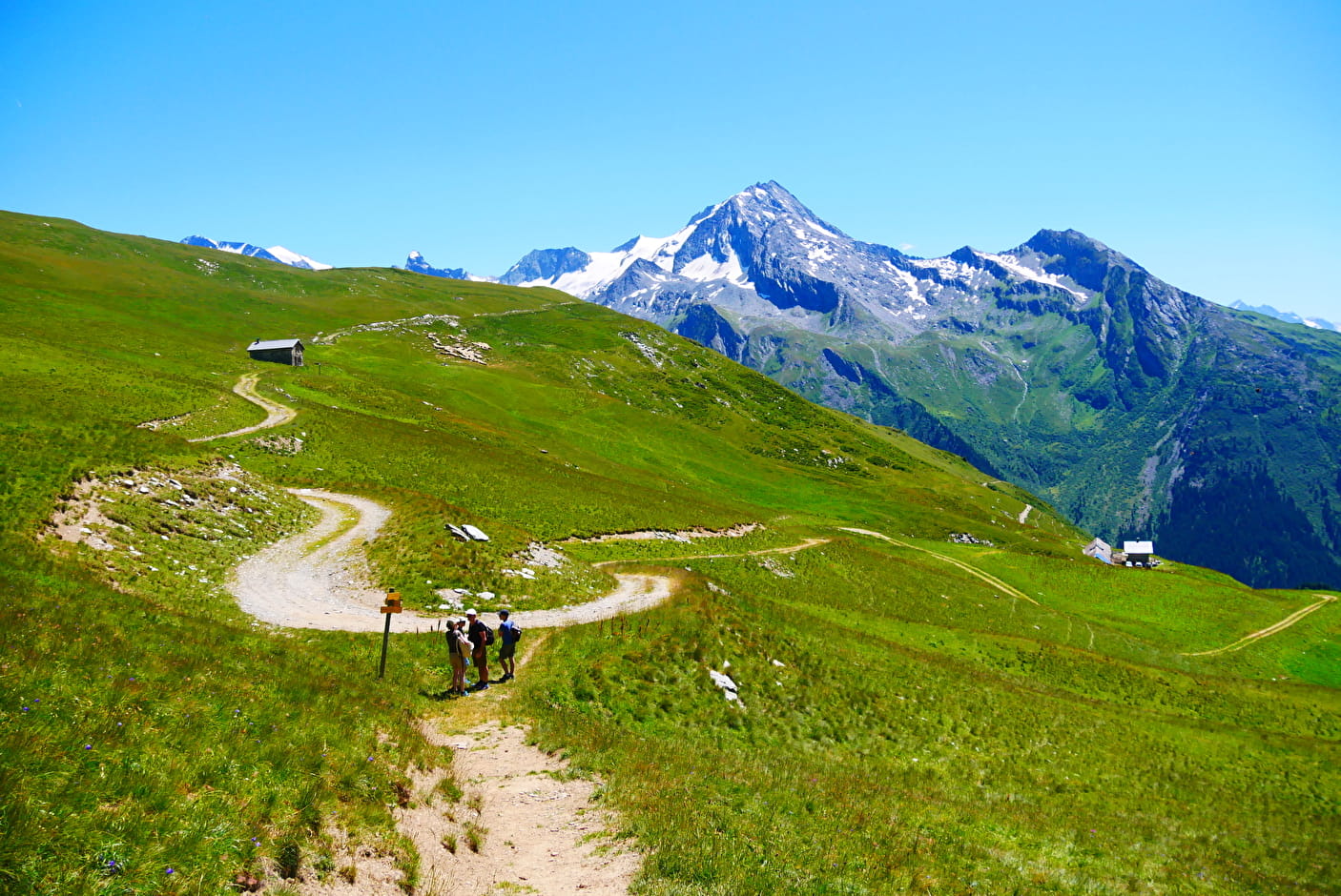
0/ From the wood car park, turn right back onto the tarmac road, then right onto a track alongside the stream, crossing the road leading to the centre of the village of Le Bois.
1/ At the bridge, take a track that runs along the stream; at the end, a path rises to the left across the large grassy slope, then a scree.
2/ At the crossroads, turn right (direction La Vélière) to pass under the rocky bar; higher up, the path zigzags up a grassy combe.
3/ At the top of this coomb (alt. 1930 m), do not take the track that takes you directly to La Vélière, but take on the right a path that climbs on the ridge (direction Col de la Chiaupe), then in the meadows and wet pastures to the ruins of Tovet (alt. 2120 m).
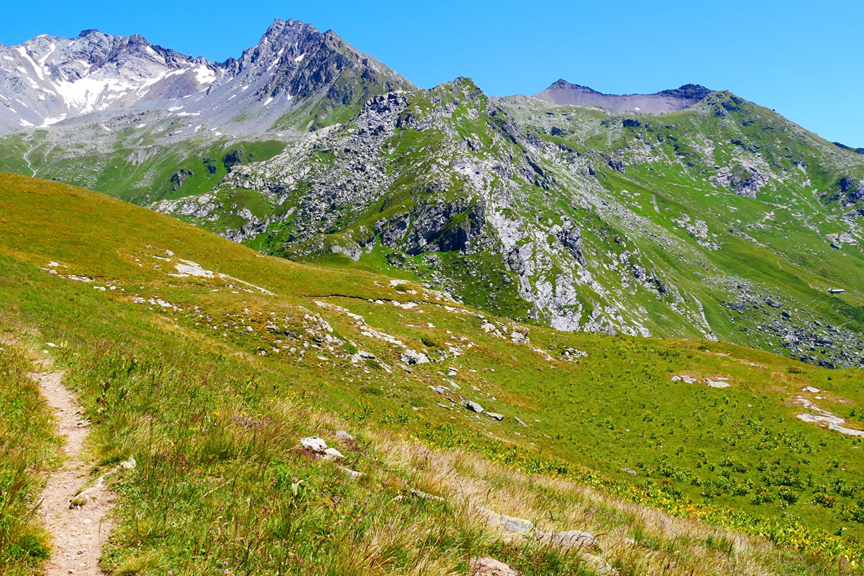
Go to the right (east) to go up a track that crosses to the stream and then joins the alpine pasture of La Chiaupe (alt.2240 m); the track continues straight on and then returns to the left (crossroads).
4/ Turn left (south) to go down towards the Vélière mountain pasture; the track passes near the small "lake" (gouille) of La Vélière (alt.2390 m), goes straight on at first and then makes a big bend and reaches the Vélière mountain pasture (alt. 2162 m).
5/ From there, descend by the path then the steep track through the alders to reach the top of a combe and the ascent route.
We switch to the left (east) to join the Champagny le haut valley and the starting point.
SHORTER ALTERNATIVE (3h-3h30 loop): at the ruins of Tovet, turn left towards La Vélière. This alternative will not take you to the La Chiaupe mountain pasture or to the small lake of La Vélière.
Prices
Free access.
Reception
Period of practice
From 01/05 to 01/11.
Subject to favorable snow and weather conditions.
- Car park
- Free car park
Contacts
Access
- Not accessible in a wheelchair