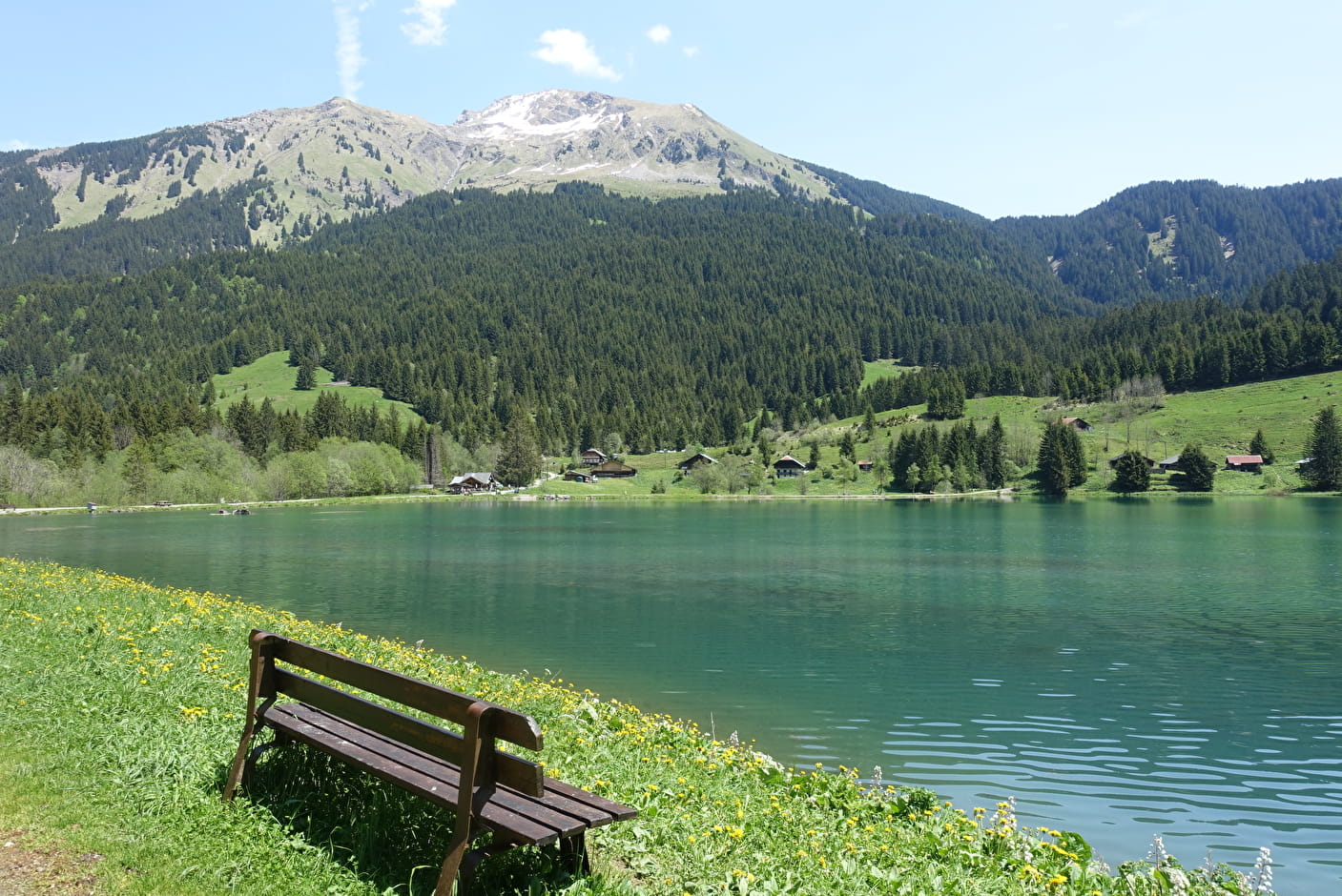
The tour of Lake Plagnes is a pleasant little walk in the summer. Picnic tables and benches allow you to enjoy this refreshing place.
The Plagnes lake is Unesco Chablais Geopark site. From the glaciers to the bulging peat bogs, the path around the lake takes you through the landscapes that have succeeded one another over the last 20,000 years.
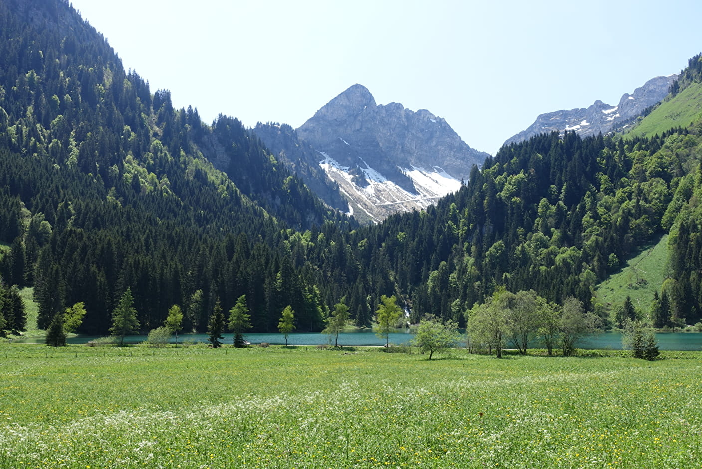
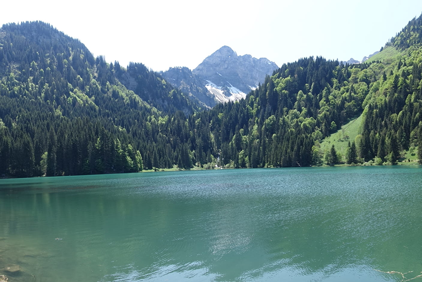
In May and June, when the ice melts, the water level of the lake is at its highest, the turquoise waters and the still snow-covered peaks make it a magnificent place to discover. A variant via the Cubourré waterfall is possible at the end of the lake where you can discover beautiful waterfalls.
From the lake, you can see the sunny side of the Mont de Grange, the highest point in the Abondance valley at 2,432 m.
This hike is accessible for families (the smallest will have to be carried in a baby carrier) and children from 4 years old.
We advise you to be well shod as, depending on the weather conditions, the path can be slippery, especially in spring and autumn.
The dike is accessible to most people but the tour is not accessible to people with walking difficulties.
The fishermen's path is not recommended as it is difficult to access and not suitable for walkers.
- Sport
Tour of Lac des Plagnes
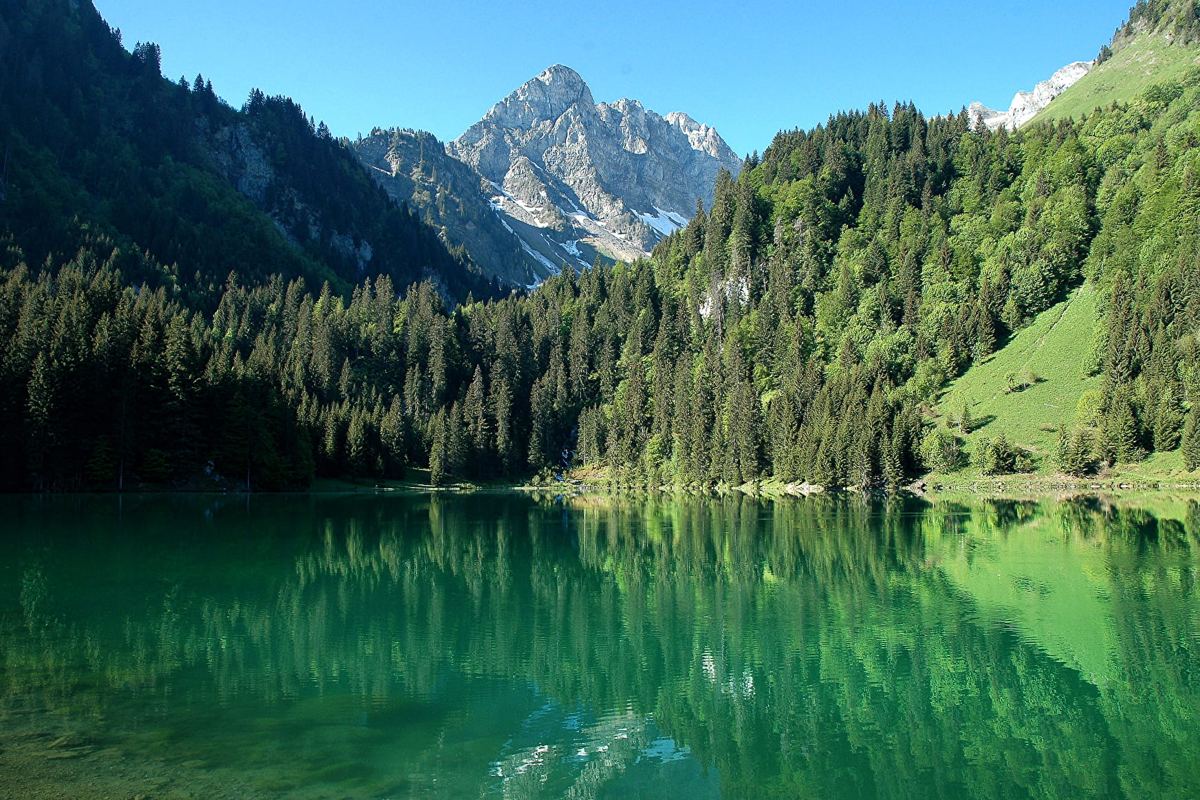
The Lac des Plagnes is the largest lake in the Abondance valley. Accessible by car, it is located 5 km from the centre of Abondance village. A short walk around the lake to refresh yourself in a mountainous setting.
About

Signs
Departmental markings called P.D.I.P.R. on beige metal panels with green lettering.
Topoguides references
On sale at tourist offices in the Vallée d'Abondance.
Further informations
Stone, Ground, Hard coating (tar, cement, flooring)


Start: Lac des Plagnes parking lot
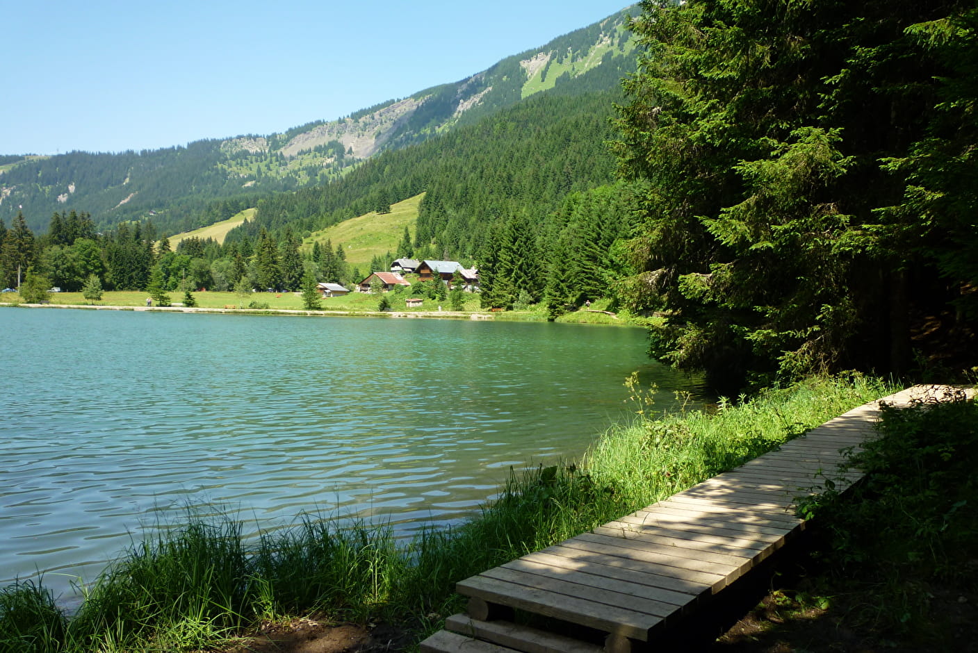
1/ Go down to the edge of the lake and continue along the dike, following signs for "Chalets de Lens" via the "refuge des Tindérêts". Turn left at the end of the dike.
2/ Around the lake on a fairly wide path. Follow "Tour du lac" (wooden markers).
Caution: it is not advisable to take the "sentier des pêcheurs" (fishermen's path) at the very edge of the lake, which becomes quite difficult to access when the ground is wet.
3/ At the end of the lake, after the small bridge, take the path up into the forest on your right.
4/ The tour ends with a descent to the lakeside just below the chalets. Cross several wooden footbridges to reach the dike, planted with larch and birch trees.
5/
Option to extend the tour: 250 m ascent, 2.5 km walk.
Variant via the Cubourré waterfall: after taking the path to the right of the lake, at the end of the lake, before the wooden bridge, take the path towards the Tindérêts refuge and Cubourré. Take the forest track on the left down to the lake parking lot.
Prices
Free access.
Reception
Dogs must be kept on a leash (fishing area) and wildlife.
Period of practice
From 01/05 to 01/11.
Trail accessible with the arrival of good weather. In case of snowfall, avalanche passages. Access prohibited at the end of the lake in winter. Ask at the Tourist Office.
- Pets welcome
- Restaurant
- Parking nearby
- Free car park
- Car park
- Picnic area
Contacts
Access
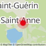
Lac des Plagnes car park located less than 10 minutes by car from the centre of the village of Abondance, take direction Lac des Plagnes.