- Sport
Tour du Thabor - Etape 2 - Du Refuge des Marches au Refuge du Thabor
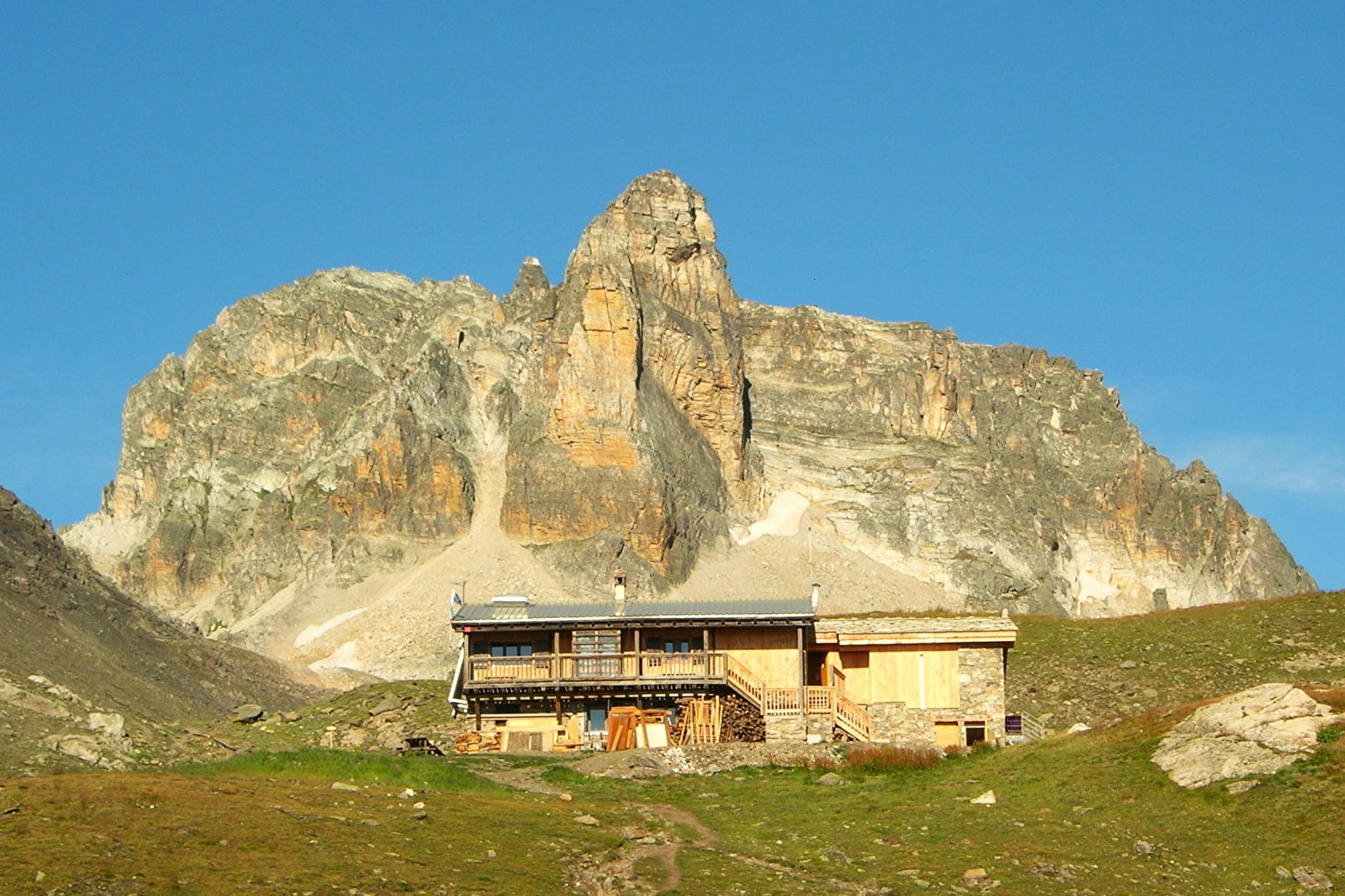
The Tour du Thabor is a cross-border trail linking the Vallée de la Maurienne, the Haut Val de Suze and the Clarée. This is a hike of average difficulty which enables walkers to discover varied landscapes, via mountain passes and crossing from valley to valley.
Sport Tour du Thabor - Etape 2 - Du Refuge des Marches au Refuge du Thabor Valmeinier
About

Further informations
Stone, Ground
1 13


Reception
Services
- Pets welcome
Contacts
Access
IGN 3535 OT Névache Mont Thabor - Topoguide "Autour du Thabor
Car access and parking
From the A43, exit at Saint-Michel-Valloire, then go up towards Valloire
(D902), then Valmeinier 1500 (D215A). Go to the Chef Lieu and 100 m
left after the Taverne, follow "la ville Dessus" and park.


