- Sport
Tour des Charbonnières: A10 Hiking Path
Bagné parking lot on the edge of the D921 (Attignat-Oncin road).
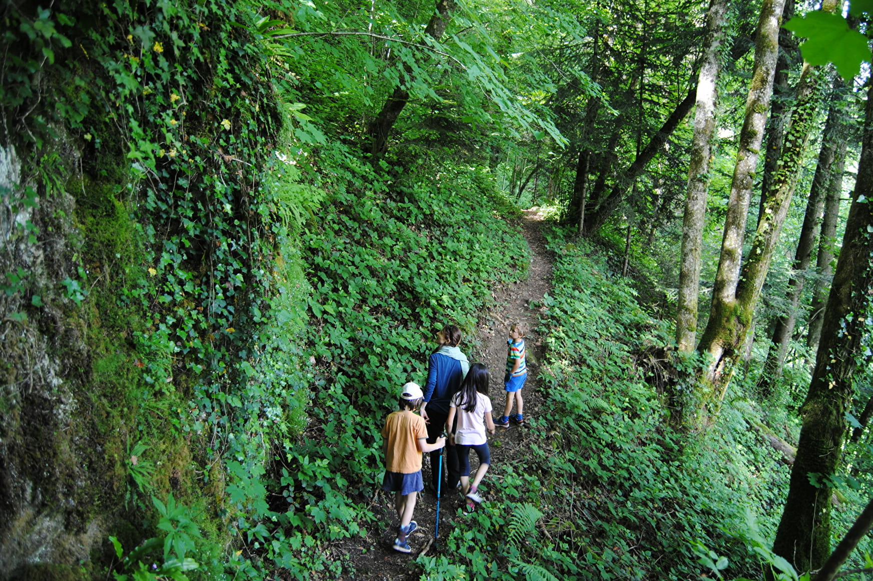
On a route of 5 km, you will be surprised by the diversity of natural habitats that you will cross: wet undergrowth, farming pastures and small hamlets...
Sport Tour des Charbonnières: A10 Hiking Path Attignat-Oncin
About

Signs
From the parking lot, cross the road at the bridge and follow directions for Bagné (yellow signage). After 200m along a small road, the trail runs alongside a prairie before leading into the Grenand Canyon forest.
Difficult passages
Caution! Short craggy pathway with a metallic footbridge and handrails. Very slippery sections in rainy days.
Further informations
Stone, Ground
1 1

Reception
Period of practice
All year round.
Services
- Pets welcome
