

From spring to autumn, you will be dazzled by the shimmering blue waters.
Melodic accents, straight from neighbouring Italy, resonate in your ears and
give this hike an exotic flavour. You advance at your own pace, staying alert
as you feel a few stones rolling under your shoes. The challenge of the day
comes when you cross a delicate passage equipped with a handrail. On the way
back, the passage makes you feel like you're diving into a great blue ocean.
The Mont-Cenis Pass, trodden by countless tradesmen since the Middle Ages,
reveals its most captivating stories at the Pyramid Museum. Here, at 2,000 m
of altitude, you'll find a harmonious blend of agriculture, military heritage,
hydroelectric power, water activities, and relaxation.
In summer, it's a paradise for Tarines and Abondances dairy cows. Lovingly
cared for by their breeders, their milk produces exceptional cheeses such
as Beaufort d'Été and Bleu de Bonneval. If you make a quick detour to the
alpine farms near the lake, you're in for an unforgettable tasting experience.
- Sport
The shores of Mont Cenis lake
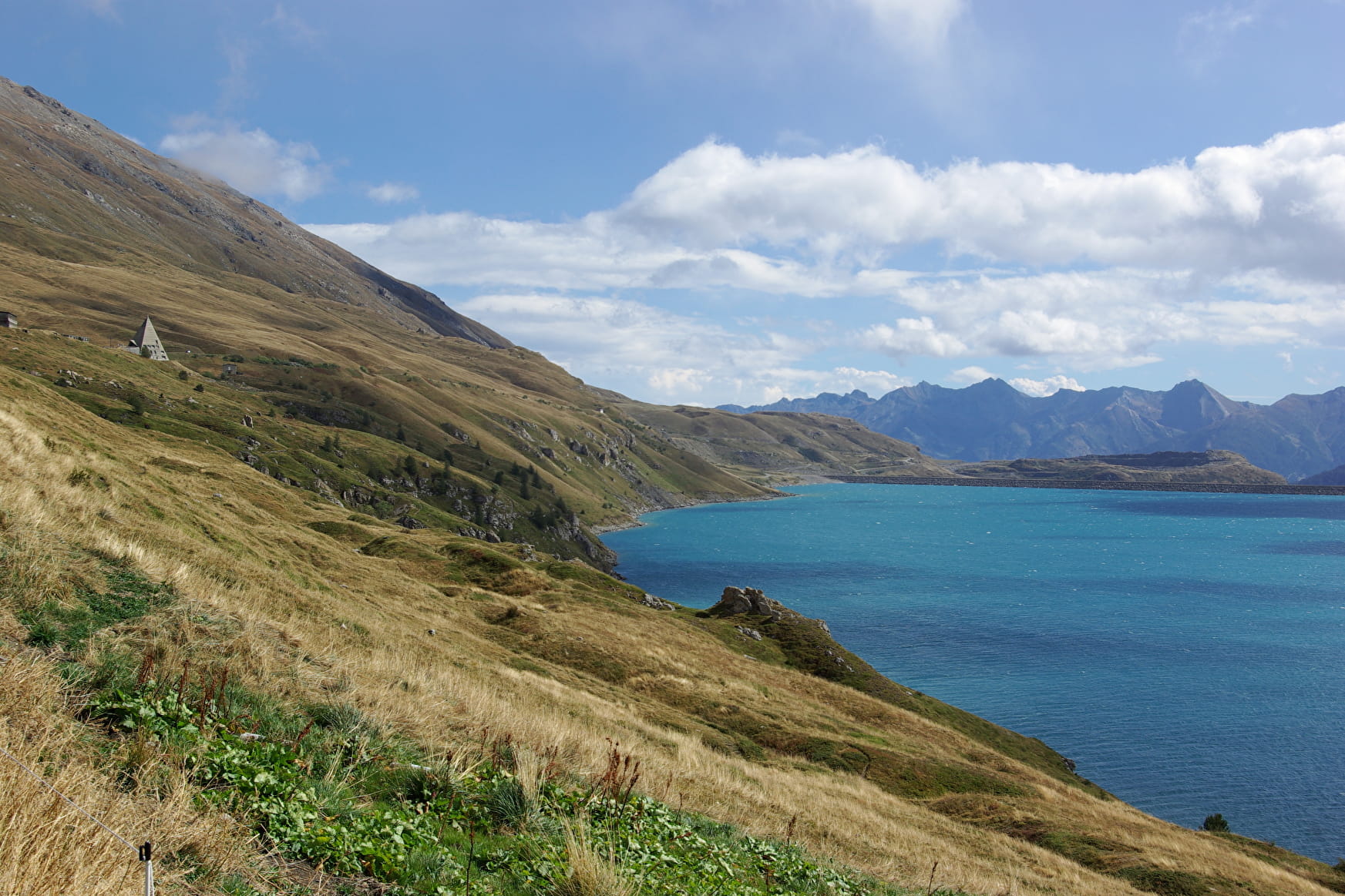
Steady legs and a strong heart are the key ingredients to fully enjoy the
thrilling section that spices up this trail. Ready for a little adventure at
this epic site?
Sport The shores of Mont Cenis lake Val-Cenis
About
Signs
Departmental signposting (PR)
Difficult passages
Pay attention to the passage equipped with cables and rungs in the gorges of the creek of Ronce.
Map references
Map and Booklet "Walks and Hikes Haute Maurienne Vanoise" (sold 10 € in Tourist Office)
Topoguides references
Blue route n°44
Further informations
Ground
Prices
Free access.
Reception
Pets allowed on leash only.
Period of practice
From 01/06 to 01/10.
Subject to favorable snow and weather conditions.
Services
- Pets welcome
- Parking nearby
Contacts
Access
I go by bus: park in the Molin parking lot - just below the Le Toët alpine gîte.