The Lac de Roy is a superb mountain lake at the heart of the pastures, perfect for a revitalising break!
At the summit, there are two orientation tables with a 360-degree panoramic map so you can understand the view better. From mid-July to mid-August, you can access this area on a cable car. You will be able to see all the way from the Jura Mountains and Lake Geneva, to the Chablais Mountains, Mont-Blanc and the Aravis Mountains.
- Sport
The Pointe du Haut Fleury
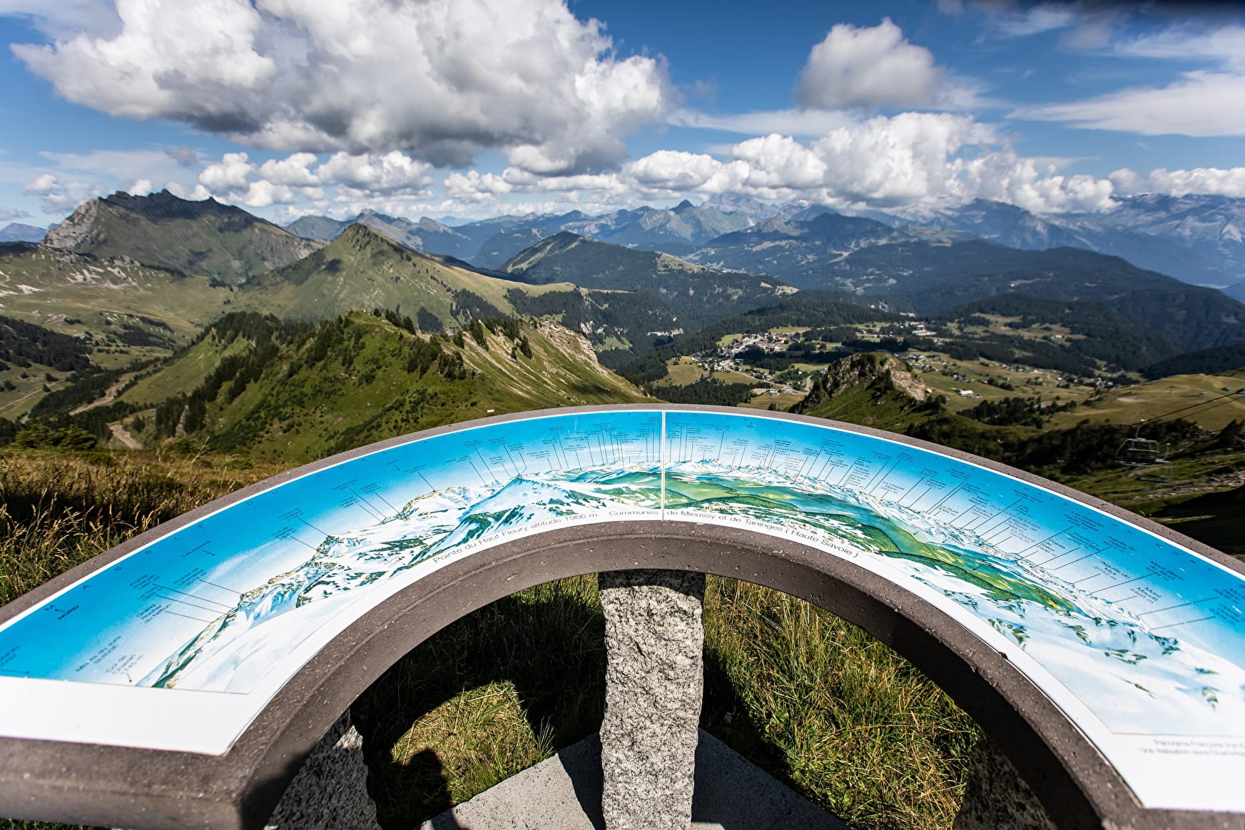
Family-friendly hike through the Praz de Lys Sommand Alpine pastures. When you get to the summit, the view from Lake Geneva to the Alps is remarkable.
Sport The Pointe du Haut Fleury Taninges
About

Further informations
Stone, Ground
1 1

From Les Molliettes, follow a rocky path that very quickly turns into a steep slope up to the Lac de Roy. Go alongside the lake to the left and take the steep footpath up the mountainside through the pastures until you reach the wide footpath to the right, towards the Pointe du Haut Fleury at an altitude of 1,981 metres. Come back along the same route.
Prices
Free access.
Reception
Period of practice
From 15/05 to 15/11.
Subject to favorable snow and weather conditions.
Services
- Pets welcome
- Accessible via ski lift
- Car park
- Public WC
- Orientation board
