ITINERARY
At the edge of Les Eucherts, just before the Plan de l'Arc, take upper track towards the Combe des Moulins. Just after the bottom of the Fort chairlift turn right onto a pathway. At the sign for the "Source Captée", turn off onto the path on your left, which heads up the middle of the fields towards the pass. As soon as you reach the Traversette pass, turn right and walk around the side of the Combe des Moulins. Continue along the path around the mountain face for about 800m then climb up the path on your left to the ridge. After the next rock, you will reach the cross on top of the Mont Valezan. At the summit, take time to enjoy the unhindered views over Italy and the Mont Blanc massif. Take the same route back down to Les Eucherts.
- Sport
THE MONT VALEZAN
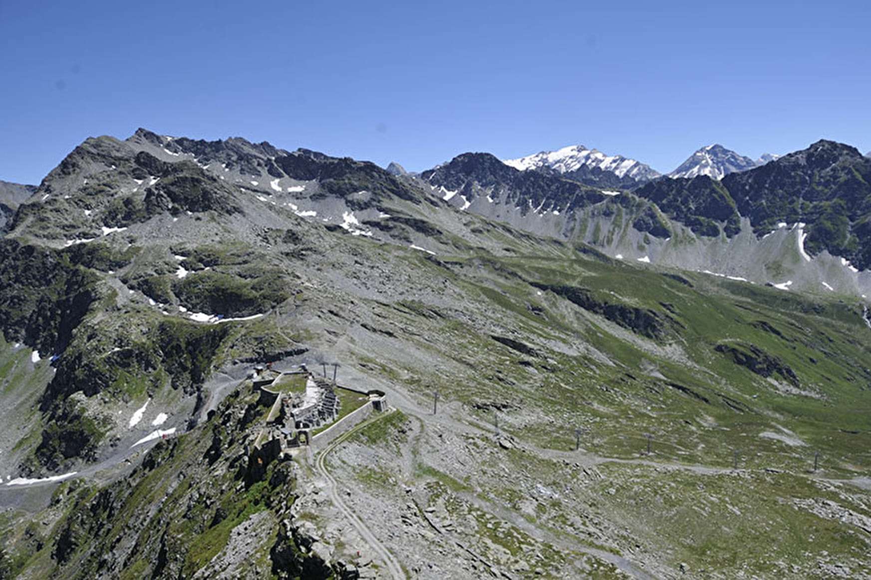
Climb up towards the Italian border and drink in the stunning views of Mont Blanc and the Alps. Start: Plan de l’Arc. Competent hikers.
About

Difficult passages
The final climb to the Mont Valezan cross is steep and can make you dizzy.
Prices
Free of charge
Reception
Period of practice
From 15/06 to 15/10 : open daily (subject to snow cover).
Services
- Pets welcome
- Accessible via ski lift