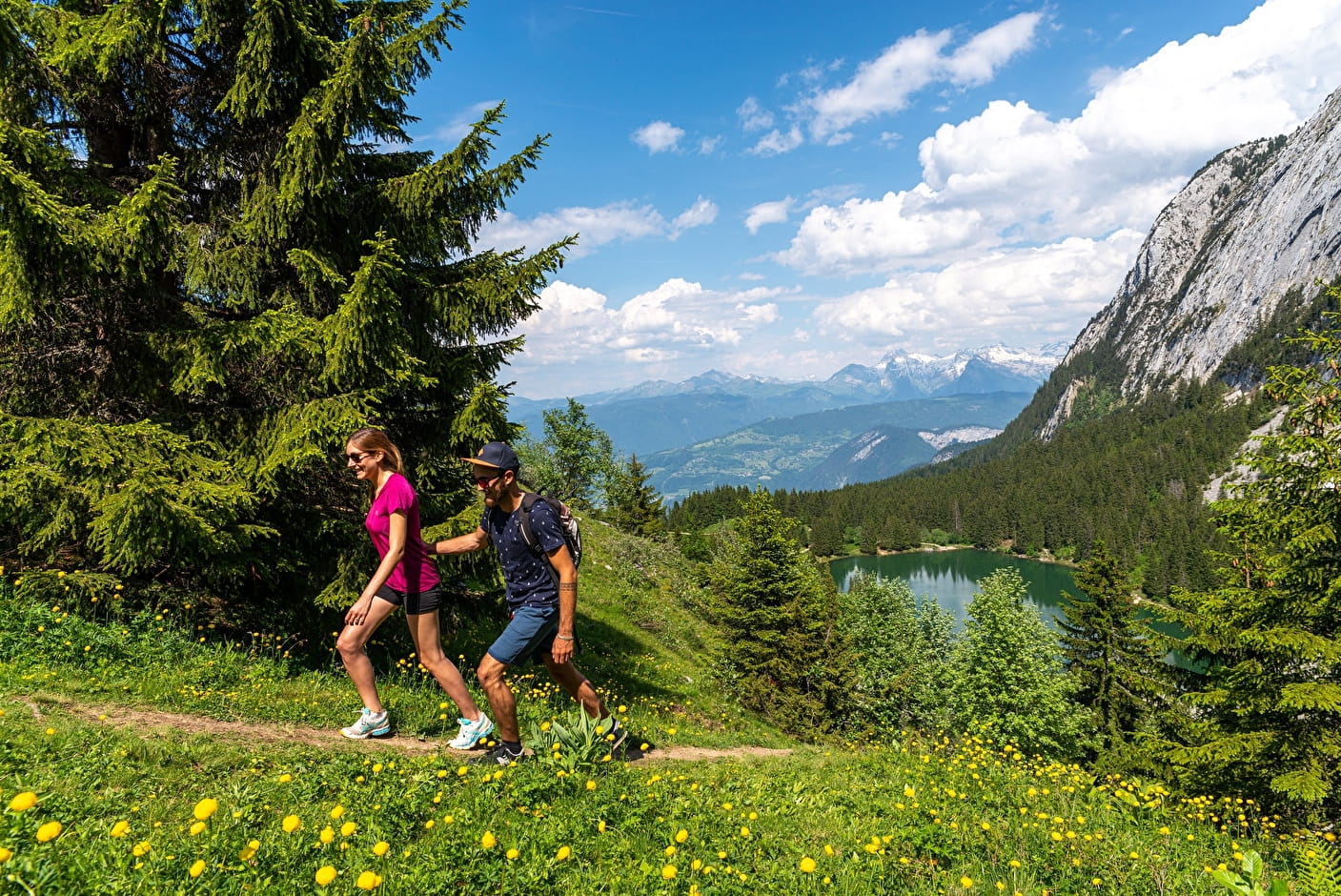
Step-by-step guide : From the car park, follow the wide track which goes up in the direction of Lac Bénit. It goes up in the forest before going alongside the ski lift. In front of you, the two characteristic eyes of little Bargy. At the Pierre à Muselire, descend by the lake. The return is by the same route. To make the Lac Bénit loop more: From Lac Bénit to Morsullaz (parking): 1h20 Go up to the Pierre à Muselire sign. Go left towards Enténiou. Go around the top of the chairlift on the left to descend towards Morsullaz (parking). Under the cliffs of Grand Bargy, you will reach the ski slope. Take a right to enter the forest and join the departure of the chairlift. From Morsullaz (parking) to Bété (parking): 25 minutes Follow the path on the right across the fields towards Les Côtes. At Bété d´en Haut, leave the path and take the paved road which will bring you back to the Bété car park.
- Sport
The blessed lake - Hike
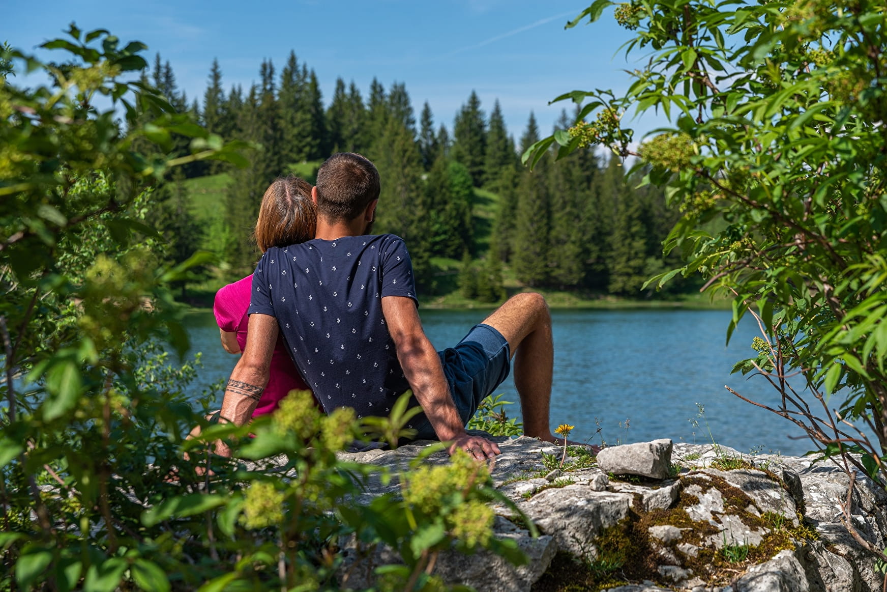
A lovely family walk that offers a wonderful view of the surrounding valleys and mountains.
Bivouac is prohibited around the lake.
About

Signs
Trail marked with directional posts (PDIPR)
Map references
TOP 25 IGN 3430 ET
Further informations
Ground, Grit


Buvette du Lac Bénit open from Pentecost to September.
Possibility of fishing in Lake Bénit from June. License on sale at the Tourist Office.
Lac Bénit is located on the north face of the Bargy massif and straddles two municipalities of the Community of Municipalities Cluses Arve and Mountains (2CCAM): the municipality of Mont-Saxonnex and the municipality of Marnaz. Covering an area of 4 hectares for a maximum depth of 8 meters, it was formed following a glacial retreat, more than 10,000 years ago. The site presents a mosaic of environments favorable to the presence of exceptional fauna and flora: the lake and its meadows, meadows, spruce forests, scree and cliffs.
Due to its remarkable natural heritage and its unique landscape setting, Lac Bénit is included in the Natura 2000 site of the Bargy massif, designated to protect a certain number of habitats and species representative of European biodiversity.
All the fauna typical of the mountain environment can be observed there: ibexes, chamois, marmots... The site is also flown over by the bearded vulture, a large vulture reintroduced into the Bargy massif at the end of the 1980s. The lake and its surroundings are the refuge for many species: newts, toads and frogs, dragonflies and other insects, fish.
The Lac Bénit site is marked by high visitor numbers and presents conflicts of use, particularly in connection with the work carried out by the alpine pastor on land grazed by the cattle herds that maintain the site. Attendance, if it is not channeled and respectful, induces significant disturbances both for the mountain pasture but also for the biodiversity of the site. The communities and the various local players are working to solve the problems encountered, in particular by implementing the actions defined in the site management plan.
Prices
Free access. Guidebook on sale at the Tourist Office.
Reception
Keep your dog on a leash, he can scare off herds and wild animals.
Period of practice
From 01/04 to 14/11.
- Pets welcome
- Sustainable development
- Outhouse
- Picnic area
Contacts
Access
From the Arve Valley, take the direction of Mont-Saxonnex. Go through the village. After the tourist residence Le Jarbay, be vigilant and turn left towards route de Morsullaz, chairlift. Continue for 2 kilometers. On your right a wooden sign indicates the car park on the left before the houses of this hamlet.