


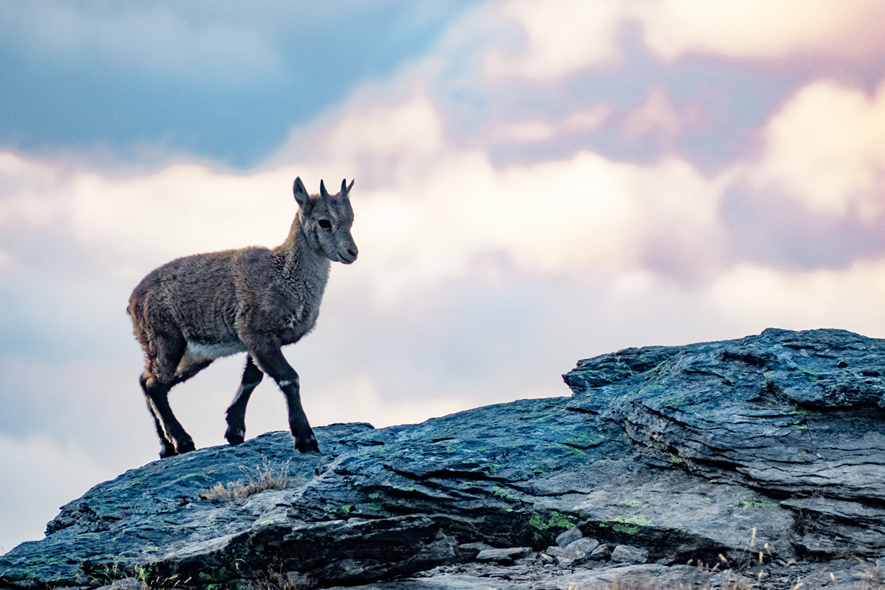
The majority of the circuit passes through a busy and perfectly marked path. You'll reach the Col de la Masse at 2,923 m without difficulty. If you're lucky, you might even come across "étagnes", female ibexes, accompanied by their adorable young, known here as "éterlous". From cairn to cairn, make your way between the boulders as you tackle the last ascent. The view awaiting is unforgettable – and well-deserved! What that 4,810-metre-tall you can see in the distance? After a moment of contemplation at the highest point, your next reward
appears: Plateau du Mauvais Berger. The marmots have set up a base camp here. Look at them fooling around among the blueberries and rhododenrons. Before reaching the Col du Barbier, picture how the plateau would look in autumn, all decked out in flamboyant colours. Now, that's a sight worth seeing! With your mind already filled with precious memories, take your time walking back to the well-marked GR® trail southwards. You're still feeling full of energy, and you make light of the descent, back towards Plan d'Aval. Let's go! One last push and you'll deserve a hero's welcome at Plan d'Amont.
- Sport
The Aussois rake
Reach the "3,000" mark, with a panoramic view of high mountain peaks, so close it feels like you could reach out and touch them. Râteau d'Aussois is a summit that's accessible enough, provided you're sure-footed. At the end of your ascent, be prepared for the presence of late snow patches until July.
Sport The Aussois rake Aussois
About
Signs
Mixed signposting (PR, PNV and GR)
Map references
Map and booklet "Haute Maurienne Vanoise. 103 walks and hikes - 38 trail trails. For all levels" (sold for €10 in Tourist Offices)
Topoguides references
Black route n°97
To guide you in the field, consult the "step-by-step" directional diagram provided in pdf.
Prices
Free access.
Reception
Period of practice
From 15/05 to 15/10.
Subject to favorable snow and weather conditions.
Equipments
- Parking nearby
Contacts
Access
By car: park in the Carrière parking lot between Plan d'Amont and Plan d'Aval.