
Pass the tennis courts (on the left below the road), and follow until a crossroad. Take the dust road on the right (follow the sign posts).
- Sport
Station -la Maîtaz - le Rey
Take the road that climbs behind the tourism office, then first left (route des espagnols).
Sport Station -la Maîtaz - le Rey Peisey-Vallandry
About

1 4


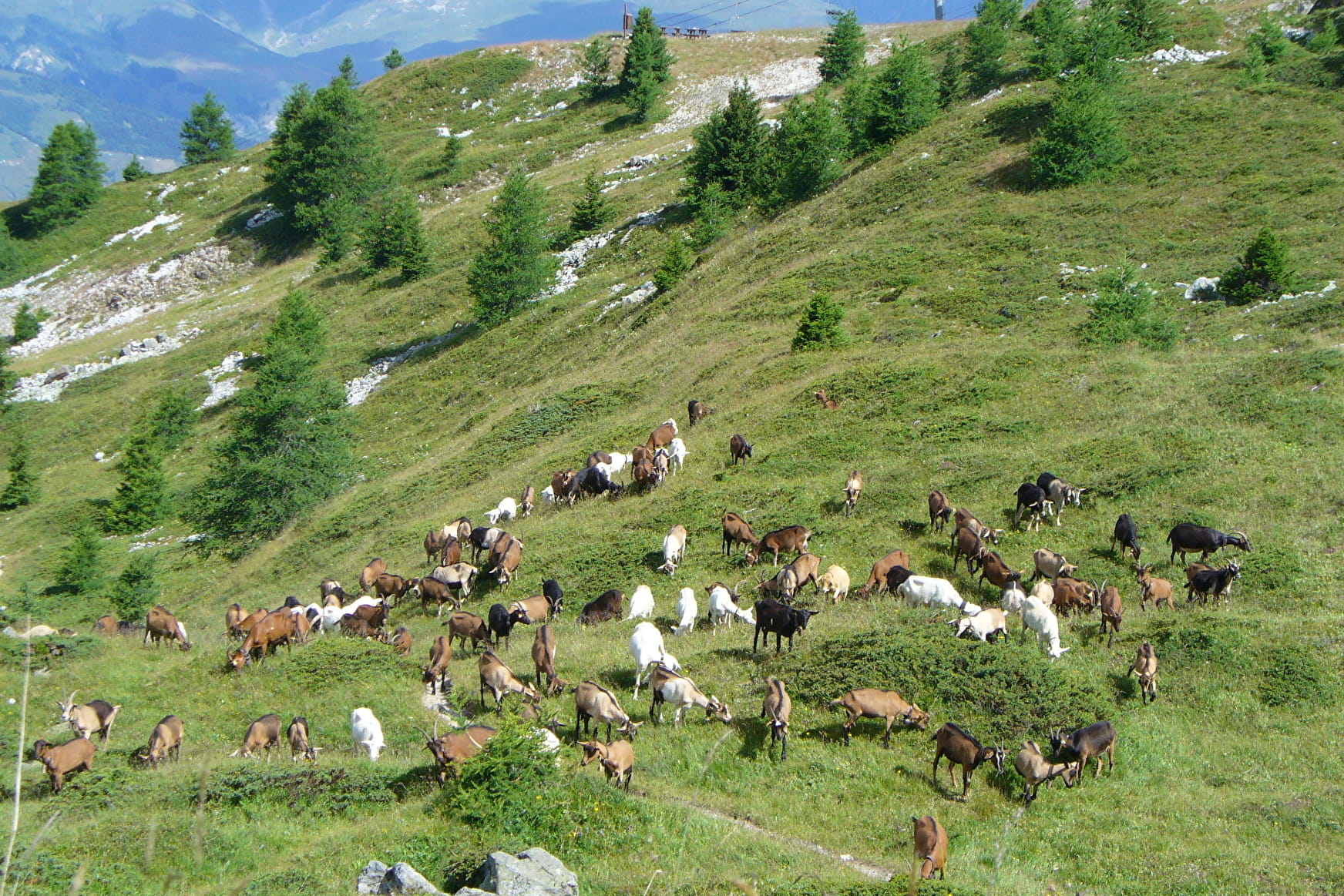
Above Vallandry, take the route des espagnols for a few dozen metres. Before entering the forest, climb to the right to join the forest trail next to an erratic boulder (large rock left there by a glacier. This one has 3 beautiful prehistoric cupules dating back at least 5,000 years! ). This path crosses a ski run and a pastoral track to catch a glimpse of the Maïtaz clearing, before Arc 1800. We return to the forest to climb to the next clearing: Praz-Pellier, (1870 m) from where the path returns south through the forest to the Rey sheepfold (2056 m) (caution: possible herds and patous guard dogs)
The descent: the path goes down under this Bergerie and joins the Plan-Peisey forest to the south by the Plan de l'ours. You arrive just above the Vieux-Plan.
Reception
Services
- Accessible via ski lift
Contacts
Access
From Vallandry, take the route des espagnoles, then turn right onto La Maïtaz


