Don't miss the view of the village centre, with the summit of Pic de la Corne in the background, from the hamlet of Le Crêt!
Seytroux river walk
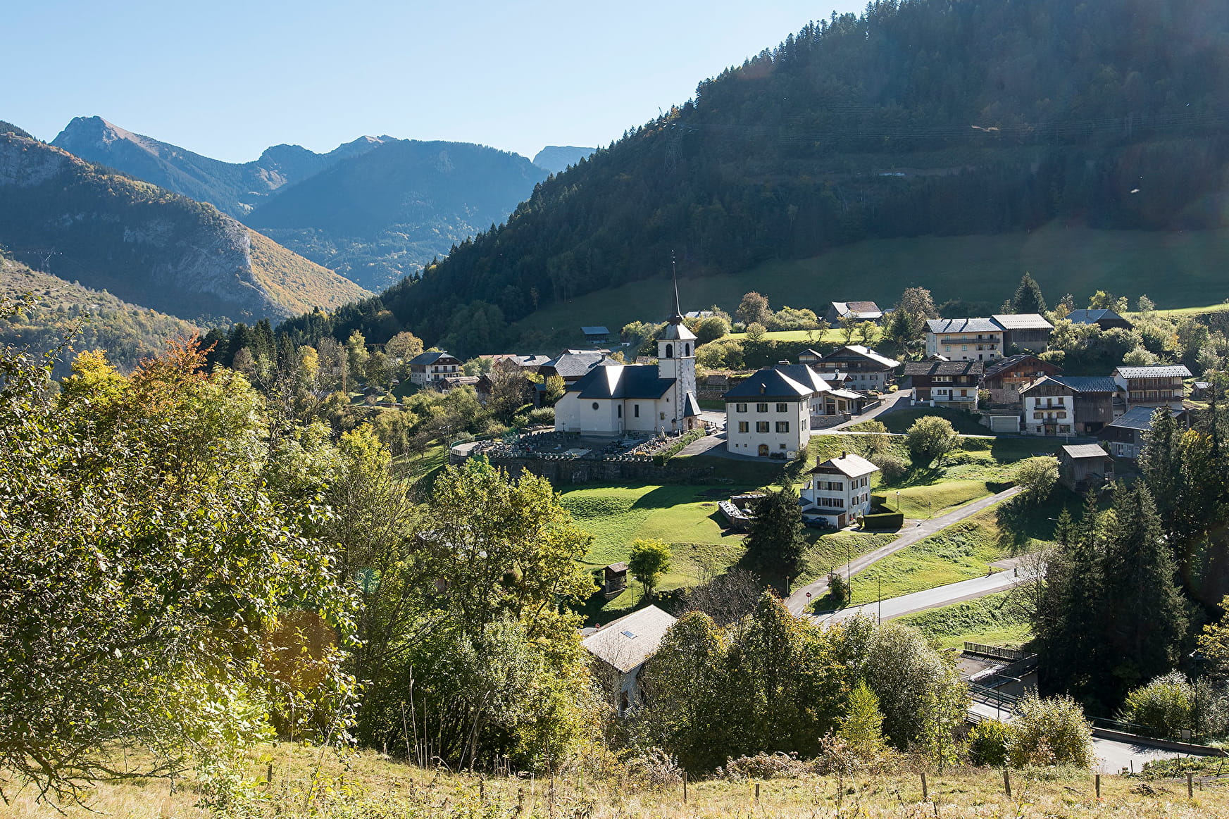
A family walk that begins with a peaceful path along the Seytroux river, known here as the Nant de Seytroux, before exploring the hamlets of Seytroux and their traditional houses.
Seytroux river walk Seytroux
About

Signs
Beige panels with black lettering and green arrows
Map references
Map: IGN TOP 25, 3528 ET, Morzine
Further informations
Ground, Hard coating (tar, cement, flooring), Grit
1 1

Start: Seytroux mini-golf car park
1/ From the car park, cross the wooden bridge and turn right onto the path that runs alongside the torrent.
2/ After about twenty minutes on a pleasant forest track, the path crosses the torrent on a bridge and rejoins the road.
3/ Head towards Les Meuniers.
Continue along the road, passing through a number of hamlets (Les Landoz and Le Crêt) where you will still find a number of houses with traditional architecture.
4/ After Le Crêt, take the path that crosses the meadow to the right and rejoins the road that leads to the car park.
Prices
Free access.
Reception
- Choose your route according to your physical condition and the weather conditions.
- Follow the instructions for signposting.
- Don't set off too late in the afternoon, to make sure you're back before dark.
- Take sufficient food and water with you. Mountain sports require a lot of energy
Pets allowed
Period of practice
All year round.
Recommended practice period: all year round. Can be done in all weathers.
Subject to favorable weather.
Services
- Pets welcome
- Car park
- Free car park
- Play area
- Picnic area
Contacts
Access
Departure from the mini-golf car park in Seytroux
> Access by car from Thonon or Cluses via the D902 then the D294 to the roundabout (opposite the Kern restaurant), turn right then left just after the bridge (route des Meuniers), parking 200 metres further on the left.
> Access by shuttle bus: Balad'Aulps Bus stop (valley shuttle bus) in front of the Kern restaurant (200 metres from the start of the walk).
