
Roche Veyrand is 1420m high. A tiny peak compared to its neighbours, Grand Som and Mont Granier. But it doesn't let itself be beaten! From the cross, you have a panoramic view. The village of St Pierre d'Entremont will seem very small from up there! And the climb starts at an altitude of 650m, making it one of the most challenging in the Entremonts! You'll be climbing ‘dré dans le pentu’ as we say in Savoie! It's on the limestone cliff that you walk along that thrill-seekers can enjoy the via ferrata. The return journey is much more leisurely, along a gently sloping path that leads to the small hamlet of La Fracette, a typical Cartusian village. Back in the village, you'll find everything you need to eat or drink!
- Sport
Roche-Veyrand - Sommet
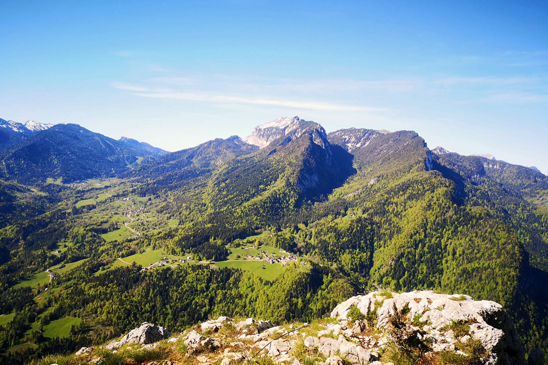
A beautiful and challenging hike, typical of Chartreuse, between forests and limestone. In spring, you can meet a lot of orchids along the way.
Sport Roche-Veyrand - Sommet Saint-Pierre-d'Entremont
About

Signs
Departure signs are set up in the villages at parking and public access points. To follow your itinerary, posts are set up at crossroads and identified by a plaque indicating its name and altitude. Between two posts, paint markers indicate the path to follow or not. You can also be guided by small signposts. Map "Promenades et randonnées en Chartreuse" recommended.
1 1

Ascent: 1/ Take the bridge opposite the church in Saint-Pierre-d'Entremont Savoie, then turn left and immediately right onto a path that cuts through the twists and turns of a housing estate. Follow the yellow markings. The path joins a forest track, which you should soon leave to take a path 2/ on the right, which leads up to the ruins of ‘Sous la Roche’. At the ruins, cut across a track to climb the very steep and craggy slope that leads to the summit of Roche Veyrand. The climb is difficult for almost 2 hours (cables, overhead passages requiring great care), then less sustained towards the summit. 3/ A short round trip takes you to the summit viewpoint. Descent: Retrace your steps and take the path on the left towards La Tournette, which descends into the forest and then joins a forest track. 4/ Leave the forest track quickly and take a small path on the right. At the end of the forest, walk alongside the ruins and cross a meadow to reach the Tournette barns. 5/ At the ruins, turn right at the pond and then, after a 5-minute walk, right again to reach the hamlet of La Fracette. 6/ Continue along the small road on the right, which leads back to Saint-Pierre d'Entremont.
Prices
Free access.
Reception
Period of practice
From 01/04 to 15/11.
Subject to favorable weather.
Services
- Pets welcome
