
Itinerary: Cross to the church. On your right, take the path that runs alongside the houses and descend towards the torrent to join the road below. Cross the stream and follow the signs for Bonneval/Dent du Villard.
Take the forest path which, after crossing a stream, climbs steeply, offering brief views of the Grand Bec, Vuzelle, Planay and the peaks of the Vanoise massif.
At the fork in the road, turn left towards Bonneval. Cross a large area of gypsum erosion cones before reaching the ruins of the Bonneval summer cottages.
Continue towards the Col de la Chal, Col de la Dent, Col du Golet and Rocher de Villeneuve.
Return route: Return by the same route.
- Sport
Roche de Villeneuve return
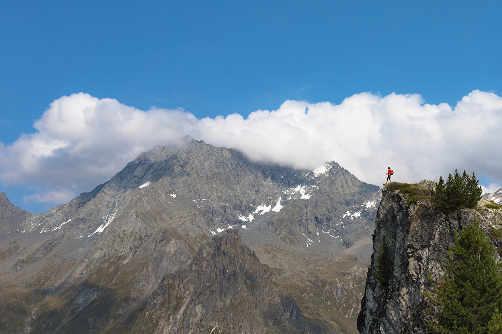
Another way to access to summits: trail for confirmed hikers, not fearing to say hello to eagles and in search of another view to admire the Vanoise.
Sport Roche de Villeneuve return Planay
About

Further informations
Ground
1 3


Prices
Free access.
Reception
Period of practice
From 01/05 to 31/10.
Depending on snow condition.
Services
- Pets welcome
- Car park


