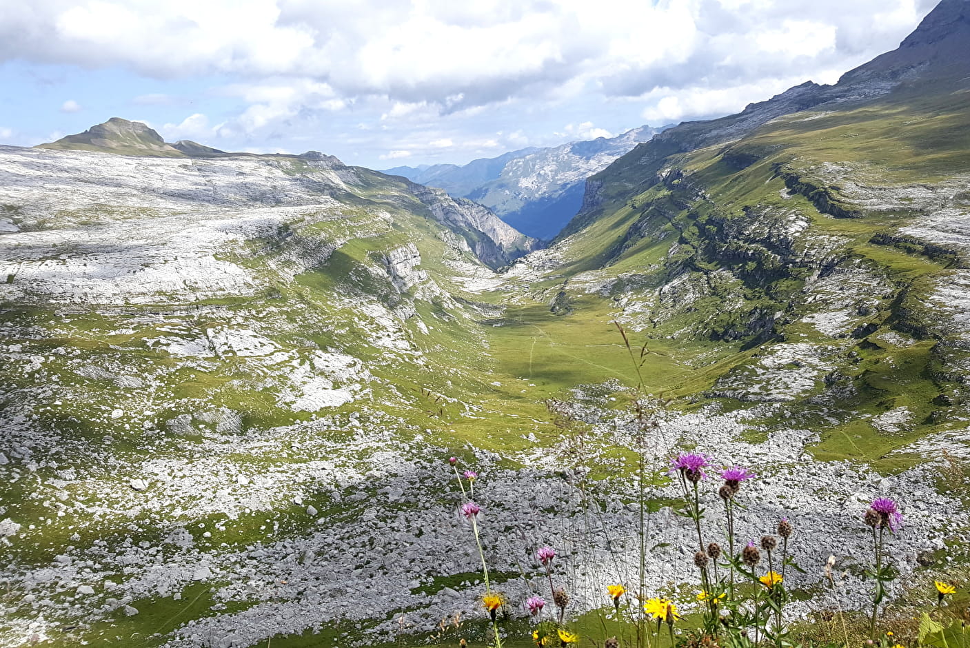
From Plaine-Joux, follow the motorable track which crosses the ski resort and will lead you to Ayères des Pierrières. A path on your left winds through scree and large boulders to reach the cable passage and the ladders going up to Dérochoir. You then enter the Passy nature reserve and enjoy a magnificent view over the valley of Sales.
From the Passage du Dérochoir, turn left towards the Col de la Portette and then descend to the Platé refuge. You will then go south to descend the chimney of Platé by a narrow and steep path. At the bottom of the descent, turn left to join Plaine-Joux.
Refuge de Platé looped through the Dérochoir
Alpine hike to venture behind the Fiz and reach the largest lapiaz in Europe: the Platé Desert, a listed natural site.
Refuge de Platé looped through the Dérochoir Passy
About

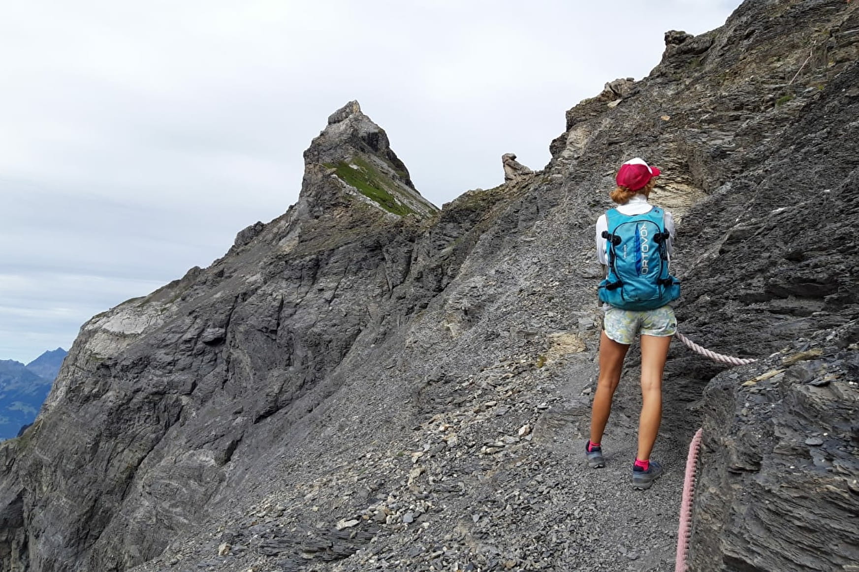
Difficult passages
Cable passage and ladders to climb to the Dérochoir.
Further informations
Rock, Stone, Ground
1 2


Prices
Free access.
Reception
Period of practice
From 15/06 to 15/11.
Subject to favorable weather.
Services
- Coach access
- Restaurant
- Picnic area
- Public WC
- Car park
- Coach parking
- Free car park