- Sport
Refuge de la Martin (au départ des Brévières)

About

Signs
Yellow hiking signs
Difficult passages
Crossing torrents can be very tricky when the bridges are not in place. Remember to inquire in June then September/October. Snowfields may persist in early summer.
Topoguides references
Sheet n°14, Summer Trails (25 walks and hikes in Tignes). On sale in the Maisons de Tignes (€12).
Further informations
Ground
Prices
Free access.
Reception
Dogs, even on a leash, are not allowed in the Vanoise National Park
Period of practice
From 01/06 to 31/10.
Subject to snow conditions.
Equipments
- Public WC
- Parking nearby
Contacts
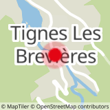
Access
A small part of the trail before the refuge, then from the refuge to the Savinaz glacier, is in the Vanoise National Park