Duration: 2 hours
Difference in altitude: +180m
Altitude at start point: 1400m
Altitude at end point: 1581m
Map reference: IGN TOP 25 - 3429 ET map
Signage: PDIPR signs
Difficulty: family-friendly hike
In toponymy, Miribel means "Beautiful view". In addition to the stunning views, this trail also has fascinating religious heritage. In 1774, Pointe de Miribel received an oak crucifix and neighbouring parishes came on pilgrimages here. The crucifix was knocked down during the French Revolution. In 1808, following a vow made during the French invasion of Russia, Joseph-Marie Félisaz from Villard sculpted 17 columns from blocks of red marble brought to him on site. Each column symbolising the Miribel cavalry, is topped by an iron crucifix. There’s a statue of the Virgin Mary at the top. Many pilgrims still travel this path during ceremonies.
From Ajon, travel up to Pointe de Miribel via a pretty path bordered by a stunning way of the cross. Go back down the same path to get back to your starting point.
- Sport
Pointe de Miribel - from Ajon
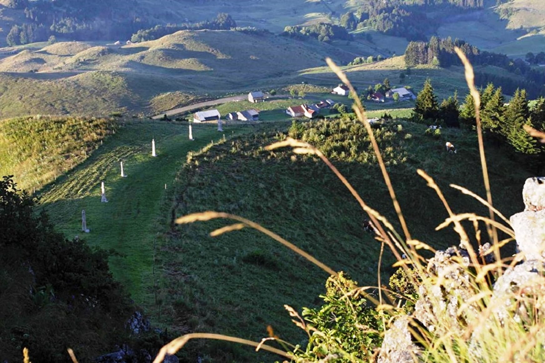
An easy walk snaking through forests and meadows. The mountain location is ideal for views of Chablais, Lac Léman and, of course, the Alps.
Sport Pointe de Miribel - from Ajon Villard
About

Topoguides references
Les Alpes du Léman map and hiking guide is available at the Tourist Offices (Bellevaux and Habère-Poche) 32 paths + a map: 8 €
Further informations
Rock
Prices
Free of charge.
Reception
Les Alpes du Léman map and hiking guide is available at the Tourist Offices (Bellevaux and Habère-Poche)
32 paths + a map: 8 €
Period of practice
From 01/01 to 31/12.
Subject to favorable weather.
Services
- Pets welcome
- Picnic area
Contacts
Access
In Villard, head for the church then continue to Ajon. Park at the end of the asphalt road.