
Who'd think the sense of escape could be so strong as you kick off your hike from the ski slopes of La Norma? Soon, spruce trees of all ages surround you as you walk through a shady forest. Intrepid squirrels may escort you some of the way. Skipping from branch to branch or sprinting at the edge of the paths, they'll spark your curiosity as you pass through the forest. Soon, the ski slopes give way to high-altitude meadows where herds graze in summer. Here, on "ubac" (north-facing slope), the mountain gets rocky and rugged at a lower alpine zone than on "adret" (south-facing slope). All of a sudden, the hike's reward jumps out at you! A panoramic view of the Vanoise, the Écrins and Italy. Enjoy! It's a good diea to leave early in the morning, in order to reach your destination before the sun is at the zenith. The descent will be more comfortable and you can happily take as many refreshing breaks as you need.
- Sport
Pointe de La Norma
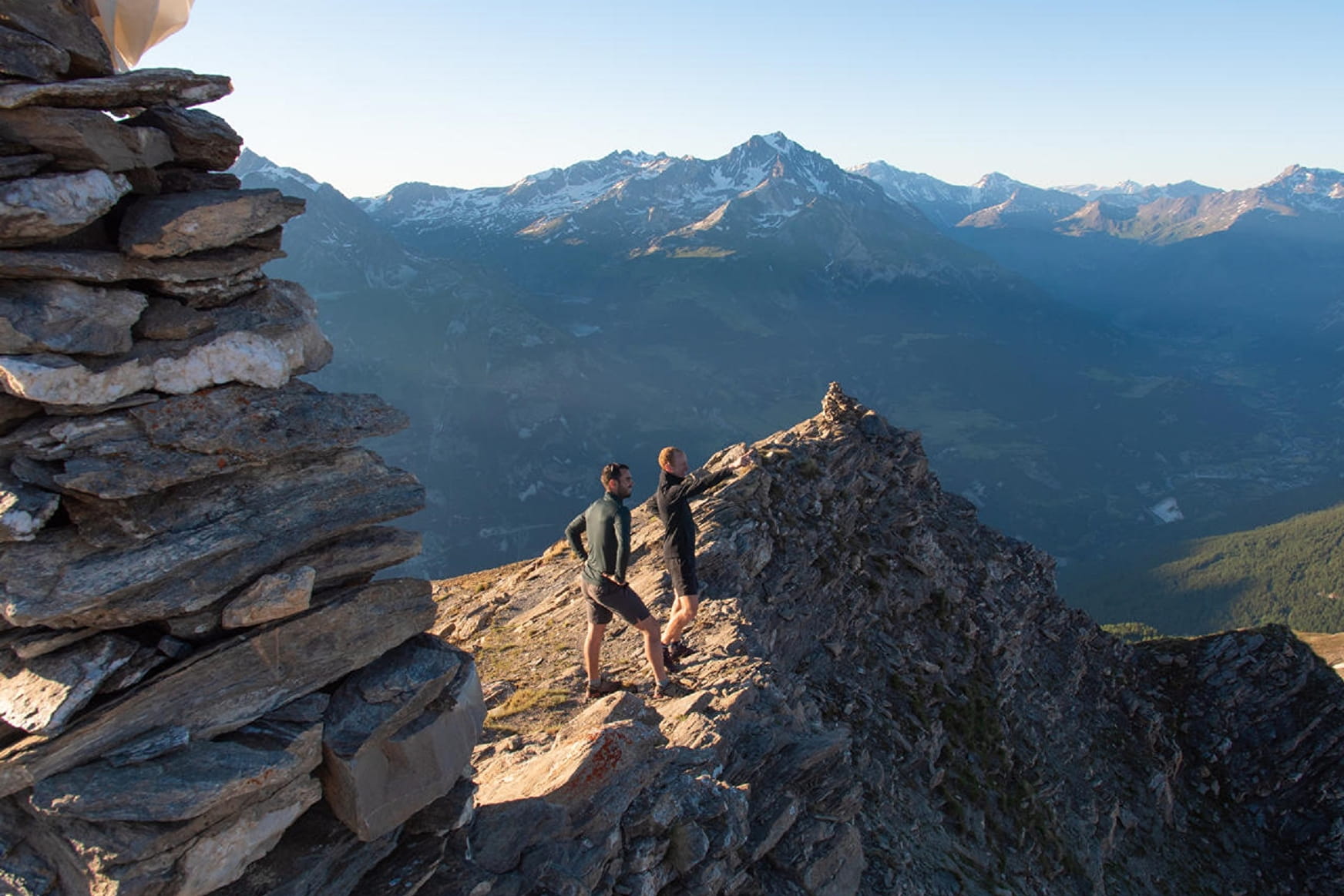
A full panorama of peaks lies at your fingertips. Altitude calls out to you and, on this hike, it seems the peaks have no limits. Discover the panoramic views that have made the resort famous in all seasons.
About
Signs
Departmental signposting (PR)
Map references
Map and booklet "Balades et Randonnées Haute Maurienne Vanoise" (sold for 10 € in the Tourist Office)
Topoguides references
Black itinerary n°95
Further informations
Stone, Ground, Grit

To guide you in the field, consult the "step-by-step" directional diagram provided in pdf.
Prices
Free access.
Reception
Pets allowed on leash only.
Period of practice
From 01/06 to 15/10.
Accessible by ski lift in summer.
Subject to favorable snow and weather conditions.
- Pets welcome
- Accessible via ski lift
- Parking nearby
Contacts
Access
The hike starts at the top of the Mélézet cable car.
By bus: Line 2 - Rond-point de La Norma stop.
By car: park in the La Norma leisure center parking lot.
