IGN 3428ET map-PDIPR signage
At the junction with the road to Col des Moises, walk approx. 100m and you’ll find the path to the Granges Mamet just after the bend on the right.
Park on the edge of the woodland path so you don’t disrupt traffic.
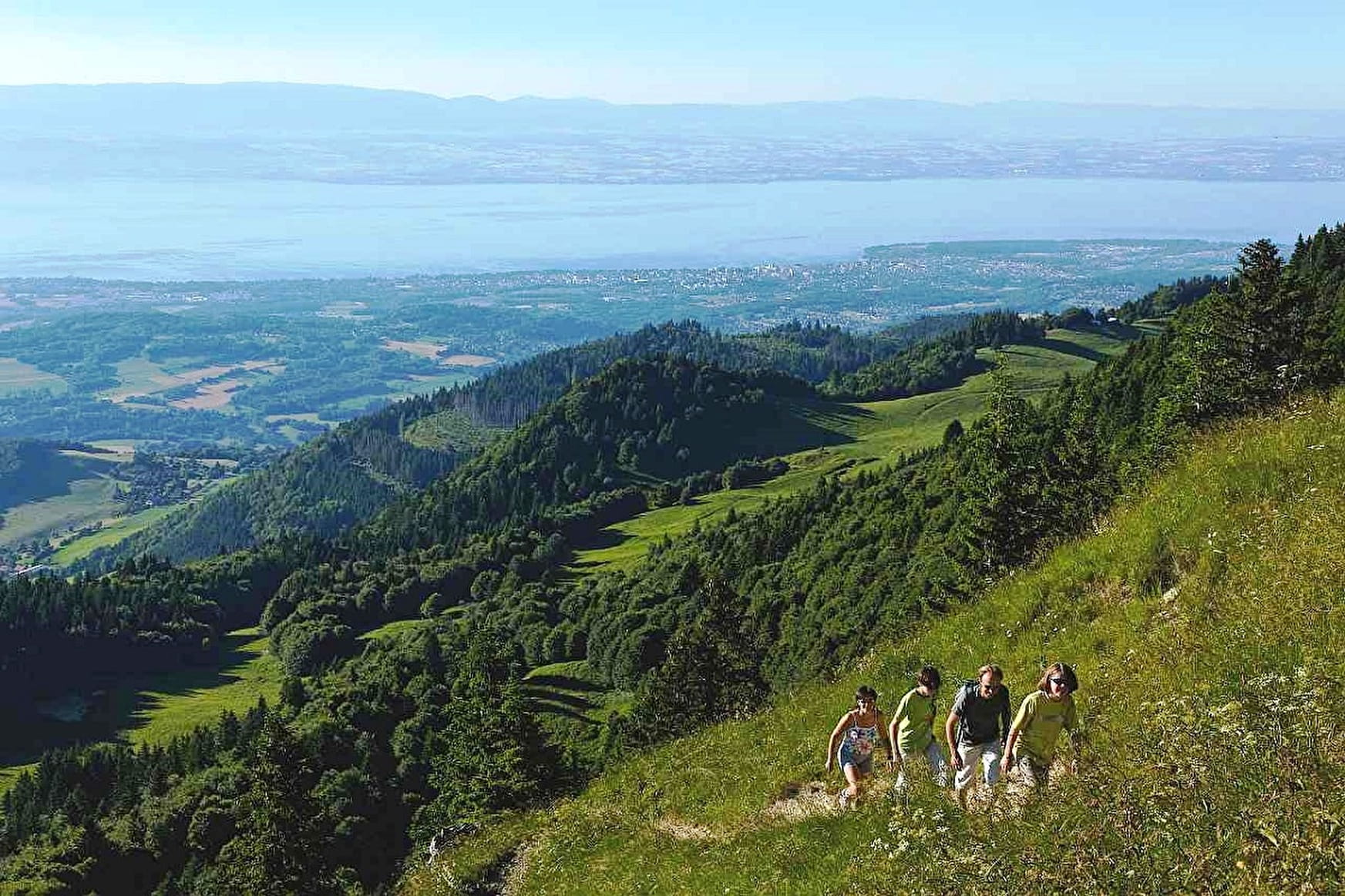
Uphill: Walk on the easy woodland path to Granges Mamet where you’ll spot the statue on the top of Mont Forchat. Continue along this sloping path snaking through the forest shared by Habère-Poche and Lullin.
Persevere and the Col de l'Encrenaz will appear for lovely views of Lac Léman. Next go up the slope to the peak.
There are great views of Lac Léman and Chablais. You can also see Mont Blanc when the sky is cloudless.
It’s not unusual to see gliders skimming past the ridges in the Vallée Verte.
Downhill: Be careful; the path gets slippery in damp weather.
Go back to Col de l'Encrenaz and take the signposted path ahead to the Col des Moises. Go through the meadow and the path gets steeper and zigzags through the forest to the Creux de la Marlat.
When you reach the main road, turn left to get back onto the woodland path you started on.
- Sport
Mont Forchat - summer
Mont Forchat in the heart of the Vallée Verte is the perfect place to explore the Chablais and for incredible views of Lac Léman and Mont Blanc at the foot of the statue of St François de Sales.
Sport Mont Forchat - summer Habère-Poche
About

Further informations
Stone, Ground
1 1

Prices
Free of charge.
Reception
Period of practice
From 01/04 to 31/10.
Subject to favorable weather.
Services
- Pets welcome
- Motorhomes allowed
- Picnic area
