Behind the tourist office, walk around the cemetery and climb towards Le Tovat. When you get to the road, go horizontally left as far as the first crossroads. Approach the house named Le Trovat in order to find the footpath which threads its way to the right of the garden and between the mazots. A climb brings into view the Croix de Varoche. Take care, at this level you are going through alpine pastures so please respect the work of the farmers and make sure you close any gates behind you. At the place known as Le Manstu, you will have a beautiful view over Mont Blanc. From the crossroads, go up left through the fields. Going out of the forest, you can leave the track to go immediately right along the stony channel and then reach the edges of the little lake at Mont Lachat.
Follow the road towards Les Ayes for about 5 minutes and then go right towards Le Cernix - Entre Deux Bois - Ballevard. Your descent will take you through woodland before reaching an open space with magnificent views over the Aravis mountains. Continue towards Ballevard. In Ballevard, go to the right of the house towards Les Berets Verts as far as the village centre.
- Sport
Loop of Mont Lachat
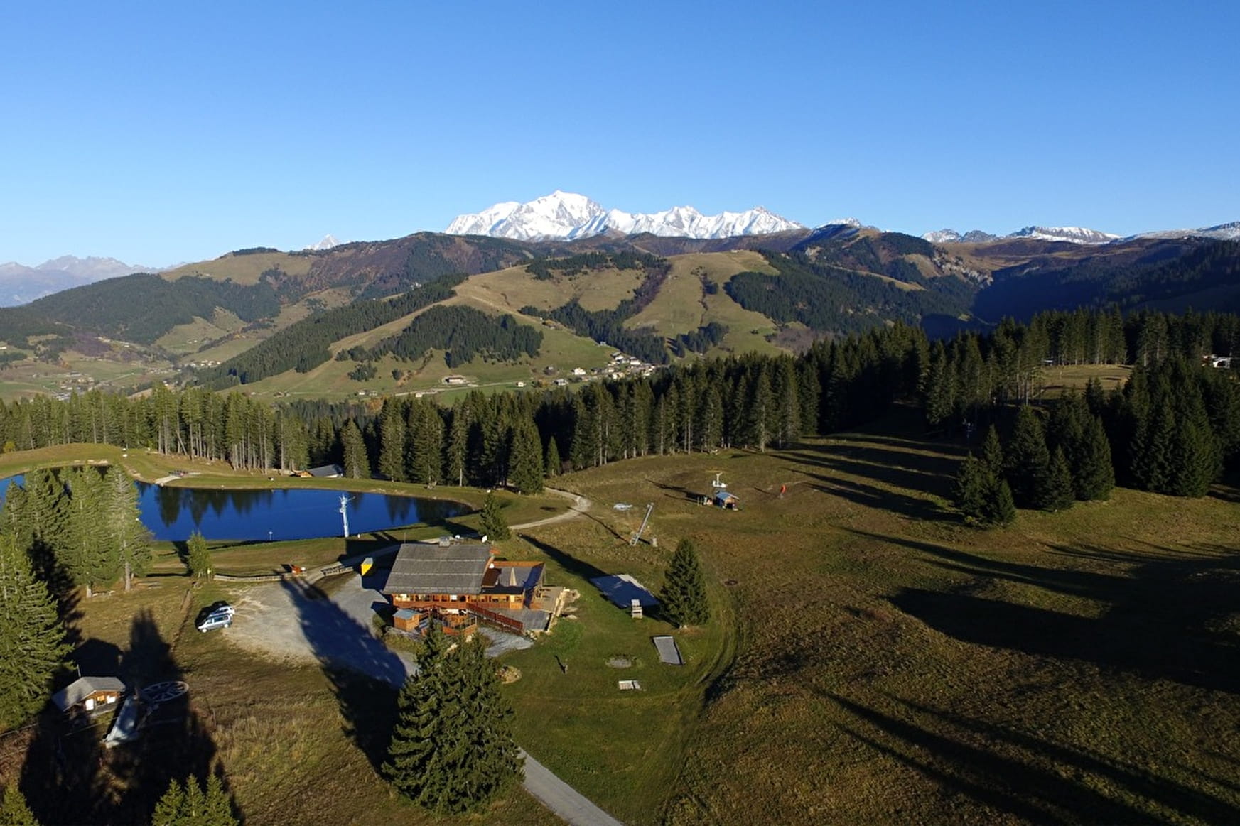
Walk on panoramic paths around Mont Lachat with beautiful points of view over the Aravis mountain range and Mont Blanc mountains.
Sport Loop of Mont Lachat Crest-Voland
About

Reception
Period of practice
From 01/06 to 01/10.
Services
- Pets welcome