This hike, for experienced hikers only, takes in two mountain lakes: Lac des Plagnes (1190 m) and Lac de Tavaneuse (1806 m). You'll cross mountain pastures and discover chalets and fountains.
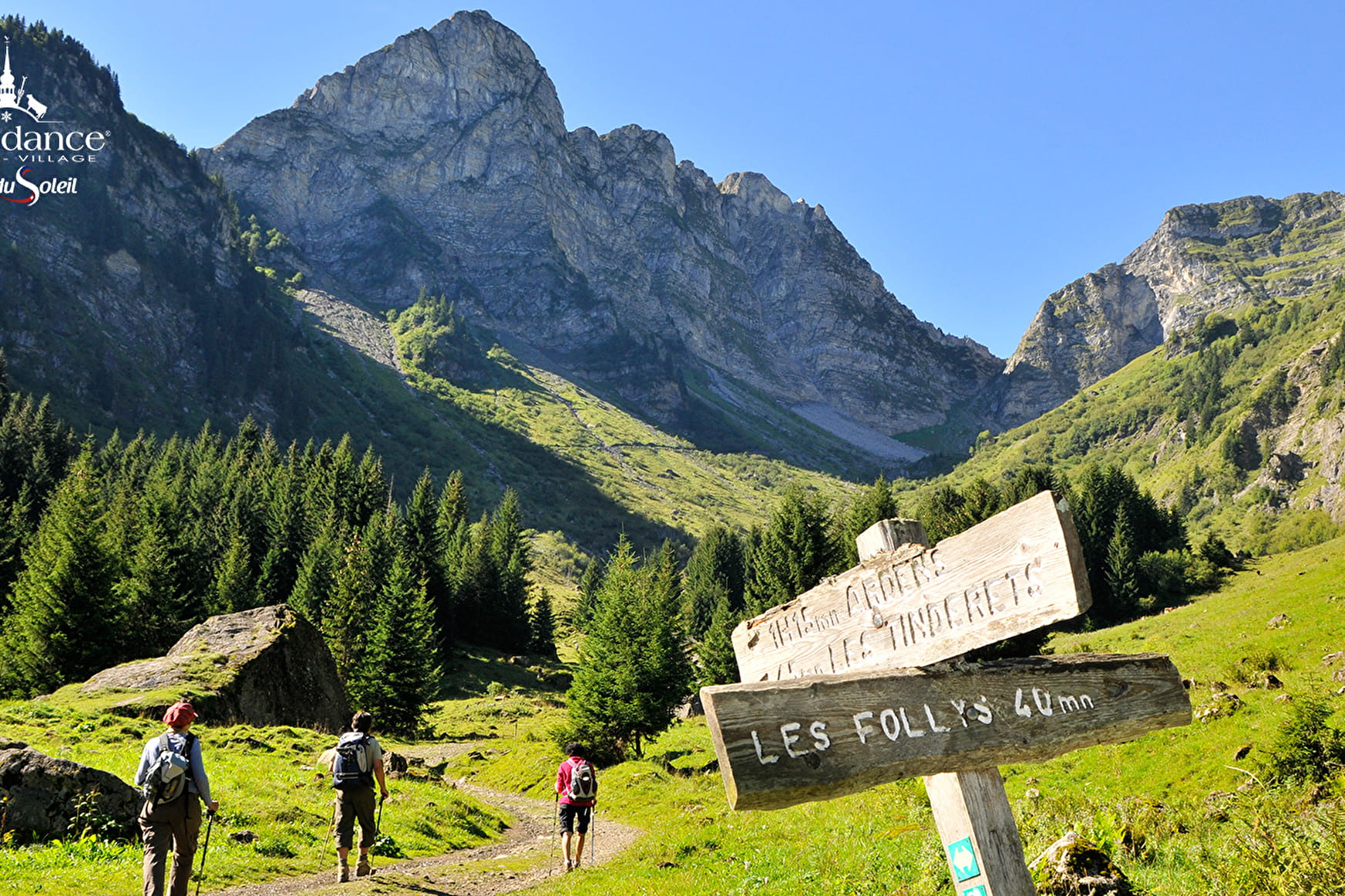
The hike starts from the Lac des Plagnes parking lot. Take the Cubourré path. Then head for the chalets d'Ardens via the pirons d'Entre Deux Pertuis, which will take you all the way to Lac de Tavaneuse.
Once there, you can enjoy the lake and its crystal-clear waters. Picnics are a welcome way to enjoy the place.
Return via Entre-Deux-Pertuis to Lac des Plagnes via Prétairié and Le Cazot.
This hike offers magnificent views.
- Sport
Loop: Lac des Plagnes and Lac de Tavaneuse
Discover the two mountain lakes of Abondance, the Lac des Plagnes and the Lac de Tavaneuse, a magnificent day trip.
Sport Loop: Lac des Plagnes and Lac de Tavaneuse Abondance
About

Signs
Departmental markings called P.D.I.P.R. on beige metal panels with green lettering.
Difficult passages
In the descent of Prétairié, the trail can be muddy and slippery, make sure you have hiking shoes.
Map references
Portes du Soleil hiking map in France and Switzerland TOP 25 N°3528 ET Morzine Massif du Chablais Les Portes du Soleil
Topoguides references
On sale at tourist offices in the Vallée d'Abondance
Further informations
Stone, Ground
1 4


0/ Parking des Plagnes.
1/ From the "Parking des Plagnes", walk along the north side of the lake, always following the signs for "Chalets d'Ardens". You will pass the signposts for "Lac des Plagnes" and "Cubourre". At the first intersection after "Cubourre", turn right. Then, after the hairpin bends, turn right at "Sous Pointe de Chavache".
2/ At "Chalet d'Ardens", follow the signs for "Lac de Tavaneuse", passing "Les Pirons d'Ardens".
3/ At Col d'Entre-Deux-Pertuis, descend to Lac de Tavaneuse.
4/ Climb back up to the Entre-Deux-Pertuis pass and take the path that descends to the left towards Entre-Deux-Pertuis and Cazot.
5/ Rejoin the forest towards "Cazot", then head towards "Lac des Plagnes".
6/ Take the path on your right to reach Lac des Plagnes and its parking lot.
Prices
Free access.
Reception
Period of practice
From 01/06 to 01/11.
Subject to favorable snow and weather conditions.
Services
- Pets welcome
- Car park
- Parking nearby
Contacts
Access
The departure of the hike is situated at 10 minutes in car from the center of the village of Abondance. Follow the direction of the" lac des Plagnes". A car park is in your left in arriving to the lake.


