
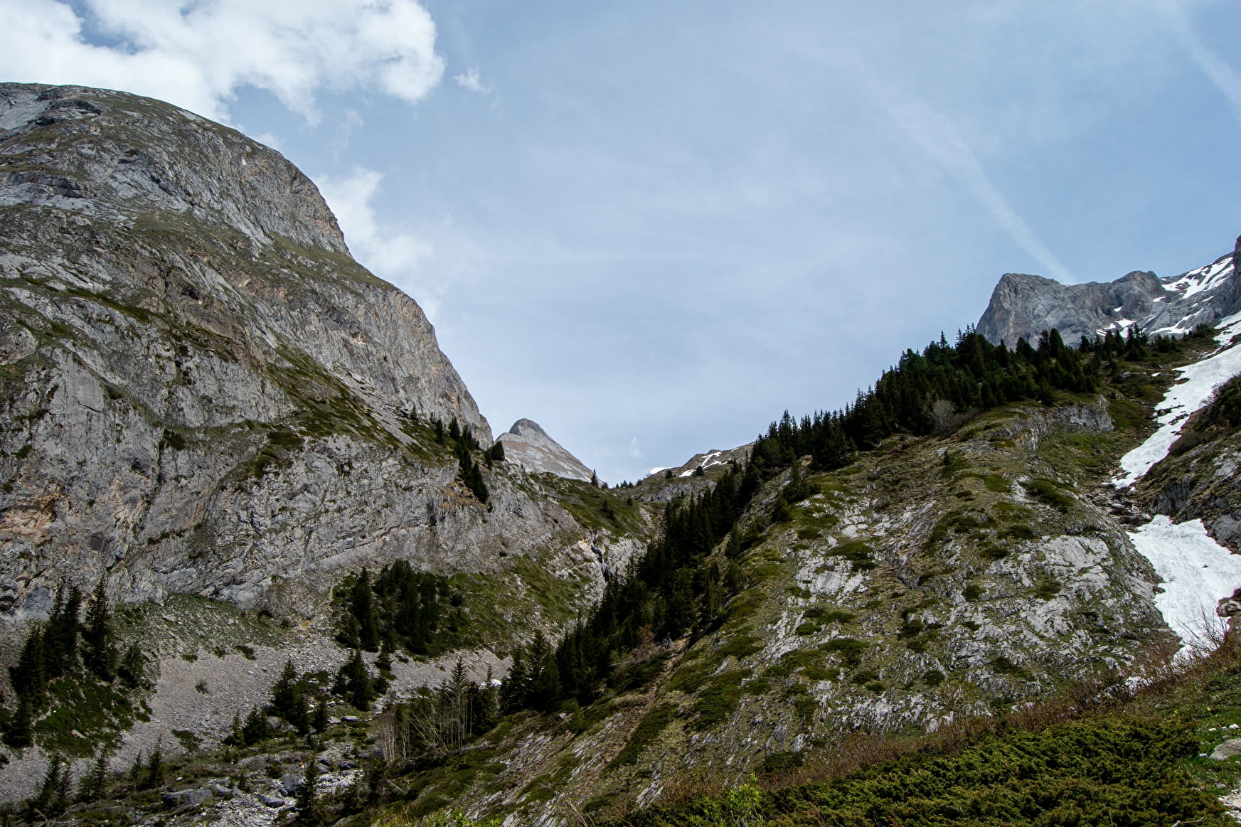
The cirque de l'Arcelin is a natural amphitheater offering breathtaking views of the towering vertical walls of Moriond, the Aiguilles de l'Arcelin and the Grand Marchet. A special place for families!
- Sport
Loop hike - Cirque de l'Arcelin - Les Barmettes
For the variant, it is it is possible to take the Genépi chairlift to save save you money and and reduce walking the descent (subject to opening conditions).
Sport Loop hike - Cirque de l'Arcelin - Les Barmettes Pralognan-la-Vanoise
About

Signs
Yellow signs
Map references
Map of Pralognan-la-Vanoise footpaths available from the Tourist Office. IGN 3534OT map sold at the Tourist Office
Topoguides references
Topo Pralo Rando sold at the Tourist Office
1 1

From Place du Barioz (barrier in local dialect) follow rue de l'Erlet to the hamlet of Les Bieux (bouleau in local dialect)/ Follow the path towards Les Fontanettes (path no. 17). This path starts at the bachal and leads to an orientation table/Go up the Fontanettes hamlet and continue towards the Arcelin cirque, passing the Creuset bridge, then the Dard torrent footbridge and finally the Crépéna torrent footbridge (path no. 21)/Continue on the horizontal track to the Arcelin bridge, then descend to the left on the "toboggan" path (path no. 20), which joins the ascent route (paths no. 21 and 17).
VARIATION: LES BARMETTES (2,010 m) (difficult) +1h30, +250 m ascent, +2.5 km round trip
(in addition to the main itinerary)
Follow the main itinerary to stage 3.
Leave the paths leading up to Col du Grand Marchet and Col de la Vanoise via Les Arollets on your right and, after the bridge over the Crépéna torrent, turn right onto the Couloir de l'Eau path (path no. 23)/ Continue along this path until you reach the track leading to the Barmettes refuge (path no. 13)/On the way down, return to the village center via Les Fontanettes on the GR 55 (trails no. 13 and 17).
Prices
Free access.
Reception
Drinking water, sanitary facilities, hors sac room and restaurant in the Fontanettes car park.
Dogs are welcome as the trails are outside the Vanoise National Park.
Period of practice
From 15/05 to 31/10.
Services
- Pets welcome
- Coach access
- Motorhomes allowed
- Restaurant
- Covered picnic area
- Parking nearby
- Public WC
- Picnic area
Contacts
Access
From the centre of Pralognan village, walk up Avenue de Chasseforêt. At the top of the street, an alleyway will lead you to the Barioz district, the starting point for the hike.
