Beyond its unusual and impressive character, this hike is conducive to the discovery of a varied heritage route (forest, walkways, torrent, etc.) and offers magnificent panoramas of the valley. The route is accessible to trained walkers and sports people. The cantilevered section can present difficulties to people prone to vertigo.
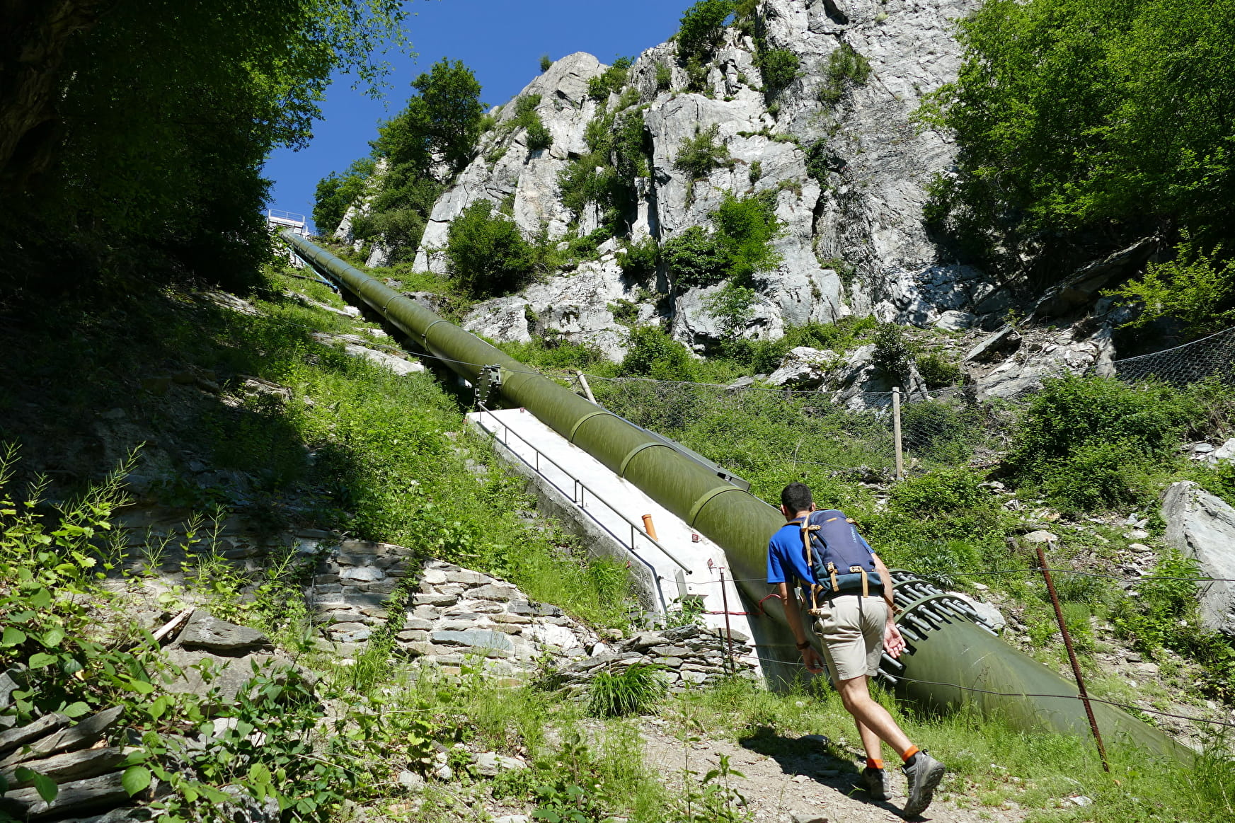
Departure behind the factories of Notre Dame de Briançon (cemetery parking lot). Along the route through the Cudray forest you will discover the hydroelectric facilities of Notre Dame de Briançon and in particular its penstock. Then you will cross a corbelled path above the Eau Rousse canyon which will take you as close as possible to the torrent.
The most spectacular walkway section. It was fitted out in 1897 when the penstock for the Notre Dame de Briançon power plant was installed. You will then reach the picturesque village of Cudray (return short loop) and continue to the point of interest of the hike: the Belvédère du Jet (990 m). From there, you will benefit from an exceptional and aerial point of view on the Bassin d'Aigueblanche, the lower Tarentaise valley and the surrounding mountains.
- Sport
Les passerelles de l'Eau Rousse - B20
A fairly demanding but atypical route that allows you to discover the local industrial and hydroelectric heritage from another angle.
Sport Les passerelles de l'Eau Rousse - B20 La Léchère
About

1 5


Prices
Free of charge.
Reception
Period of practice
From 01/05 to 31/10.
Services
- Pets welcome


