This hike is designed for sporty, good walkers. A number of exposed aerial passages require great vigilance. A good physical condition, an early start and a steady pace are the secrets to a successful hike.
From the parking lot, head north on a wide track towards the Col de Vernaz. Cross the right bank of the Ruisseau de Chevenne and continue north-northeast.
At a fork, turn right onto a path (leave the wide track and go left towards Crêt Pèzerin). Keep parallel to the stream, then turn away from it and, after a few hairpin bends, reach the Col de Vernaz.
From the Col, head north towards La Calaz and climb a wide grassy ridge via a number of hairpin bends (steep slope). This brings you to the Chalet de La Calaz.
Turn left (north-west) and continue up into the pastures, past the Saix de la Calaz and then the Rochers de Chaudin. At the edge of a combe to the north (Chaux du Milieu), reach a flat spot with yellow Swiss signposts.
Continue west towards the Cornettes de Bise. Climb between rocks and lapiaz to reach the base of the summit. Turn right and, after several switchbacks, reach the summit.
Return in the opposite direction on the same path to the Chalets de Chevenne parking lot (D/A).
- Sport
Les Cornettes de Bise from Chevenne
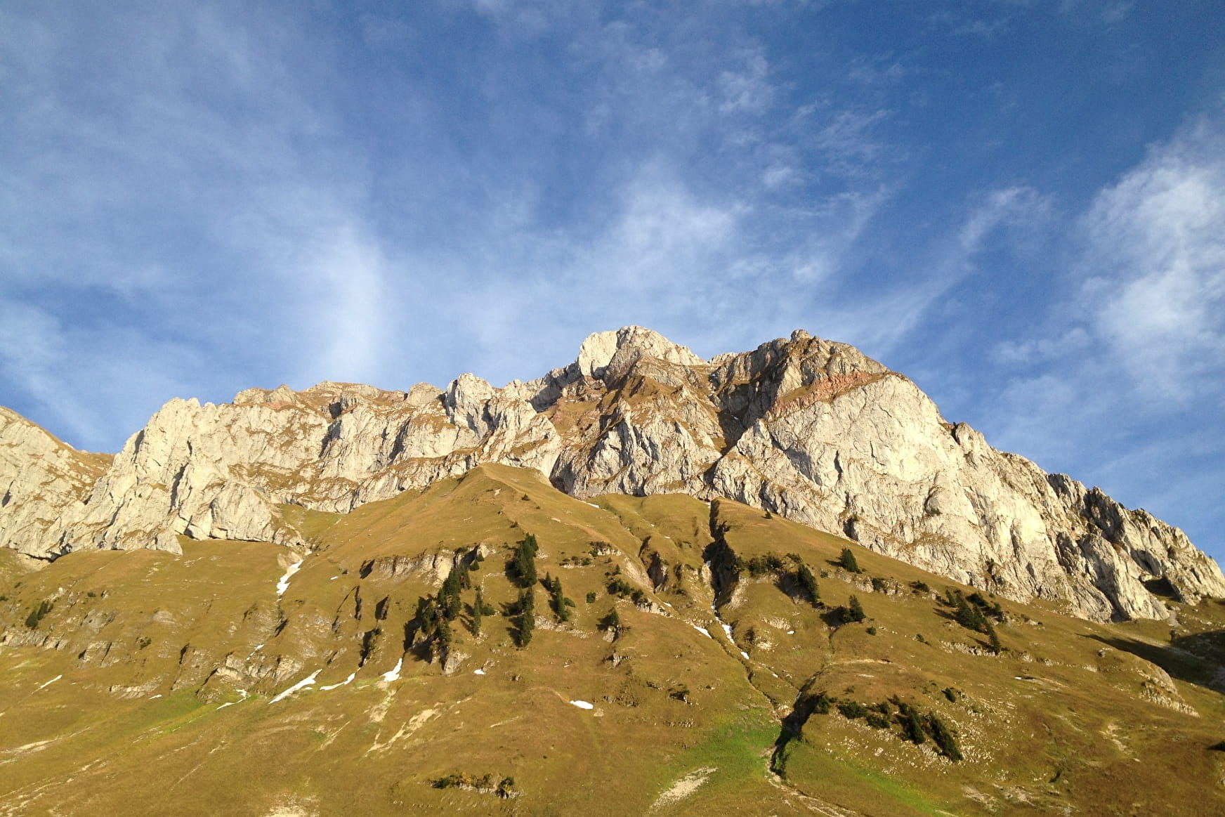
A common route for the Cornettes de Bise when you live in the upper Abondance valley. A long route with elevation gain, which leads into a sumptuous setting.
About

Signs
Departmental signposting called P.D.I.P.R. on beige panel and green writing.
Map references
Portes du Soleil hiking map in France and Switzerland TOP 25 N°3528 ET Morzine Massif du Chablais Les Portes du Soleil
Further informations
Rock, Stone, Ground, Grit


Minimum altitude: 1217m
Altitude highest point: 2432 m
Route type (loop, A/R): Round trip
Duration: 6h30
This hike is intended for a sporty public, good walker. Several exposed air passages require great vigilance. A good physical condition, an early start, a regular step, and these are all the little secrets for a successful hike.
From the car park, head north on a wide path towards the Col de Vernaz. Pass on the right bank of Ruisseau de Chevenne and continue North-North-East.
At a fork, turn right onto a path (leave the wide path going left towards Crêt Pèzerin). Stay parallel to the stream then deviate from it and, by a few bends, reach the Col de Vernaz.
From the pass, head north towards La Calaz and climb a wide grassy ridge via numerous switchbacks (steep slope). Thus reach the chalet of La Calaz.
Then turn left (North-West) and continue to climb in the mountain pastures and directly above the Saix de la Calaz then the Rochers de Chaudin. Reach a flat area with yellow Swiss signposts at the edge of a valley to the north (Chaux du Milieu).
Continue west towards the Cornettes de Bise. Climb between rocks and lapiaz and arrive at the base of the summit. Slant right and, after several switchbacks, reach the summit.
The return is in the opposite direction on the same path to the Chevenne chalets car park (D/A).
Prices
Free access.
Reception
Pets accepted on a leash only.
Period of practice
From 01/06 to 30/09.
The route is accessible outside periods of snowfall or bad weather. You are strongly advised to check access conditions with the Tourist Office. The route is potentially available for access during Spring, Summer and Autumn.
Subject to favorable weather.
- Pets welcome
Contacts
Access
Accessible from the Chevenne car park with free parking or the village on foot up the Chevenne road (allow 30 minutes for 1.5km).

