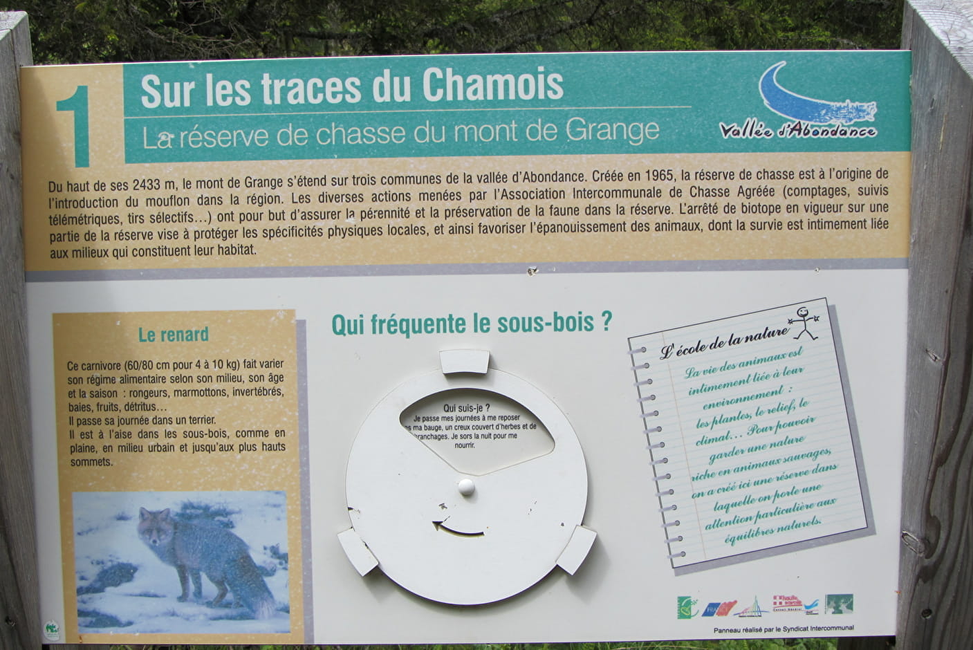
A medium difficulty hike in the Mont de Grange hunting reserve, the highest mountain in the valley at 2432m. It is a Natura 2000 reserve where chamois, mouflons and marmots live together.
The departure is located at Chez les Ogays at the start of Richebourg in Abondance.
You will take the direction of the Chalets de la Plagne and discover its mountain pastures.
You will join the discovery trail "in the footsteps of the Chamois" passing by the Chon and the Chable de la Plagne to reach Pertuis.
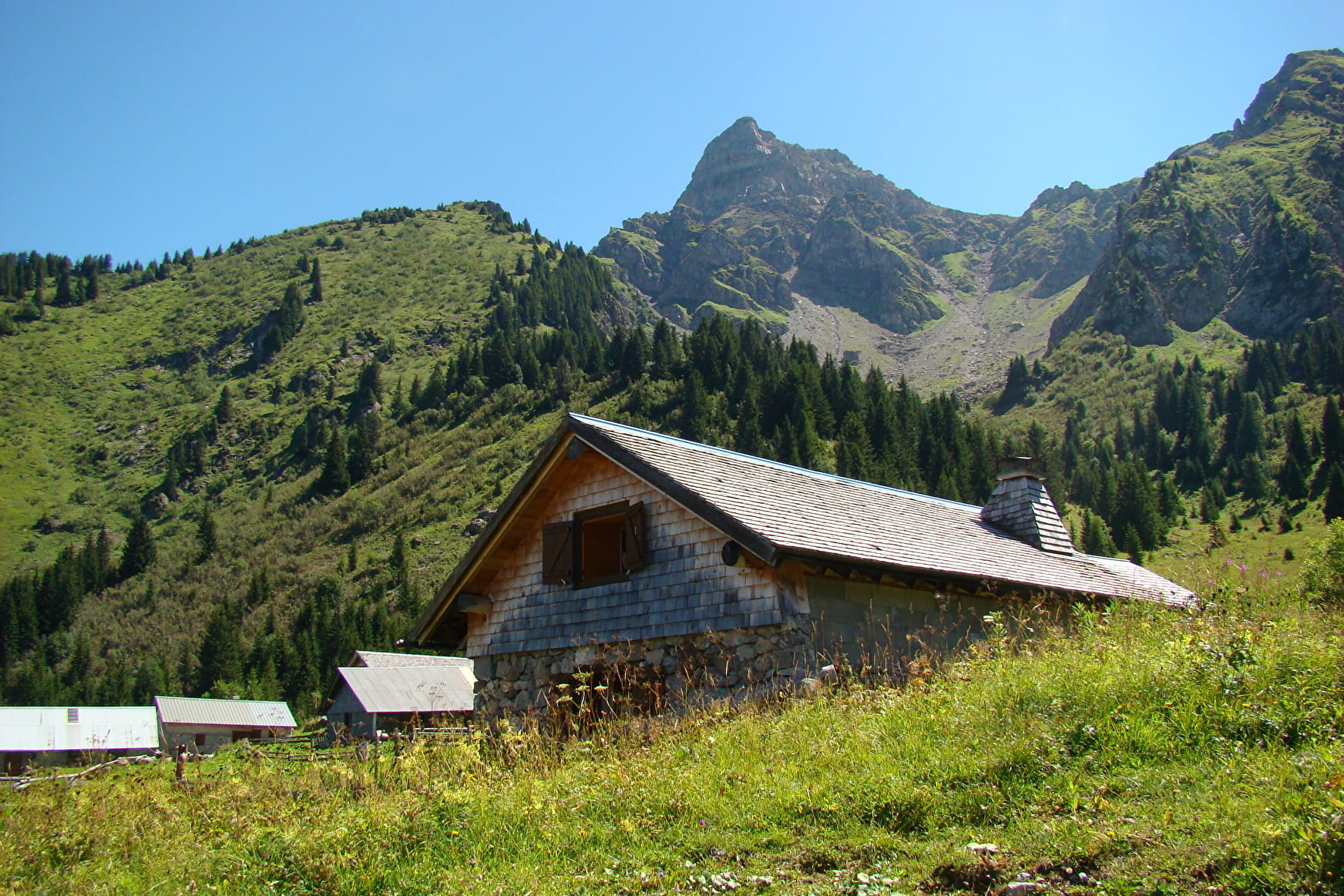
At the chalets of Pertuis, you will discover an ancient glacial valley with a small lake carved by the glacier, which dries up at the end of the summer, and its large lateral moraine.
To go back down, you will continue on the Bel Air ridge (1783 m) with a magnificent view of Abondance and the surrounding mountains.
You will then reach the chalets of Leschaux and Plaine Joux. You will then head towards the Chosalets to reach the start of the hike.
- Sport
Les chalets de Pertuis (loop)
Hiking in the "Mont de Grange" hunting reserve, which has more than 500 chamois deer and mouflon sheep. Pertuis is also an area where marmottes have been reintroduced. Enjoy your walk.
About

Signs
Departmental markings called P.D.I.P.R. on beige metal panels with green lettering.
Map references
Portes du Soleil hiking map in France and Switzerland TOP 25 N°3528 ET Morzine Massif du Chablais Les Portes du Soleil
Topoguides references
On sale at tourist offices in the Vallée d'Abondance.
Further informations
Stone, Ground


0/ Chez Les Ogays à Richebourg in Abondance.
1/ Cross the bridge over the Dranse then turn right. Follow the direction of "La Plagne", you will go along its chalets.
2/ Take the direction of " Le Chon ".
3/ When you arrive at "Le Chon", take the trail that goes up on your left towards "Chalets de Pertuis".
4/ At the crossroads of " Chable de la Plagne ", follow the direction of " Pertuis " on your left. After 5 min, the trail to Pertuis starts on the right towards the pasture. Continue to the chalets of Pertuis.
5/ To go back down, you have the choice between the ascent route or to continue on the ridge of " Bel Air " (1783 m).
6/ Go back down to the " Chalet de Leschaux " and continue towards the chalets of " Plaine Joux ".
7/ From there, take the direction of " Chosalets ", then the direction of " Chez les Ogays ".
Prices
Free access.
Reception
Pets accepted on a leash only.
Period of practice
From 15/06 to 15/09.
Accessible outside the snow period and depending on weather conditions. Check with the Tourist Office beforehand to find out the current access conditions. Recommended practice period: spring - summer - autumn.
- Pets welcome
- Parking nearby
Contacts
Access
The departure is located in Richebourg, between Abondance and la Chapelle d'Abondance at the place called Chez les Ogays.