

Setting off in the early hours, when dew still lingers on the forest floor, you
soon feel the gentle caress of the morning sun's first rays.
As the trail gradually winds its way through the woods, the mild, soothing
sound of the Étache stream follows your steps. You spot wild strawberry and
raspberry bushes. If they're in season, you might even treat yourself to a taste.
What a luxury! But you're not about to forget that you're sharing the space
with alpine herds that are often fenced in. So, you carefully shut the gates
behind you as you make your way along, and suddenly, you're struck by the
magic of the high-altitude Arolla pines. Take a closer look at these Arollas,
also known as Swiss pines. Here's a trick to recognise them: Their long and
soft dark green needles are grouped into small clusters by groups of five.
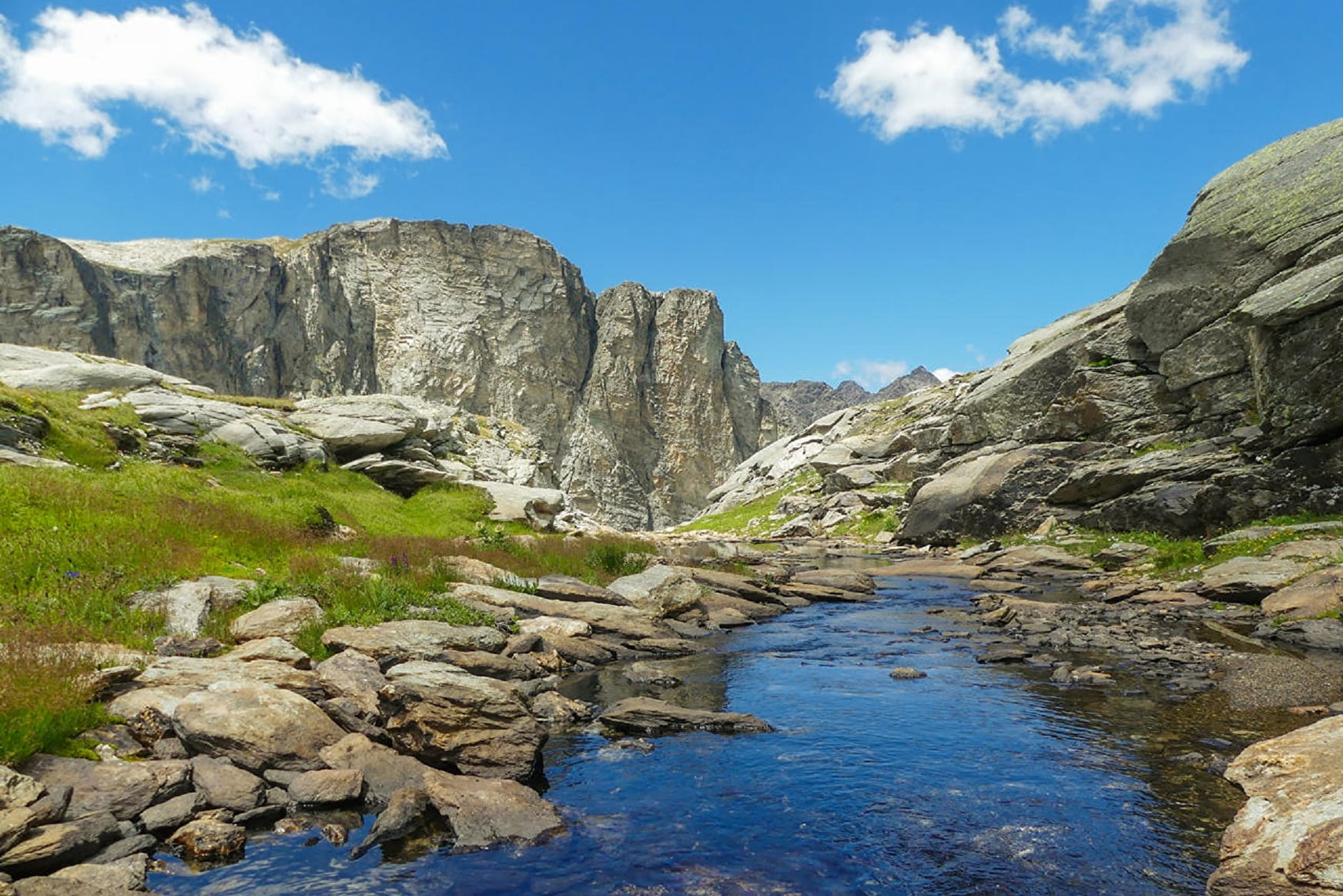
Oh, look over there! The great beak of the Étache can already be seen in the
distance. After a rest at the Étache farm, you figure that, this time you've
really done it… you've finally uncovered the valley's secret.
A harmonious blend of farmland and nature opens up to you.
- Sport
Le Vallon d'Etache
Here's a sample of Haute Maurienne Vanoise in its raw natural state. This
secret valley will enchant you with its kaleidoscope of atmospheres. At
each different mountain zone you pass, a new journey begins...

About
Signs
Departmental signposting (PR)
Map references
Map IGN 3534OT - Les Trois Vallées Map IGN 3634OT - Val Cenis
Topoguides references
Map and booklet "Haute Maurienne Vanoise. 115 walks and hikes - 35 trail routes. For all levels" (sold for €10 in Tourist Offices) - Itinéraire bleu n°37
To guide you in the field, consult the "step-by-step" directional diagram provided in pdf.
Prices
Free access.
Reception
The duration of hiking trails is calculated using reference paces: 300 m/h ascent, 500 m/h descent and 4 km/h on the flat.
As hazards may occur at any time on the routes, the GPX tracks provided are not contractual. They are given for information only. Riders use them at their own risk, depending on their level of technological proficiency and their understanding of the terrain.
Pets allowed on leash only.
Period of practice
From 15/05 to 15/10.
Subject to favorable snow and weather conditions.
- Pets welcome
- Parking nearby
Contacts
Access
I'm going by car: park in the Planay parking lot in the Val d'Ambin.