
First day, from Nancroix (1 450 m ): direction Bauches, then Pramain (1 833 m) then the Tchiaupe pass (2 492 m). Go back down to Champagny and sleep at the refuge du bois de Champagny le haut (1 476 m)
Second day: go up to the Plaisance refuge (2 150 m), then over the Plan Sery pass (2 609 m) and down to the Entre le lac refuge (2 144 m)
Good walkers who are not afraid of going off the beaten track will be able to avoid descending to the bottom of the valley of Champagny le haut. At the level of the Tchiaupe stables (2,303 m), follow the contour line (trail) until the climb to the Frête passage (2,500 m), then the descent into the Froide Fontaine valley, then the ascent to the Golet de la Vallaisonnay (2,796 m). We descend along the Vallaisonnay stream to the refuge: freedom in an extraordinary glacial landscape.
Third day: return via the Plan Sery pass (2,653 m) and via the Entre-le-lac refuge to Rosuel and then Nancroix.
Difficulties: difficult because it is long. Well-marked paths.
Loop that can be done in the other direction!
- Sport
Le tour de Bellecôte par le col de Plan Sery. Boucle 3
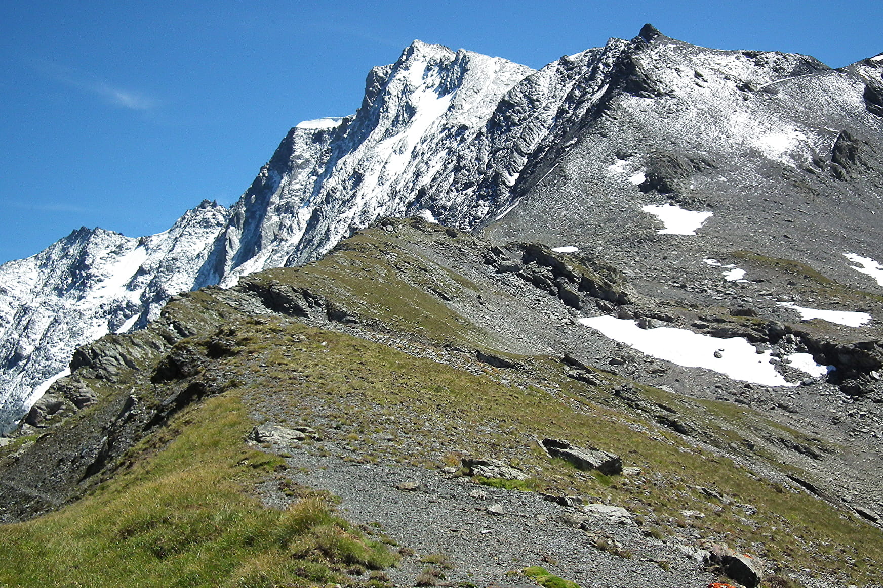
A superb route over the mountain pastures of Bellentre, Champagny and Peisey. The Bellecôte massif, its glaciers and all its torrents!
About


First day, from Nancroix (1 450 m ): direction Bauches, then Pramain (1 833 m) then the Tchiaupe pass (2 492 m). Go back down to Champagny and sleep at the refuge du bois de Champagny le haut (1 476 m)
Second day: go up to the Plaisance refuge (2 150 m), then over the Plan Sery pass (2 609 m) and down to the Entre le lac refuge (2 144 m)
Good walkers who are not afraid of going off the beaten track will be able to avoid descending to the bottom of the valley of Champagny le haut. At the level of the Tchiaupe stables (2,303 m), follow the contour line (trail) until the climb to the Frête passage (2,500 m), then the descent into the Froide Fontaine valley, then the ascent to the Golet de la Vallaisonnay (2,796 m). We descend along the Vallaisonnay stream to the refuge: freedom in an extraordinary glacial landscape.
Third day: return via the Plan Sery pass (2,653 m) and via the Entre-le-lac refuge to Rosuel and then Nancroix.
Difficulties: difficult because it is long. Well-marked paths.
Loop that can be done in the other direction!
Prices
Free of charge.
Reception
Period of practice
All year round.
Contacts
Access
Departure from Pont Romano in Nancroix.
Ideally park at the entrance to the village and walk straight on to the starting point.


