- Sport
Le Suet
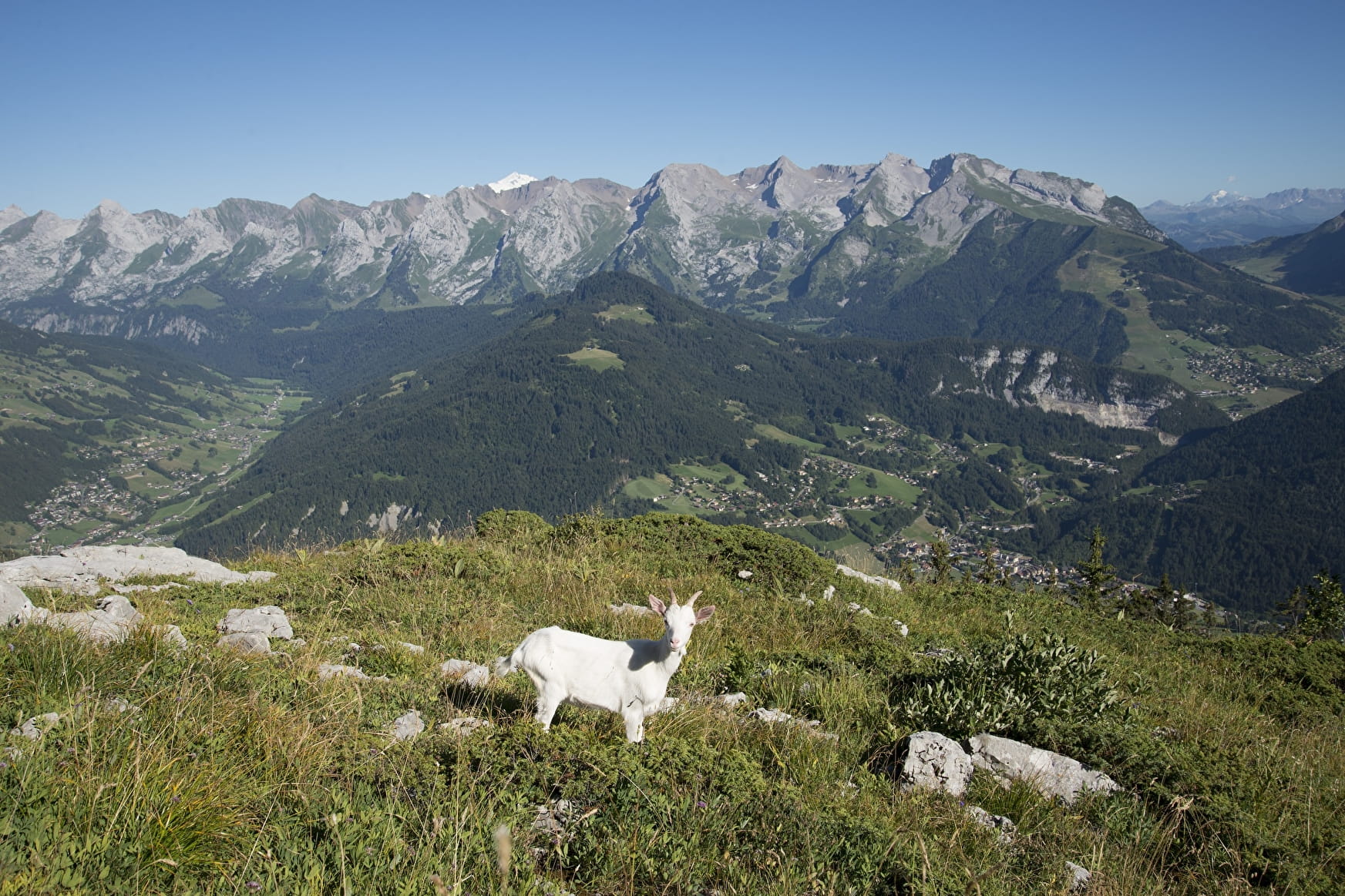
From the Suet a beautiful panorama of the Grand-Bornand, the Aravis and Bargy mountain range, and the Auges Mountain.

About

Topoguides references
Pages 30-31, hike no. 13. Guide "Randonnées sportives et incontournables" on sale for €3 at the Tourist Office.
Further informations
Ground, Grit
Access to the starting point:
From Saint Jean de Sixt, follow the road to the Grand-Bornand. After the Town Hall, turn left to the direction of Forgeassoud-Dessus. Park your car on the car park on the right after 1,1km.
Hike:
From the car park, go throught the Fogeassoud-dessus hamlet. Go in front of the farm Milk & Bouse and turn right to the Suet. On Les Plans locality turn right to the Suet. Climb gradually throught the wood until La Perrière. You walk near the panoramic view of "Crêt Brûlé"(1/2h) the path goes to the Suet hut (2h) then continue to walk up to the summit.
Go down by the same itinerary.
Prices
Free access.
Reception
The hiker's 12 commandments, respect and safety:
.
- Goud sense, safety and respect:
Walking in an unspoilt environnment is a delight! To make sure that our children also have the opportunity to enjoy this magical experience, please be a civic-minded, responsible hiker.
.
- Make the right choice:
Is the hike you have planned suited to the weather conditions, your physical abilities, your equipment and the amount of time you have available? Before you set off, tell your friends and family about your itinerary. In the mountains, you must always take care. You are responsible for your own safety and of the others.
.
- Find out about the weather conditions:
Wheter you are going on a short or long excursion, it is essential to check the weather forecast: the weather in the montains can change very fast (storms, fog, etc...).
Setting off early in the morning, even if the hike can be done in half a day, allows you to deal with any unforseen circumstances and gives you a better chance of seeing wildlife. if in doubt, it is always best to cancel if you want to be sure of avoiding problems.
.
- Keep to the paths:
Do not take shortcuts. Trampling the vegetation causes erosion, which can quickly cause an environment to deteriorate. The state of the paths may also change according to the weather conditions, seasons and how many people are using them. Caution: if you come across downhill mountain bike trails where pedestrians are not allowed for safety reasons, take care and follow the instructions shown on the path.
.
- Be discret:
We are not the only ones using the paths. Let's be considerate of others and keep the countryside a peaceful place to be.
.
- Admire the flowers but do not pick them, and please take your rubish home with you:
Nature needs you.
.
- If a site allows dogs, please keep your dog on a lead:
It could harm wildlife and disturb livestock.
.
- Close fences and gates behing you, and avoid walking on crops:
Respect private property and fields of crops or mountain pastures, and close the gates behind you. Do not disturb wild animals. If you come across a dog guarding livestock (known locally as a patou), do not approach it. They are there to protect the herds.
.
- Follow site-specific rules:
Some protected natural areas have their own specific rules: dogs, bivouac, fires and picking the plants may be prohibited. In private forests, picking forest plants like mushrooms is forbidden. In public forests, they may be picked sparingly.
.
- Avoid fires:
Particularly in high-risk areas. Fire can spread very fast in covered environments (forests) or overly exposed areas (scrub, dry moorland).
.
- Take care:
Do not drinl the water from the streams. Clear water does not mean drinking water, especially in pasture areas where the animals may have soiled the rivers.
.
- Tell someaone where you are going on your hike:
Where possible, do not walk alone. There are risks involved in using the paths, injury for example. In all cases, always make sure that someone knows where you are going and what time you should go back.
Period of practice
Information at the Tourist Office
Subject to favorable weather.
- Pets welcome