
Take the road that climbs behind the tourist office until the small shopping mall of Plan-Peisey. At the end of the shopping mall, turn right and pass by the restaurant "La Vache". Continue straight ahead to "Vieux Plan" and follow the road up to the chapel.
Ask the Tourism Office for the chapel openning hours and schedule of masses. In front of the chapel, take on the left then follow the signs to go to Entreporte's pass on a steep track before reaching the top of Aiguille Grive at 2733 meters Panoramic view !
- Sport
Le plateau du Rey - Col de l'Entreporte
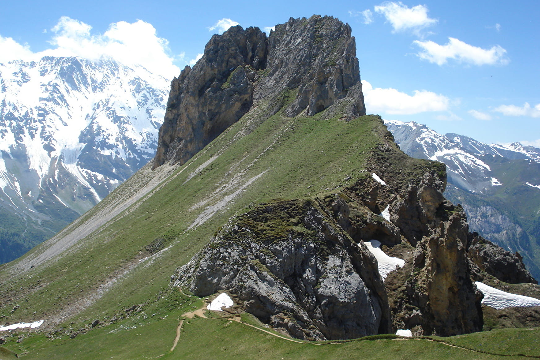
Magnificent path toward a jewel of the baroque art : la chapelle des Vernettes at 1800 m. Panoramic view from the top of Aiguille Grive.
Sport Le plateau du Rey - Col de l'Entreporte Peisey-Vallandry
About

Map references
TOP 25 IGN 3532 ET, Les Arcs La Plagne
1 4


Follow the road south from the Vanoise Express at Plan-Peisey towards Vieux Plan. After the village, take the first rising bend on the left. Continue towards Les Vernettes and take the first marked path on the left. At the end of the forest, follow the ridge between the forest and the mountain pastures, to the right of the chairlifts, which brings you closer to the Aiguille Rousse. A few aerial steps to join the stony corridor to the pass (2 389 m) hidden on the left of the Aiguille Rousse. Finally, a good climb (another stony aerial step) to reach the summit of the Aiguille Grive, culminating at 2,733 metres and offering a magnificent panoramic view, with an orientation table!
Take the same path on the way back, at least as far as the Rey plateau, from where you can return to the resort by several safe paths.
Prices
Free of charge
Reception
Period of practice
From 01/06 to 30/10.
Remember to contact your Tourism Officeto learn about the feasibility of the paths.
Equipments
- Picnic area


