

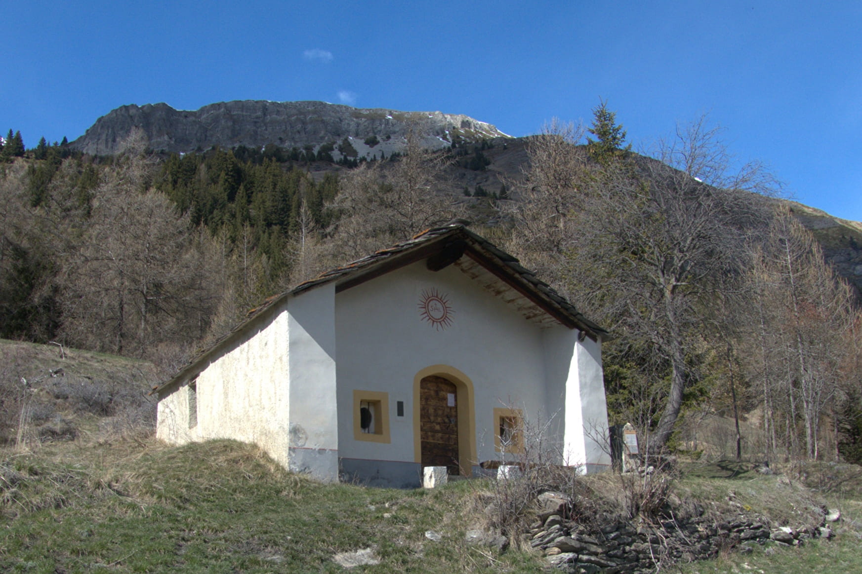
Awaiting you in the distance is the hamlet of Collet, where you'll turn back to complete a round trip. From spring to autumn, there's plenty of sunshine that'll warm you from all angles. You're sure to love this sun-soaked path and its hidden gems. At the halfway point, the charming Saint-Laurent chapel unveils an unexpected story. Continue your walk, drawn by the calls of vigilant marmots who've already spotted you. The little valley of Collet is one of their kingdoms, and if you stay quiet as you pass through, you'll see them going about their business. But what are those colourful little helmets hanging above your head? One thing's for sure: this path really does yield up the joys of the mountain! Via
ferrata enthusiasts will be the first to agree. These cliffs are also a paradise for bearded vultures, who often fly around here.
- Sport
Le Chemin de l'Adroit
Take a peaceful walk along one of the valley's sunniest south-facing slopes, on the lower foothills of Vallonbrun. A picturesque stroll through woodlands and meadows, strewn with natural wonders, leading you to a charming chapel.
About
Signs
Departmental signposting (PR)
Difficult passages
From Lanslevillard to the Saint-Laurent chapel, a small steep passage requires special attention, especially with children.
Map references
Map and booklet "Walks and Hikes Haute Maurienne Vanoise" (sold for € 10 at the Tourist Office)
Topoguides references
Blue route n°47
Further informations
Rock, Stone, Ground

To guide you in the field, consult the "step-by-step" directional diagram provided in pdf.
Prices
Free access.
Reception
Pets allowed on leash only.
Period of practice
From 15/05 to 15/10.
Subject to favorable snow and weather conditions.
- Pets welcome
- Parking nearby
- Charging stations for electric vehicles
Contacts
Access
By bus: Line S53 - Pont bus stop.
By car: park in the parking lots near the Val Cenis Lanslevillard Tourist Office.
