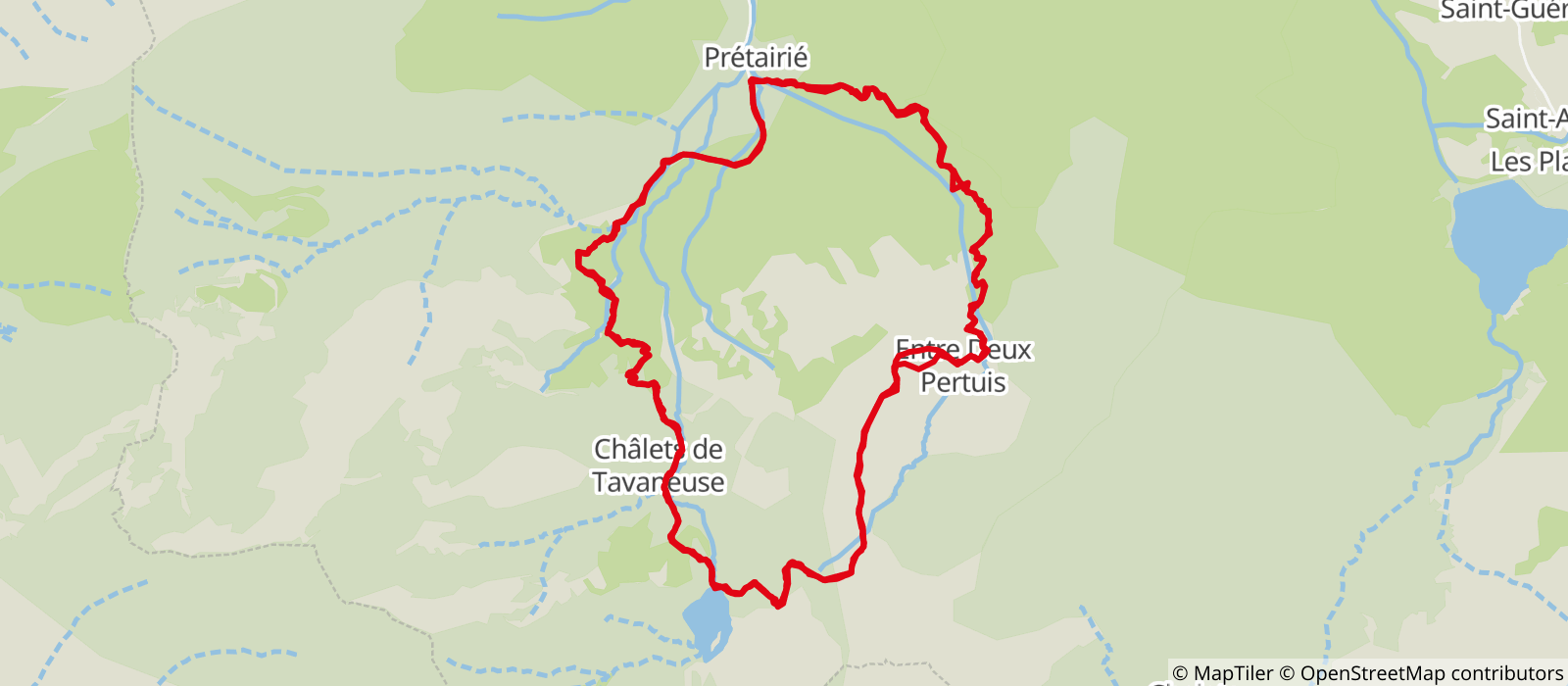
This hike takes you to a mountain lake: the Lac de Tavaneuse, which rises to 1806 m above sea level. You'll cross mountain pastures and discover their chalets.
The hike starts from the Prétairié parking lot. Take the path towards the Tavaneuse chalets. Then head towards Lac de Tavaneuse.
Once there, enjoy the lake and its clear waters. Picnics are a welcome way to enjoy the lake.
- Sport
Lake Tavaneuse loop

On this hike, discover one of Abondance's lakes, Lac de Tavaneuse
lac de Tavaneuse, reputed to be one of the most beautiful in the Chablais region.

About

Signs
Departmental markings called P.D.I.P.R. on beige metal panels with green lettering.
Map references
Portes du Soleil hiking map in France and Switzerland TOP 25 N°3528 ET Morzine Massif du Chablais Les Portes du Soleil
Topoguides references
On sale in the tourist offices of the Abondance valley.
Further informations
Stone, Ground
0/ "Prétairié" parking lot. 1/ From the parking lot, follow the path to an intersection followed by a small bridge. Head towards Lac de Tavaneuse. You'll pass the Tavaneuse chalets. 2/ At the lake, turn left and follow the signs for "Col Entre Deux Pertuis". 3/ Go downhill as far as the intersection, turn left and follow the signs for "Chalet d'Entre Deux Pertuis". 4/ Continue downhill until you enter the forest. At the intersection, take the left-hand path. Continue down through the woods until you reach the starting point.
Prices
Free access.
Reception
Period of practice
From 01/06 to 19/11.
Subject to favorable snow and weather conditions.
- Pets welcome
- Parking nearby
- Car park
Contacts
Access
The start of the hike is a 10-minute drive from the center of Abondance village. Follow signs for Prétairié. Park at the parking lot at the end of the road.


