

The magnificent Mont-Cenis plateau with its turquoise lake opens up to the south onto flower-filled mountain pastures where numerous herds graze.
Alpine farms offering delicious cheeses and blueberry jams, a warm welcome at the Petit Mont-Cenis refuge and its famous "Polenta/Saucisse" which delights the taste buds. One comes from afar to taste it!
Production area of Beaufort PDO. The bells of the Tarines and Abondance cows and the whistling of the marmots accompany the hiker from the Petit Mont-Cenis pass in the Savine valley down to the lake.
The Hannibal bivouac (named after the Carthaginian general who passed through here with his elephants more than 2000 years ago to attack Rome) at the Col Clapier on the Italian border, offers shelter in bad weather or for a night under the stars in the middle of nature.
Disconnection guaranteed, calm and serenity.
- Sport
Lake Savine
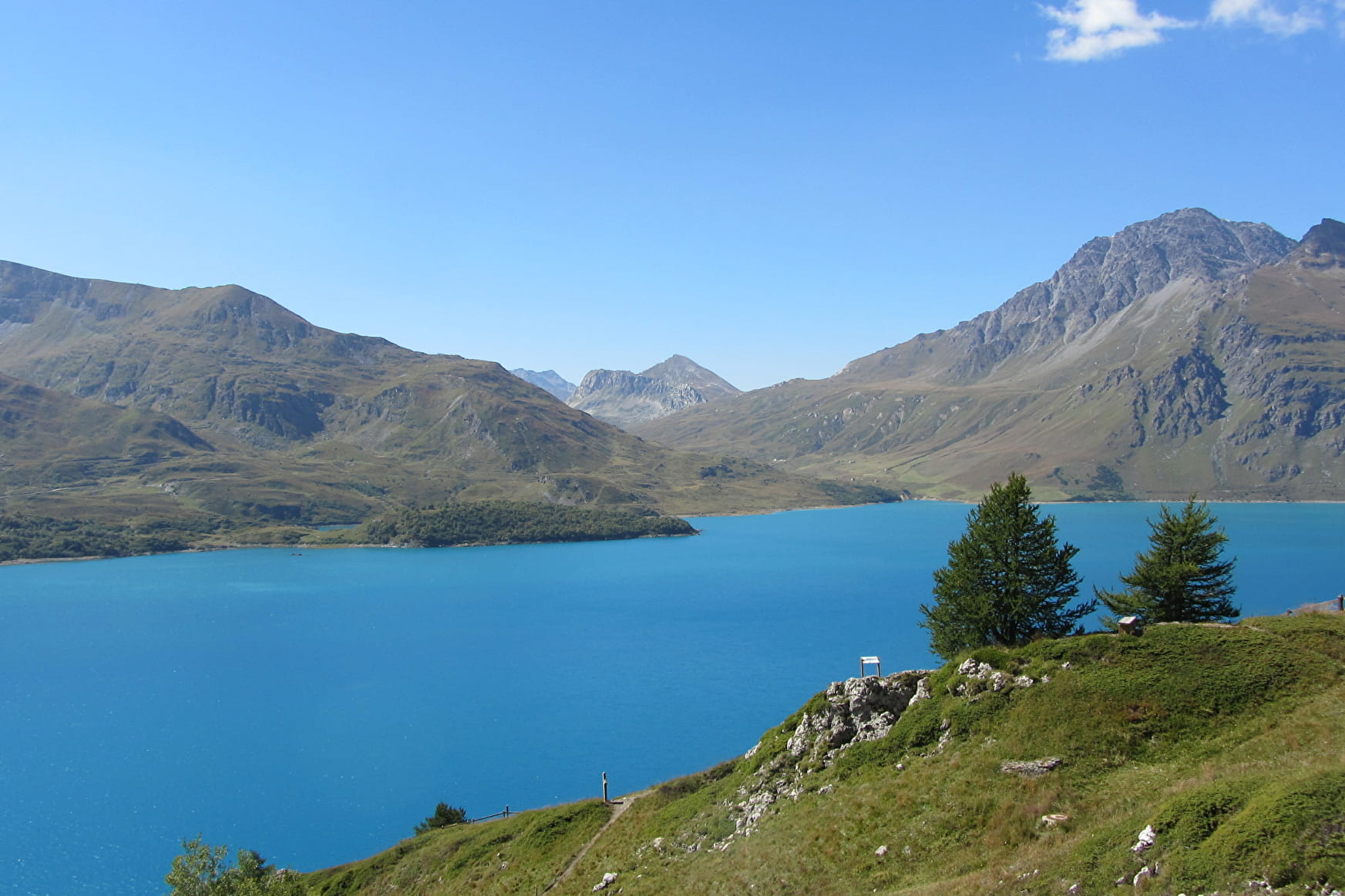
From the green pasture of the Petit Mont Cenis where tarine cows graze, the trail progressively leads to the valley of Savine. Walk on the footsteps of Hannibal the warrior to the lake and the Col Clapier.
About
Signs
Departmental signposting (PR)
Map references
Map IGN 3634OT - Val Cenis
Topoguides references
Map and booklet "Haute Maurienne Vanoise. 115 walks and hikes - 35 trail routes. For all levels" (sold for €10 in Tourist Offices) - Red route n°86
Further informations
Ground


To guide you in the field, consult the "step-by-step" directional diagram provided in pdf.
Prices
Free access.
Reception
Period of practice
From 15/06 to 15/10.
Subject to favorable snow and weather conditions.
- Pets welcome
- Parking nearby
Contacts
Access
Getting there by car: at the Col du Mont-Cenis, take the first road on the right towards the Petit Mont-Cenis refuge. Follow this narrow asphalt road to the Col du Petit Mont-Cenis.


