ROUTE: from the car park, take the road briefly towards Flumet until the directional post LES BARRIOZ. Continue on the left towards MARRIAGE then right towards LE RIANT. From here, turn right and go to the TELESKI DU LAC then FORÊT DES EVETTES. Take again on your right towards LA MONTAGNETTE, LES CLIEUX then LAKE EVETTES. Go around the lake, reach LA CROE and get off LA RUFFE then LE RIANT. Return by the route of the departure.
POINTS OF INTEREST:
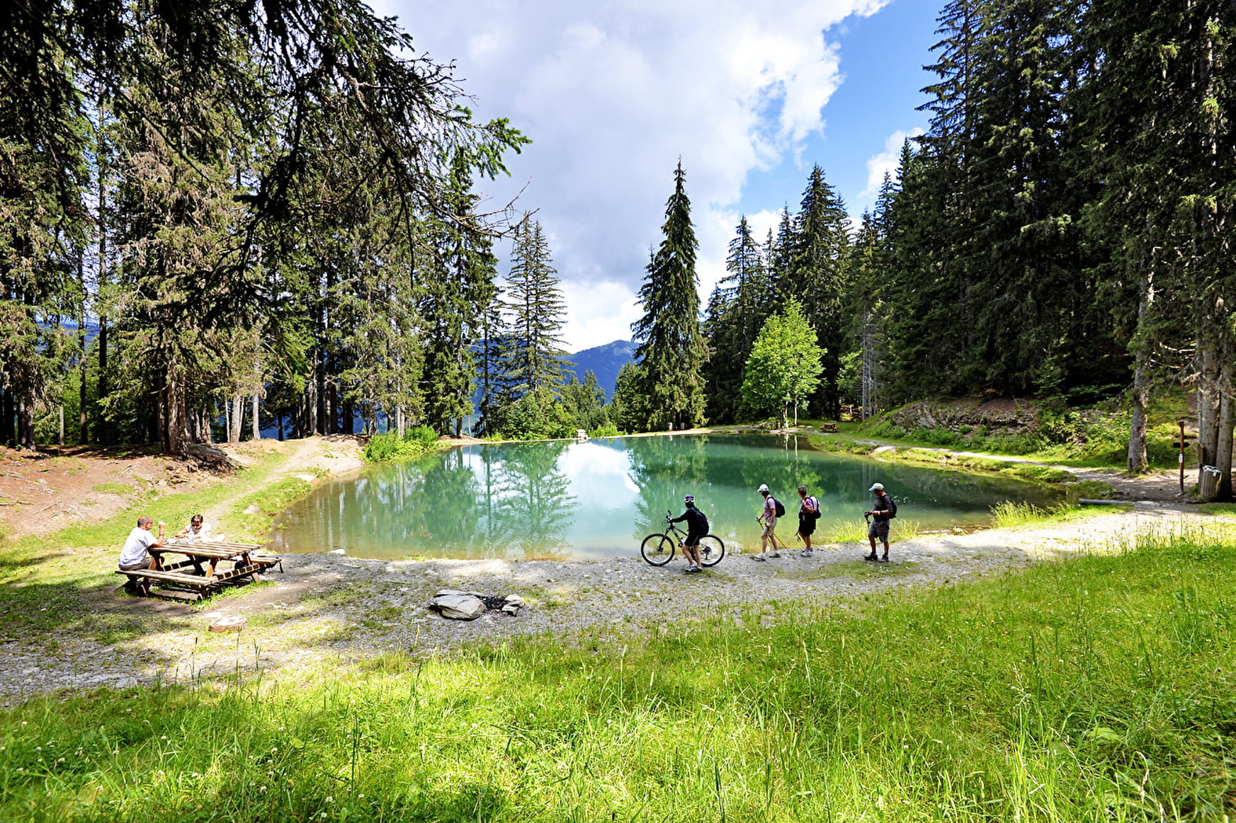
- Lake Evettes, nice little natural lake in the middle of the fir trees.
- The "Cache-cache des animaux" trail, thematic trail to discover the fauna of our mountains.
- Sport
Lake of "Les Evettes"
Savoie Mont Blanc's choice
A short walk in the woods, ideal in summer, to enjoy the bucolic atmosphere of the Lake of Evettes.
Sport Lake of "Les Evettes" Flumet
About

Signs
Marked with yellow signs.
Topoguides references
Walking and hiking map of the Val d'Arly for sale at 9 € or Topo Walks and Short hikes on sale at € 4 in the tourist offices.
1 2


Prices
Walking and hiking map of the Val d'Arly for sale at 9 € or Topo Walks and Short hikes on sale at € 4 in the tourist offices.
Methods of payment accepted : Bank/credit card, Check, Cash
Reception
Dogs must be kept on a leash due to the presence of herds.
Period of practice
From 01/06 to 30/09.
Services
- Pets welcome
Contacts
Access
Start of the route from the Evettes car park.

