Nature and Heritage:
The alpine flora is very wide ranging. Without even realising it, you will pass by rare species such as alpine dryads, martagon lilies, butterworts, bellflowers, gentians and orchids to name but a few. These plants are highly sensitive at altitude and exposure and altitude to a lesser degree. Please bring a camera and do not pick the flowers to protect our highly sensitive and unique plantlife.
Route details:
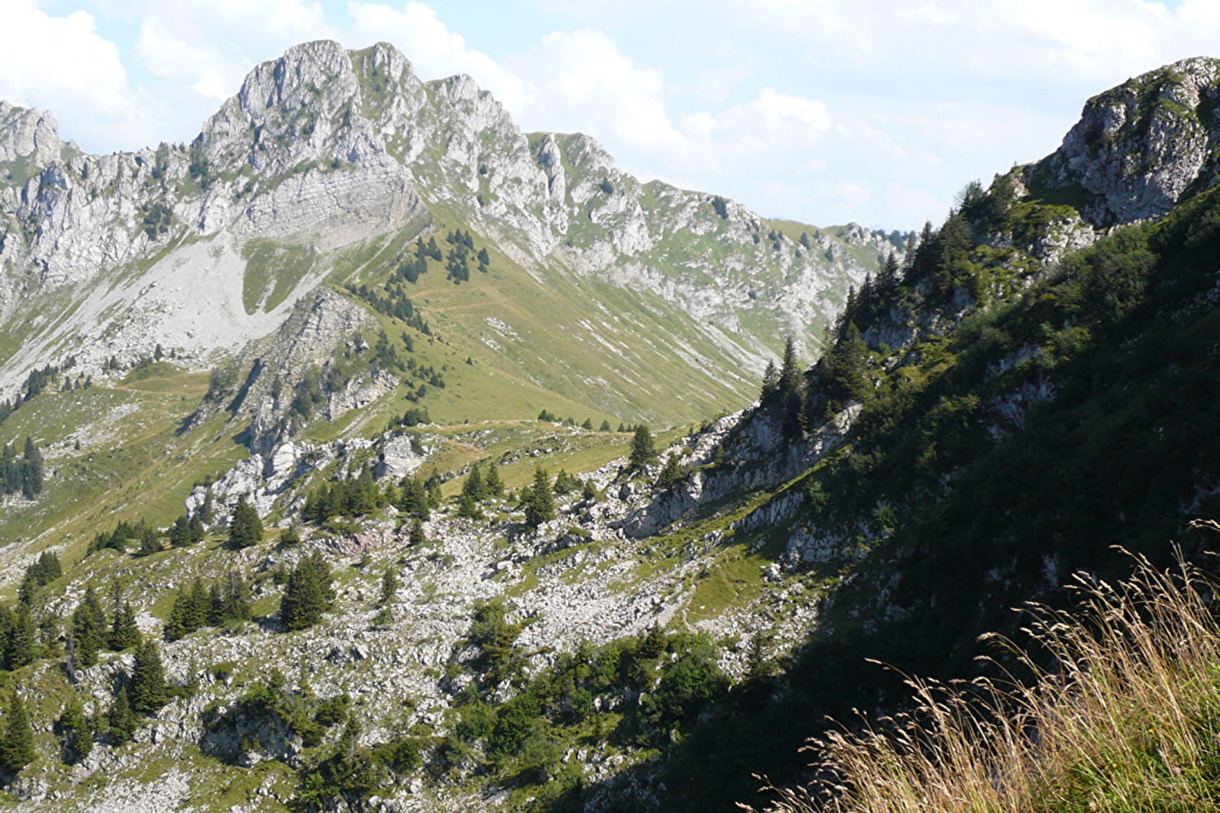
Cross the bridge and follow the forest path up to the chalets of Petétoz. After 200m (metal crucifix), continue right into the pastures and you’ll soon come out into a spruce and beech tree forest. The path then crosses a forest slope and reaches a second one after a steep climb. Take the path on the right up the Petétoz mountain pasture (altitude 1530m), drinking water. Beautiful views of the Roc d'Enfer and the buttresses of La Pointe de Chalune.
The trail veers to the right into pastures dotted with large gentians and spruces up to the Col du Jorat. You can stroll around the western side of La Pointe de Chalune. Follow the hillside path amongst scree and flower-covered alpine pastures. You will then reach the Col de Vesinaz (alt. 1802m). Go along a steep slope on your right from the Col to reach a little secret valley then a ridge to the peak of La Pointe de Chavasse (2012m).
Return via the same route until Col de Vesinaz and follow signs to the Petétoz chalets for approximately 200m before you turn left to Chavan on a path that goes down into a little valley. The path takes you into the wild valley of the Chavan pasture where you’ll find a chalet (drinking water). From the Chavan pastures, follow the path down to the woods, cross the little Chavan stream into the forest until you reach the "plan des Rasses" chalet and the woodland path to Pont de la Joux.
- Sport
"La Pointe de Chavasse" Hike
Explore the alpine flora: Less busy than its big sister Chalune, La Pointe de Chavasse takes hikers on a lovely walk amongst woodland and pastures. Explore the wide variety of alpine flora and fauna between the chalets of Petétoz and Chavan.
Sport "La Pointe de Chavasse" Hike Bellevaux
About

Further informations
Stone, Ground
Prices
Free of charge.
Reception
Period of practice
From 01/04 to 31/10.
Subject to favorable weather.
Services
- Pets welcome
- Car park
- Public WC
- Picnic area
- Orientation board
Contacts
Access
Starting point: Pont de la Joux car park in La Chèvrerie.