Go hiking safely!
Walking time is approximate and does not take into account break times.
The topo/step-by-step description guides you generally but does not replace a 1/25,000 hiking map or other topoguides available in our tourist office!
In Sallanches, our Office of Guides & Leaders also offers a wide choice of outings accompanied by mountain professionals providing you with complete expertise on the environment and alpine nature, inquire at the tourist office to register.
Whatever your hike, check the weather before you go. Remember to take cereal bars, sufficient water, sunglasses, sunscreen, a cap or hat, a small first aid kit, as well as clothing suitable for your outing in your backpack. depending on the season and the forecast weather.
The CAF refuge is guarded in summer where it welcomes hikers wishing to spend a night in the mountains.
* Departures to other possible hikes:
- La Tête de Lassy: It will be beneficial to continue the hike to the Tête de Lassy (+ 100 m) which offers a magnificent view of this always flowery valley.
- Cheminée de Monthieu and Tête du Colonney: obligatory passage before the climb to Colonney, Véran precedes the delicate passage of the Cheminée de Monthieu.
- Sport
Hiking Trail: Véran via Le Grand Arvet
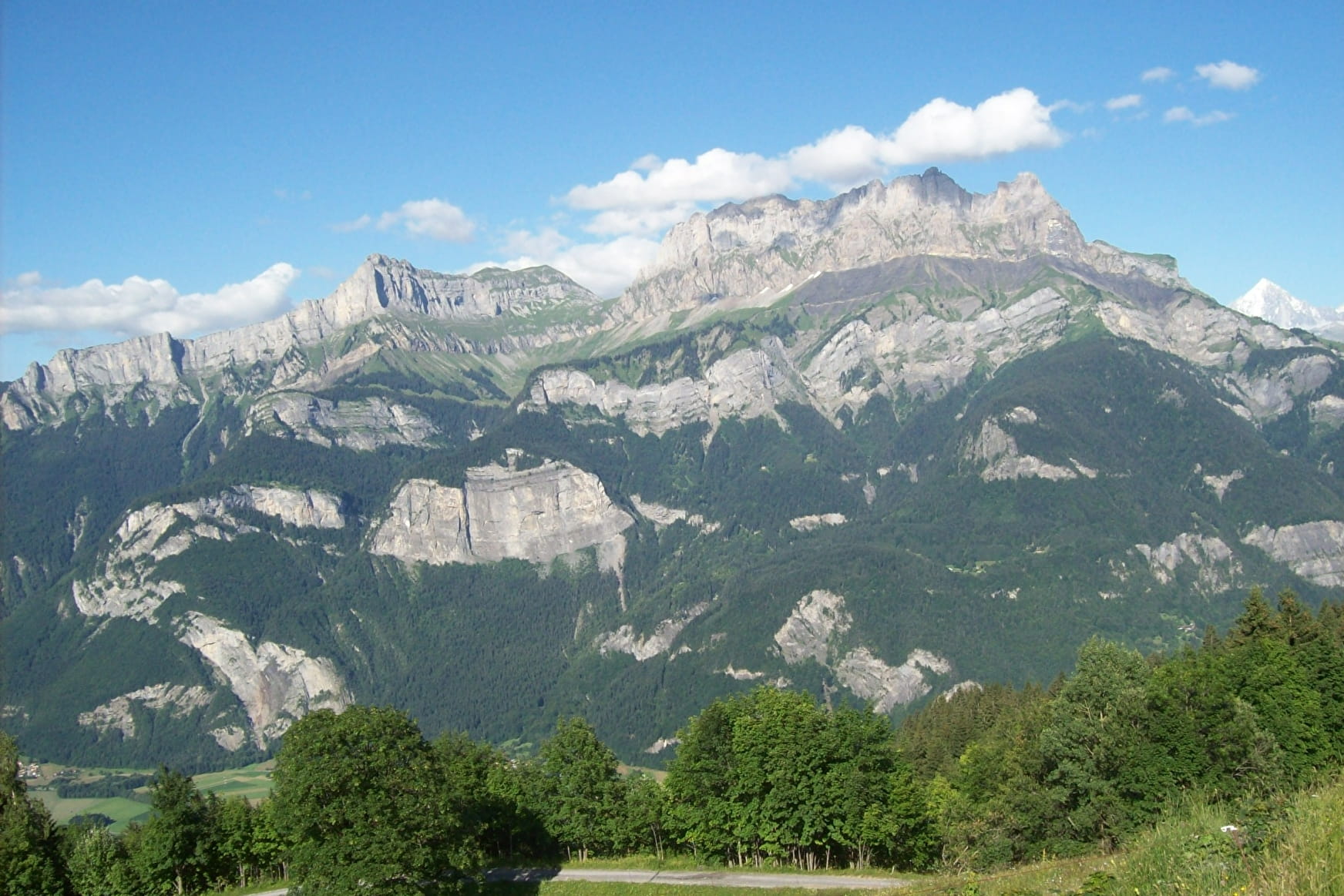
Shorter version of the classic Sallanche route, accessible via a forest trail ending at the Véran mountain pasture dominated by the steep peaks of the Croix de Fer and home to the Cascade d'Arpenaz (waterfalls).
About

Further informations
Groomed trail, Ground, Grit


Prices
Free access.
Reception
Go hiking safely!
Walking time is approximate and does not take into account break times.
The topo/step-by-step description guides you generally but does not replace a 1/25,000 hiking map or other topoguides available in our tourist office!
In Sallanches, our Office of Guides & Leaders also offers a wide choice of outings accompanied by mountain professionals providing you with complete expertise on the environment and alpine nature, inquire at the tourist office to register.
Whatever your hike, check the weather before you go. Remember to take cereal bars, sufficient water, sunglasses, sunscreen, a cap or hat, a small first aid kit, as well as clothing suitable for your outing in your backpack. depending on the season and the forecast weather.
Period of practice
Closed temporarily.
- Pets welcome
- Accommodation
- Car park
- Free car park


