The CAF refuge is kept in summer where it welcomes hikers wishing to spend a night in the mountains.
* Departures to other hikes possible:
- The Tête de Lassy: We will gain by continuing the hike up to the Tête de Lassy (+ 100 m) which offers a magnificent view of this valley always in bloom.
- Chimney of Monthieu and Tête du Colonney: obligatory passage before the climb to Colonney, Véran precedes the delicate passage of the Chimney of Monthieu.
Walking time is approximate and does not include break times.
Go on a safe hike!
This description allows you to orient yourself globally but does not replace a hiking map at 1/25000 or other topoguides that you can find in your tourist office! In Sallanches, our Office of Guides & Accompanists also offers a wide choice of outings accompanied by mountain professionals providing you with complete expertise on the environment and alpine nature, think about it!
Whatever your hike, check the weather before heading out.
Remember to take cereal bars, sufficient water, sunglasses, sunscreen, a small first-aid kit, as well as clothes suitable for your outing depending on the season in your backpack. and the forecast forecast.
- Sport
Hiking Trail: Véran via Besseray
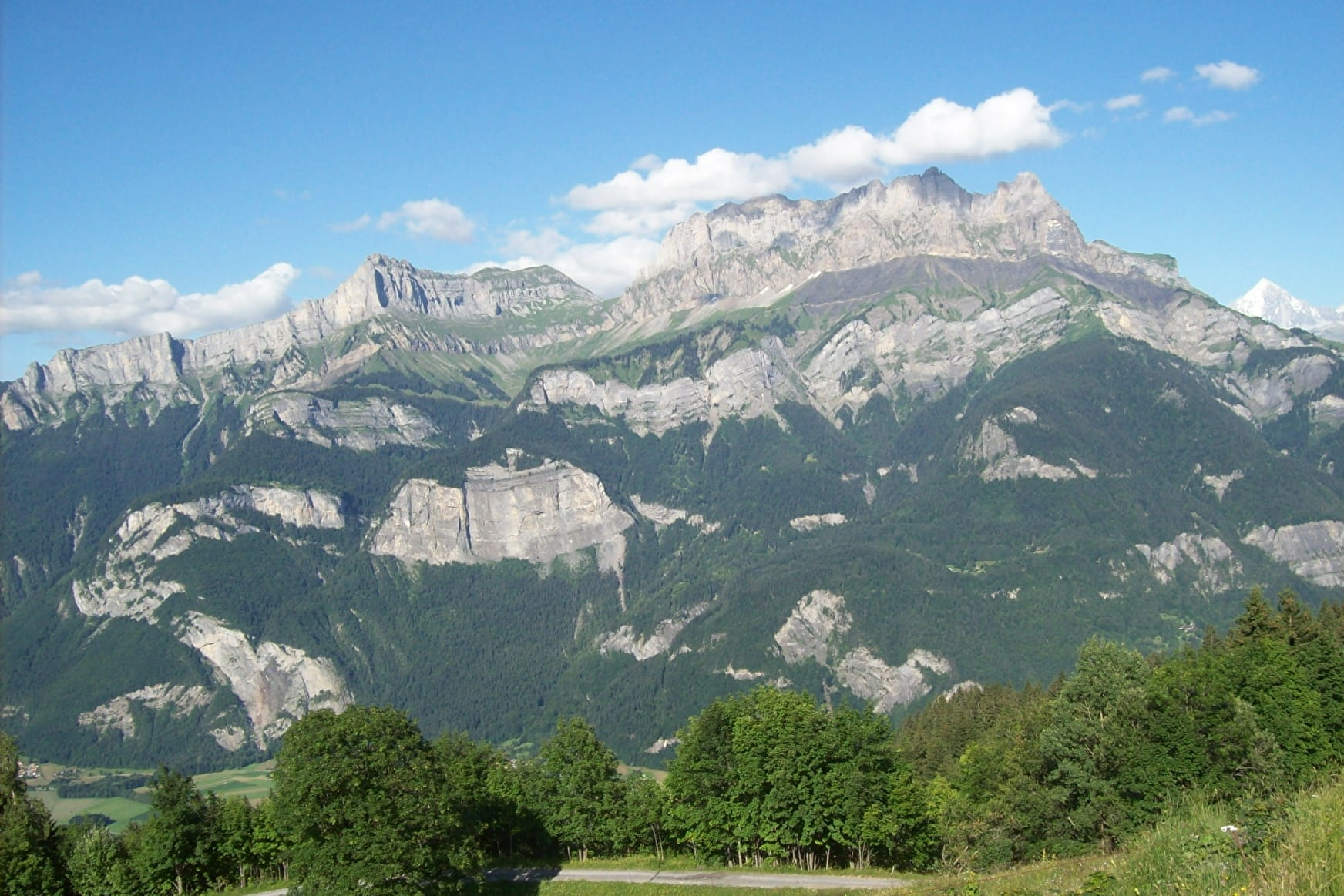
The long version of this classic hike, which climbs along a well-maintained and shady forest track all the way. At the top, the Combe de Véran extends in front of you, dominated by the vertiginous escarpments of the Croix de Fer, where a beautiful mountain pasture awaits.
About

Further informations
Grit, Groomed trail, Ground


Departure: Besseray car park in St Martin
With Mayères and Doran, this hike is one of the essentials of the Sallanches valley.
1. Follow the road to Crève Coeur, semi-asphalted which climbs up to the Grand-Arvet car park (about 1 hour 30 minutes uphill)
2.you will first pass through the Chalets des Plagnes, then Le Petit-Arvet before arriving at the Chalets du Grand Arvet where higher parking is possible for certain vehicles
3. continue this forest track, passing next to the path that takes you to the famous Sapin Président on your right, which is worth the little detour for children ;-)
4.cross the bridge that spans the Crève Coeur torrent further on, then the path climbs a little steeper for a few meters
5. this forest path continues winding through the mountain until the final clearing where you will cross the Arpenaz stream which forms the famous waterfall of the same name
6. then you will see the Véran refuge and its mountain pasture a few meters away.
Prices
Free access.
Reception
Period of practice
From 15/04 to 15/10.
Subject to favorable snow and weather conditions.
- Pets welcome
- Free car park
- Car park


