
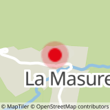
From the P7 car park, cross the hamlet of Le Miroir. At the top of the hamlet, take the path rising on your left towards La Falconnière. Once you arrive at the hamlet, which is made up of a few mountain chalets, turn right onto a flat downhill path through the Miroir forest. Before the scree, stay on the forest path on your right. Continue to the hamlet of Le Miroir.
- Sport
Hiking trail : the Falconnière
Starting from the hamlet of le Miroir, a pretty path in the forest with steep slopes. View over the whole of the upper Isère valley.
Map available in digital and paper version at the Tourist Office of the resort.
Sport Hiking trail : the Falconnière Sainte-Foy-Tarentaise
About

Signs
Yellow markings
Further informations
Stone, Ground
1/ From the P7 car park, cross the hamlet of Le Miroir.
2/ At the top of the hamlet, take the path on your left towards La Falconnière.
3/ Once you arrive at the hamlet, which is made up of a few mountain chalets, turn right onto a flat downhill path through the Miroir forest.
4/ Before the scree, stay on the forest path on your right.
5/ Continue to the hamlet of Le Miroir.
Prices
Free access.
Reception
Pets allowed on a leash only.
Period of practice
From 01/04 to 30/11.
Subject to favorable snow and weather conditions.
Services
- Pets welcome