Go hiking safely!
Walking time is approximate and does not take into account break times.
The topo/step-by-step description guides you generally but does not replace a 1/25,000 hiking map or other topoguides available in our tourist office!
In Sallanches, our Office of Guides & Leaders also offers a wide choice of outings accompanied by mountain professionals providing you with complete expertise on the environment and alpine nature, inquire at the tourist office to register.
Whatever your hike, check the weather before you go. Remember to take cereal bars, sufficient water, sunglasses, sunscreen, a cap or hat, a small first aid kit, as well as clothing suitable for your outing in your backpack. depending on the season and the forecast weather.
- Sport
Hiking Trail: Le Pont de la Flée (Flée Bridge)
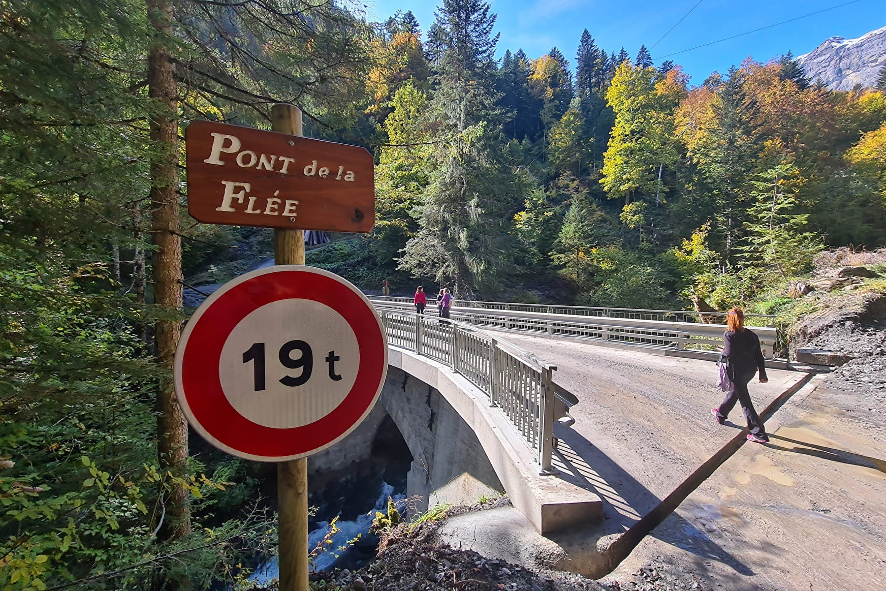
Pleasant short walk combining forest paths and clearings, dotted with pretty bridges, mountain streams and waterfalls, with Mont Blanc in the background.
Departure point for various hikes in the Aravis range.
About

Further informations
Groomed trail, Ground, Grit


Departure: Lintre - Phiterne car park
1.take the motorable path in front of the car park
2. this path climbs slightly in the woods
3. at the fork, take the path on the left which is almost flat with a beautiful panorama of the Aravis, but also behind you on the Mont-Blanc Massif and the Fiz chain.
4. continue straight ahead, the path goes a little through the forest and spans a first small bridge, the Pont de Bellecombe, with a small torrent which is very invigorating at the end of winter.
5. After approximately 45 minutes of walking, you will discover the large Pont de la Flée (renovated in 2020) with the magnificent torrent de Coeur which descends from the Gouille des Fours, via the waterfall of the same name.
6. Crossing the bridge, on the left you can stop by the side of the path so that the children can play in the small stream along the path.
7. on the left of the bridge a path leads you towards Cordon and on the right it is a departure point for many hikes in the Massif des Aravis (Pierre Fendue, Alpage de Coeur, Gouille des Fours, Mayères ...)
8. Return by the same route.
Prices
Free access.
Reception
Go hiking safely!
Walking time is approximate and does not take into account break times.
The topo/step-by-step description guides you generally but does not replace a 1/25,000 hiking map or other topoguides available in our tourist office!
In Sallanches, our Office of Guides & Leaders also offers a wide choice of outings accompanied by mountain professionals providing you with complete expertise on the environment and alpine nature, inquire at the tourist office to register.
Whatever your hike, check the weather before you go. Remember to take cereal bars, sufficient water, sunglasses, sunscreen, a cap or hat, a small first aid kit, as well as clothing suitable for your outing in your backpack. depending on the season and the forecast weather.
Period of practice
From 15/03 to 30/11.
- Pets welcome
- Car park
- Free car park


