On the route of the Tour du Mont-Blanc
At the top of the village, take the road on the right towards the Côte des
Chavants. Go up to the left on the path that leads to the Granges des Chavants
(1 256 m) 0 h 40. On the left, an itinerary goes towards the Col de Voza.
Continue to the right on a path on the side that crosses corridors to go into the forest (Vaudagne water reservoir). In a bend (1 282 m), it joins the forest track coming from Vaudagne which reaches the pass by a rather steep climb.
Routes : It is possible to go down to Vaudagne by using
the path, partly GRP variant, by the Mont-Borrel and the Bouchards. - In the same way, it is interesting to come back by the village of Vieux-Servoz and Servoz by using the GRP variant itinerary by Montcoutant and le Châtelard, on the
descent.
Other itineraries are possible from Vaudagne or Le Prarion.
More information is available at the Tourist Office or the Office de Haute-Montagne and in our trail guide.
Attention : The conditions of the trails are likely to change, think of informing you before leaving.
- Sport
Hiking trail from Les Chavants to Col de la Forclaz via Charousse
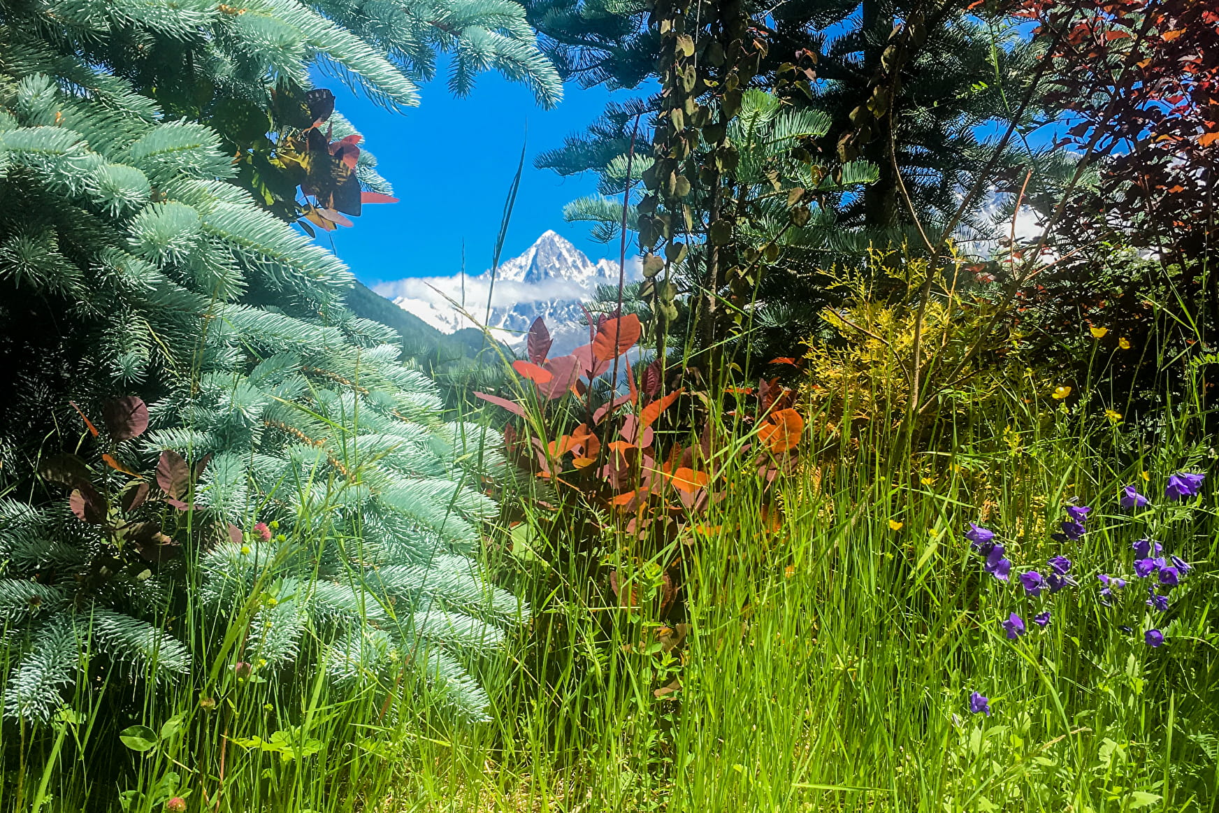
A mountain pass located in the midst of a spruce forest. This route was used by the Romans back in the 1st century to travel between the Saint-Gervais and Chamonix valleys.
Sport Hiking trail from Les Chavants to Col de la Forclaz via Charousse Les Houches
About

Further informations
Rock, Stone, Ground
Prices
Free of charge. Possible to buy one way ticket from Prarion to Les Houches.
Reception
Period of practice
From 15/06 to 25/09.
Subject to favorable snow and weather conditions.
Services
- Pets welcome
Contacts
Access
Closest bus stop : Le Prarion
Closest train stop : Viaduc Sainte-Marie train stop
Closest parking : Le Prarion / Chavants / Cote des Chavants car-parks