- Sport
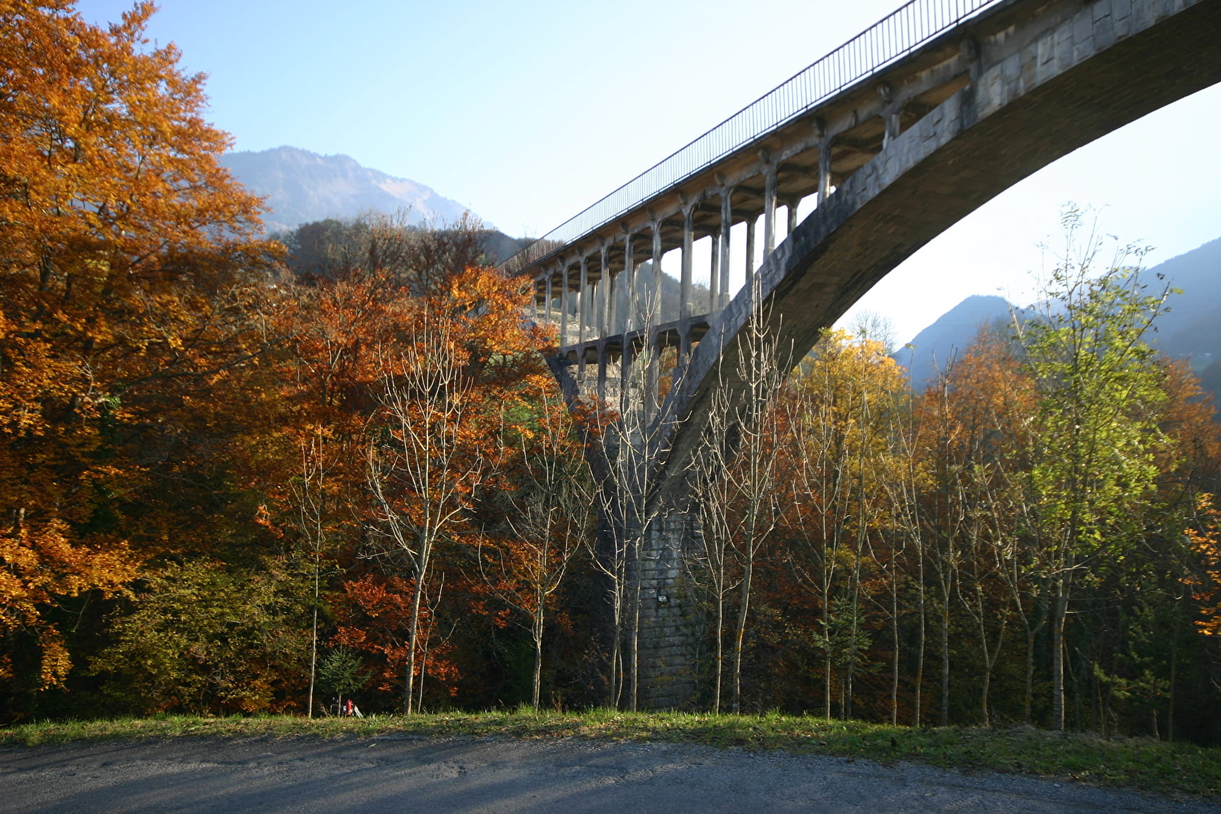
Hike: the bridge's route
About

Enter the heart of the village and on the left hand side before the school, turn right towards the Cave and Waterfall. Take a right under the Great Bridge, go down to the olds sawmill and back up to the route de Tamié. Cross it and enter la Raynoz hamlet.
Go on until the stop sign, turn left to the Frontenex bridge. Go back up the route de Tamié for 150m and follow the Entre deux nants path to your right. Walk down to the Villaret bridge. Walk up towards Glaise where you can have a sweet break at Daniel's chocolate-making workshop.
Turn left on the path going down to the postman's bridge . Go back up the route de la Sambuy. Cross it and turn left on the chemin de Pinceau and the road taking you back to your starting point.
Prices
Free access.
Reception
Period of practice
All year round.
- Pets welcome