• Sport

Hike: La Source du Biel

Sport Hike: La Source du Biel Faverges-Seythenex

About

Departing from Faverges-Seythenex (74210)
Average length : 01h00
Total elevation gain : 108m
Vertical drop : 108m
Distance : 3km
Signed walking trail
Animals allowed

Loop
Total elevation gain : 108m
Altitude max : 610m
Vertical drop : 108m

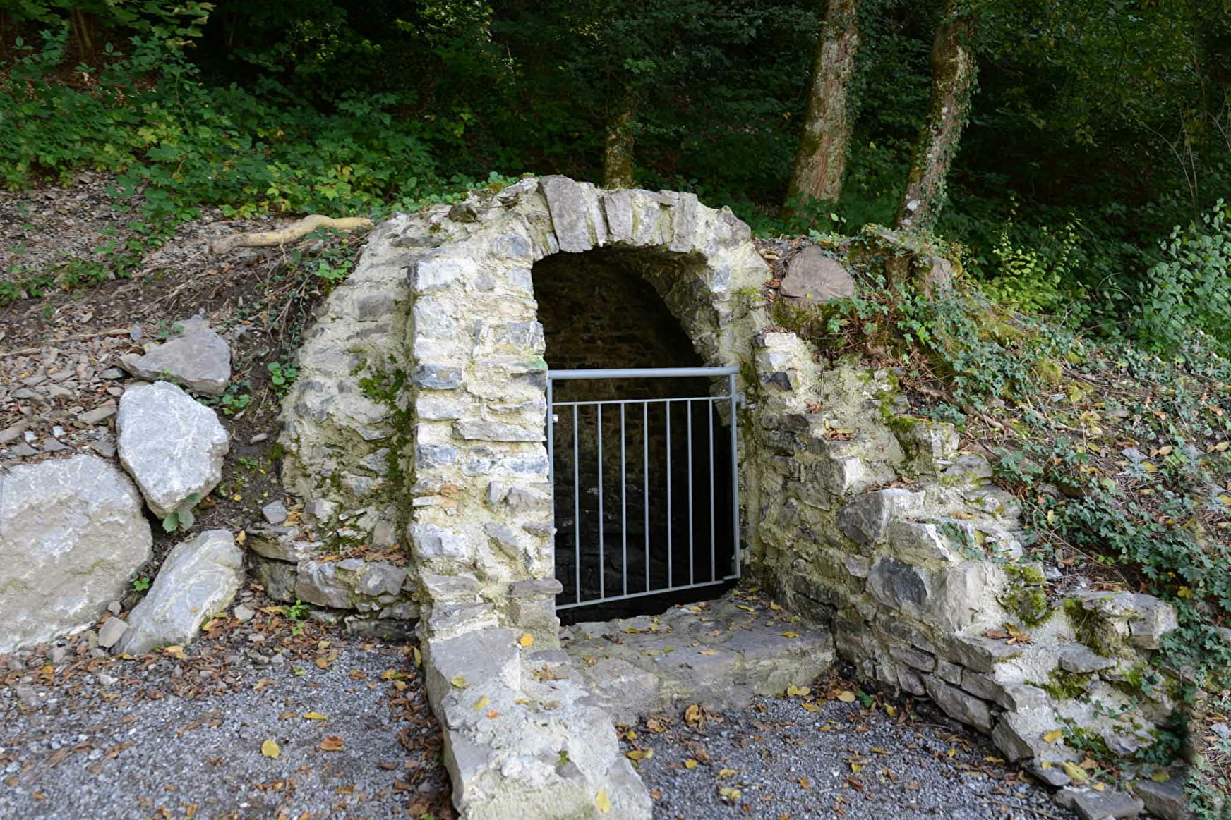
Discover one of the geosites of the Bauges mountain range! Through rue Nicolas Blanc, join the boules pitch (boulodrome) of Faverges-Seythenex. Follow the river to Favergettes bridge, take it and head towards the Lachat. An opening in the woods offers a view of the town's Castle tower and the start of the Aravis mountain range. A path goes back down to Faverges to find your starting point again.

Prices

Free access.

Reception

Animals allowed
Languages spoken : French

Period of practice

All year round.

Services
  • Pets welcome

Access

32 route d'Albertville Parking du carré des Tisserands faverges 74210 Faverges-Seythenex
Departing from : Faverges-Seythenex (74210)
Latitude : 45.746858 - Longitude : 6.297222

More informations

Information update on 24/04/2024 by Office de Tourisme des Sources du Lac d'Annecy