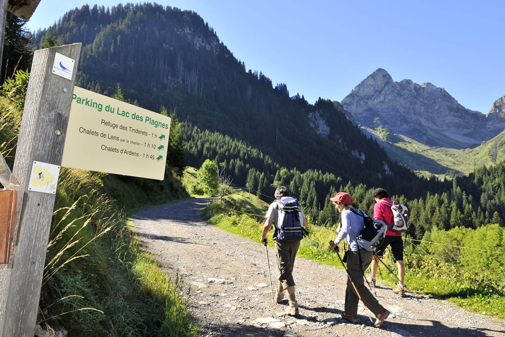
After a walk along the edge of the Lac des Plagnes, head towards Cubourré, you will discover a nice waterfall in the forest and you will reach a peaceful plateau, bathed by a stream and overlooked by the Pointe d'Entre Deux Pertuis and the Pointe de Chavache.
The Lac des Plagnes site, classified as a Unesco Geopark, is a unified geographical area whose sites and landscapes are of international geological interest. All along the route, interpretation panels invite you to understand the geological evolution of this place.
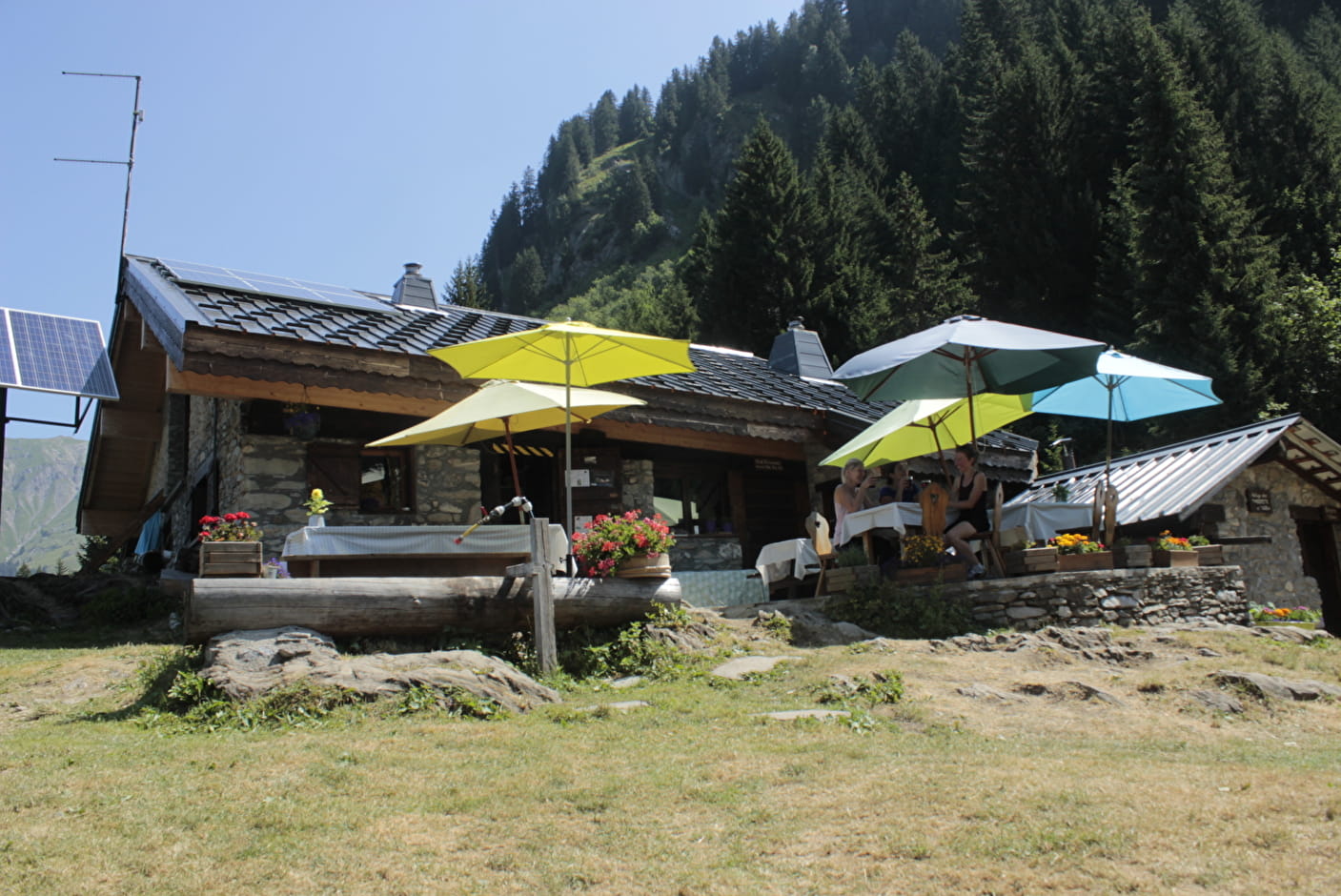
A trail leads to the Tindérêts refuge. During the summer school holidays, everyone can enjoy a gourmet break in the refuge after the climb.
- Sport
Discovery of the Lac des Plagnes Unesco Geopark site and climb to the Tindérêts refuge
A nice easy and accessible hike, ideal for a family, to discover mountain hiking in a magnificent setting and to understand the geological evolution of this Unesco Geopark site!
Sport Discovery of the Lac des Plagnes Unesco Geopark site and climb to the Tindérêts refuge Abondance
About

Signs
Departmental markings called P.D.I.P.R. on beige metal panels with green lettering.
Map references
TOP 25 IGN 3528 ET Morzine Chablais Portes du Soleil Portes du Soleil hiking map.
Topoguides references
Guide to walks and hikes in the Abondance Valley On sale at tourist offices in the Vallée d'Abondance.
Further informations
Stone, Ground
1 5


Refuge des Tindérêts is open in summer with a small restaurant on the spot at lunchtime. Half-board and accommodation on site.
In winter, the refuge is open on reservation. Snowshoe and fondue evenings.
Reception for individuals and groups.
At the departure, view of the Lac des Plagnes and observation of the local fauna and flora.
Discovery path of the flora on the way.
0/ Car park at Lac des Plagnes
1/ Go down to the edge of the lake on the dike.
2/ Take the direction "Chemin du tour du lac" passing by the right side of the lake.
3/ A little before the bridge at the end of the lake, take the path that goes up in the forest towards "Cubourré". Follow the path along the waterfall.
4/ At the top of the path, turn right towards "Refuge des Tindérêts" and continue on the path, which is flat at the start and then climbs higher and higher.
5/ At the intersection, take the path on the left towards "Refuge des Tindérêts".
6/ A path will lead you to the refuge.
7/ The return is by the same path. You can reach the car park by following the road down towards "Lac des Plagnes".
Prices
Free of charge.
Reception
Good walking shoes and sticks are required. The lake shore and the waterfall path can be muddy and very slippery, especially in spring and autumn.
Dogs must be kept on a lead (presence of herds of cows and wildlife).
Period of practice
From 01/06 to 01/11.
Subject to favorable snow and weather conditions.
Services
- Pets welcome
- Accommodation
- Restaurant
- Parking nearby
- Free car park
- Car park
- Picnic area
Contacts
Access
Head towards Lac des Plagnes from the centre of the village of Abondance.