- Sport
Combe Marto - Hike
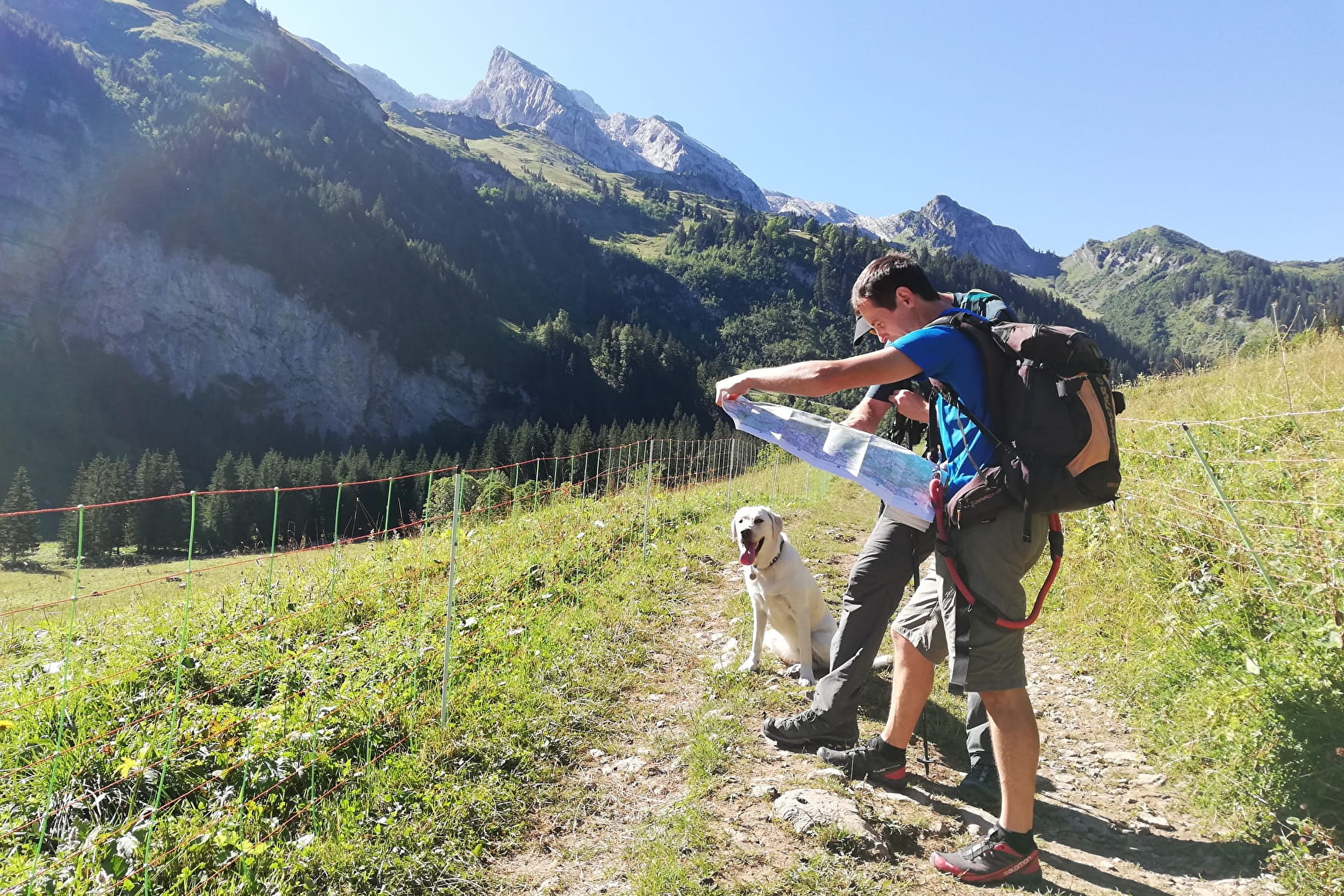
A lovely and easy hike in the alpine pasture. The track begins in forest and keeps going towar Sommier d'Aval. Open your eyes, landscapes are wonderful !
About

Signs
Trail marked with directional posts (PDIPR)
Further informations
Stone, Ground, Grit


From La Lanche to Combe Marto: 1h45
The start is at the Reposoir in the La Lanche car park. Follow the marked path "Combe d’Oulette (1h30)". After a 40-minute walk, you arrive at Sommier d’Aval in front of the "Les Cabrettes" goat farm. Follow the path that continues, cross the stream and continue until the sign "Combe d'Oulette". Turn left following the direction “Combe Marto (0h15)”. The path continues to the chalet of Combe Marto. Admire the view of Sommier upstream and downstream and on the Col des Annes.
From Combe Marto to Méry: 1 hour
Continue on the path to Méry. Arrive at the Méry pasture, enjoy a well-deserved break, you can also buy cheese sold on the farm.
From Méry to la Lanche: 1h20
Take the Méry Ouest and Le Vélard directions and descend to an altitude of 1300 m. To return to the Lanche car park, follow the "La Lanche" route.
Prices
Free of charge. Guidebook on sale at the Tourist Office.
Reception
Keep your dog on a leash, he can scare off herds and wild animals. There are sheepdogs at the Cabrettes farm in Sommier d'Aval.
Period of practice
Closed temporarily.
- Pets welcome
- Car park
- Free car park
Contacts
Access
From Cluses, take the D4 towards Le Reposoir. In the village take the left road which is located in front of the hotel / restaurant La Chartreuse. Follow the road, at the intersection continue straight ahead along the Carmel. Pass the Vallon farm on the right and continue straight until the Lanche car park.

