A pretty hike of difficult difficulty in the Mont de Grange reserve, a Natura 2000 reserve and hunting reserve, where 300 hectares of nature are preserved, a refuge for remarkable wildlife: chamois, mouflons, roe deer, stags, wild boar, marmots, golden eagles, capercaillie, etc., and a varied flora with some rare species: alpine columbine, Martagon lily, Paradise lily, bear-eared primrose.
From Plan des Feux, follow the forest track towards Louennaz, then head for the refuge de Trébentaz.
The refuge is a stage on the GR5. You can enjoy an exceptional panorama during a well-deserved lunch break!
From the hut, take a small trail to the "Altitude 2,020 m" sign, the highest point of the route and the best view of the Swiss Alps. The descent is via the Chalets d'alpage du Folliet through a combe. Return in the direction of Plan des Feux.
Departures from the village: you can start the hike from Crêt Béni or Le Moulin. Count an extra 1h45 walking time.
- Sport
Circuit de Trébentaz
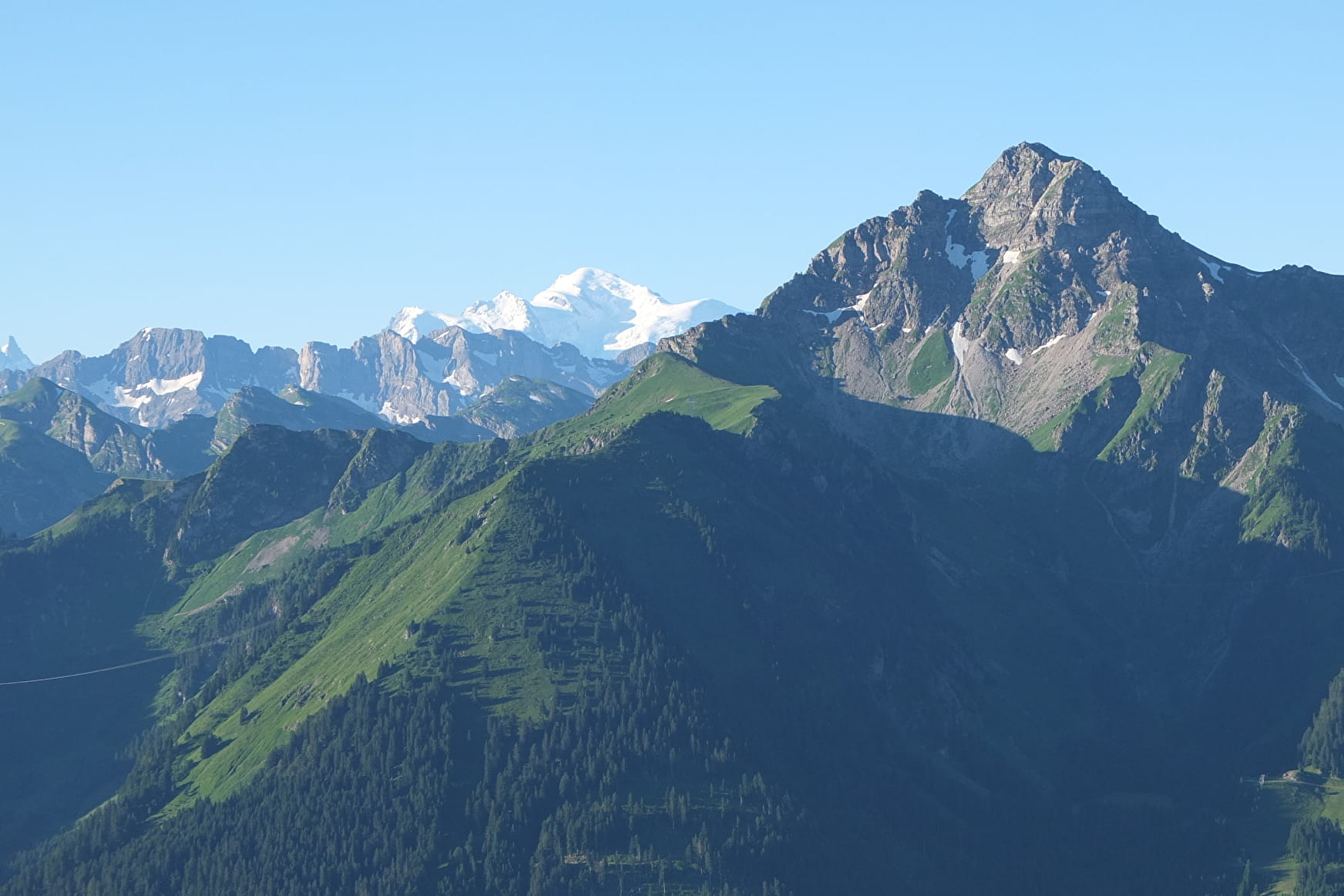
In the heart of the Mont de Grange hunting reserve, you will follow forest paths to reach the Trebentaz refuge. Magnificent views of the Valais and Vaud Swiss Alps await you.
About

Signs
Departmental markings called P.D.I.P.R. on beige metal panels with green lettering.
Map references
Portes du Soleil hiking map in France and Switzerland TOP 25 N°3528 ET Morzine Massif du Chablais Les Portes du Soleil
Topoguides references
On sale in the tourist offices of the Abondance valley.
Further informations
Stone, Ground, Grit


0/ Start: Plan des Feux.
1/ Take the forest track in the direction of Louennaz. Continue the track until you see the sign "Altitude 1550 m".
2/ Then, on the right, take the small path that leads to the refuge of Trébentaz.
3/ At the refuge, take the small path on the right, towards the sign "Altitude 2 020 m", the highest point of the route.
4/ The descent is via the Chalets du Folliet through a valley.
5/ Return to the Plan des Feux car park.
6/ Variations from the village: 1. park at the Crêt-Béni car park. Take the Guéterlaz trail at the left of the restaurant "le Clos Savoyard", leading directly to the Plan des Feux.
2. From the place called "le Moulin", take the direction of the cascade Sur Bayard by the G.R. 5, then follow "Refuge de Trébentaz".
Prices
Free access.
Reception
Pets accepted on a leash only.
Period of practice
From 01/06 to 30/09.
Accessible except during snow and depending on weather conditions.
Please check with the Tourist Office for the latest information on access conditions. This route is usually suitable for strong walkers during spring, summer, and autumn, except in adverse weather.
- Pets welcome
- Picnic area
- Parking nearby
Contacts
Access
Access from the Plan des Feux car park (free parking) by the Clos Baron road or from the village on foot, allow around 45 minutes to 1 hour to reach the car park.


