You will enjoy the various atmospheres and viewpoints on the south hillside of the Haut-Giffre Valley.
Starting from the car-park of Châtillon mountain pass, you will head to the bakery behind the small pink-walls chapel. Once at the bakery's entrance, there is a path on the left going into the woods. Quickly, you will have a view on the Marcelly Peak, Taninges and Flérier Lake, while slowly going up towards la Rivière-Enverse.
The panorama gets wider and wider, and once your are at the top of la Rivière-Enverse, you will have a view on the whole massif from the Marcelly Peak to the Criou. You are then going downhill towards the hamlet "le PLon", until the edge of the forest "les Grands Bois", where other itineraries are possible. You will walk on the same path to go back and enjoy another sight on the valley.
In summertime, the lights and the sunset behind the Marcelly Peak are beautiful.
- Sport
Chemin des Guers
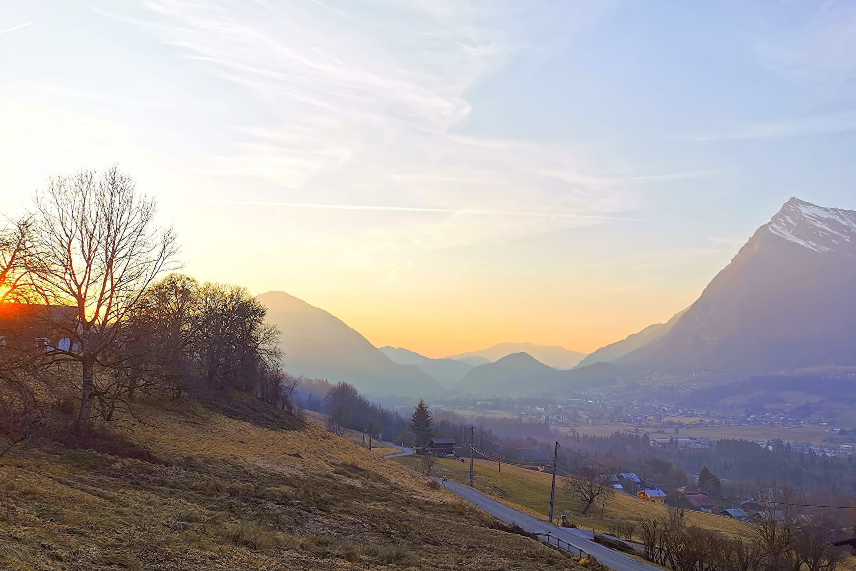
Chemin des Guers is a small path between two villages, Châtillon and la Rivière-Enverse, going on the heights but still very accessible because it is short and has a low elevation gain.
About

Further informations
Ground, Grit
1 1

Prices
Free of charge.
Reception
Period of practice
All year round.
Services
- Pets welcome
