To activate geolocation, click on the map icon.
- Sport
Chapelle et Rocher Saint-Pierre
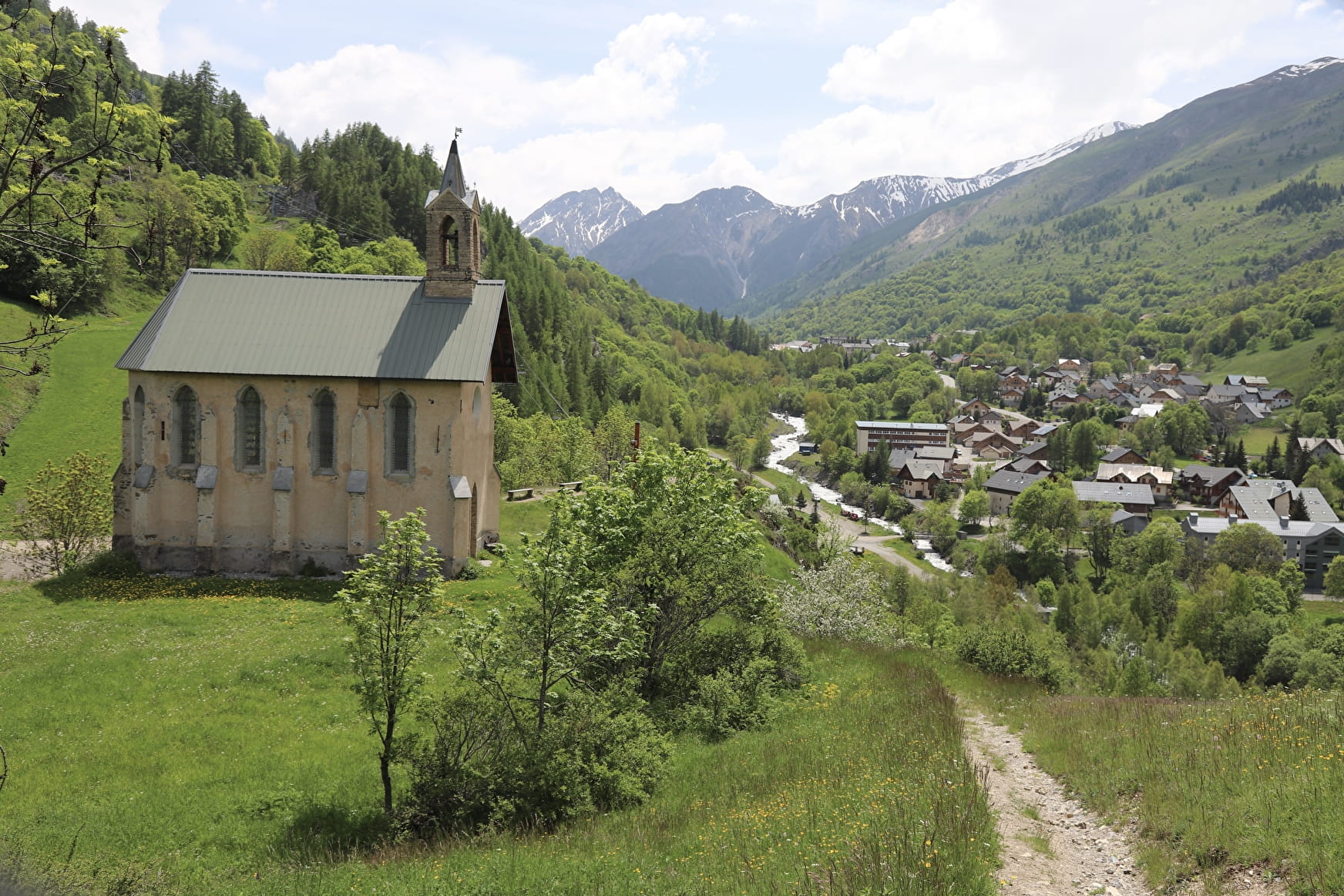
This hike, mainly in the forest, allows you to observe a magnificent panorama over the valley.
Sport Chapelle et Rocher Saint-Pierre Valloire
About

Map references
Map of Valloire's hiking and mountain biking trails, on sale at the tourist office.
Further informations
Ground
1 3


When hiking, there are a few things you can do to make your experience safer and more enjoyable. Walking poles (even on roads) improve balance in icy conditions, crampons provide grip, and regular hydration is essential.
Carry a water bottle and snacks to keep your energy up. Protect yourself from the sun with sunscreen and sunglasses. Don't forget binoculars to add a touch of observation to your adventure.
Finally, check weather conditions and avalanche risks before you set off. Inform someone of your itinerary, as communication may be limited. These small adjustments will help you make the most of your getaway.
Departure point: Parking de la Borgé. 1 - From the Pont de la Borgé, walk up the fitness trail to the riding school, then left to Chapelle Saint-Pierre. 2 - The descent takes a small path below, to the right of the chapel. This leads to the Borgé bridge.
Prices
Free access.
Reception
Period of practice
From 15/04 to 01/12.
Subject to snow conditions.
Services
- Pets welcome
- Restaurant


