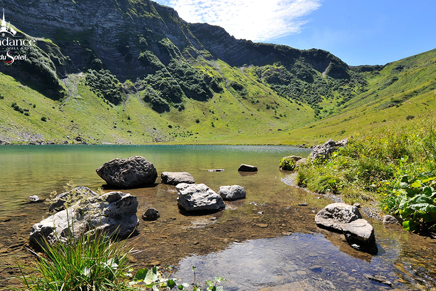
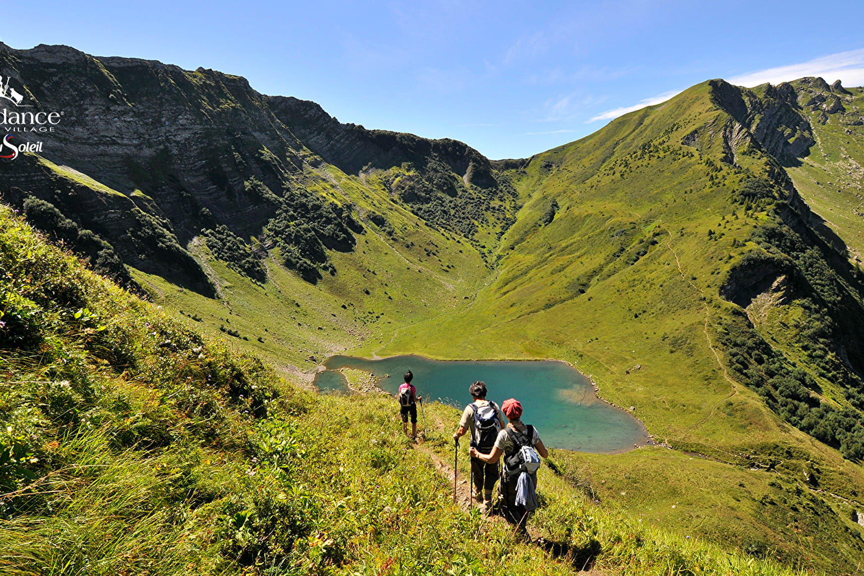
This hike, reserved for good walkers, offers a moment of freshness at its highest point: Lac de Tavaneuse, at 1805 m, is one of the jewels of the valley, its turquoise, transparent waters are awe-inspiring.
THE TRAIL THROUGH THE SERRANANTS CHALETS IS CLOSED FOR THE SUMMER 2023 DUE TO A LANDSLIDE.
Variation: take the path that climbs steeply to the left before the Serranants chalets, or start from the Plagnes lake (more gradual ascent, see itinerary).
From the Prétairié parking lot, you'll pass through an alder forest.
Follow the signs for Chalets de Tavaneuse to reach the lake.
The climb is fairly steep, with little shade, so on hot days it's best to start out cool.
A final climb takes you to the lake.
We advise you to bring a picnic lunch to enjoy this spot, where fly-fishing is available (at daybreak).
The cliffs of the Petite Pointe du Piron and the Col de Tavaneuse are overlooking the lake.
- Sport
Ascent to Lac de Tavaneuse
Discover in walking one of the most beautiful lake of the Chablais!
About

Signs
Departmental markings called P.D.I.P.R. on beige metal panels with green lettering.
Difficult passages
On the way down, the terrain can be muddy and slippery. It is recommended to pass by the Serranants chalets.
Map references
Carte des randonnées pédestres des Portes du Soleil en France et en Suisse TOP 25 N°3528 ET Morzine Massif du Chablais Les Portes du Soleil
Topoguides references
On sale at tourist offices in the Vallée d'Abondance.
Further informations
Stone, Ground


0/Departure : Prétairié. 1/ Take the trail towards Les Serranants. On the trail, fork to the left and climb the path through the alder forest. The path can be slippery. 2/ The narrow path climbs steeply towards the Tavaneuse stream. Once you reach a small promontory above the waterfall, the path climbs again, taking you to the Tavaneuse chalets. 3/ Continue beyond them to climb straight up into the combe to reach Lac de Tavaneuse.
From Lac de Tavaneuse, there are three ways back to Prétairié:
- via the 1h climb ;
- via the Entre Deux Pertuis chalets 2 hrs;
- via Lac des Plagnes 3h35.
You can reach the Col de Tavaneuse from the lake in about 20 minutes. From the pass, you will discover the mountains of the Aulps valley. Advanced hikers can reach the Roc de Tavaneuse (2516 m) in 1 hour, with a panoramic view of the Chablais mountains and the Mont Blanc.
Prices
Free access.
Reception
Mountain boots are strongly recommended.
Dogs must be kept on a leash due to the presence of wildlife and herds.
Period of practice
From 01/06 to 19/11.
Accessible outside the snow season and subject to weather conditions. Please check with the Tourist Office beforehand for current access conditions. Recommended season: spring - summer - autumn.
- Pets welcome
- Car park
- Parking nearby
- Free car park
Contacts
Access
The prétairié parking lot is located 5 minutes from the center of Abondance village, in the direction of Charmy l'Envers. The parking lot is at the end of the road.