
Departure from the Merlet park, near the entrance of the park on the Chamonix side, go up along the protection fences and take the Bel-Lachat and Brévent path on the right for 10 minutes. Leave it and go horizontally on 400 m and on the right to go up in the forest during half an hour: we find the path of Chailloux and the itinerary above.
Suggestion: Possibility to continue to Brévent over Bel-Lachat to go back down by Pierre Blanche.
Other itineraries are possible from Les Houches, Chamonix, Coupeau...
More information available at the Tourist Office or at the High Mountain Office and in our trail guide.
Attention : The conditions of the trails are likely to change, think of informing you before leaving.
- Sport
Aiguillette des Houches par Alpages de Chailloux
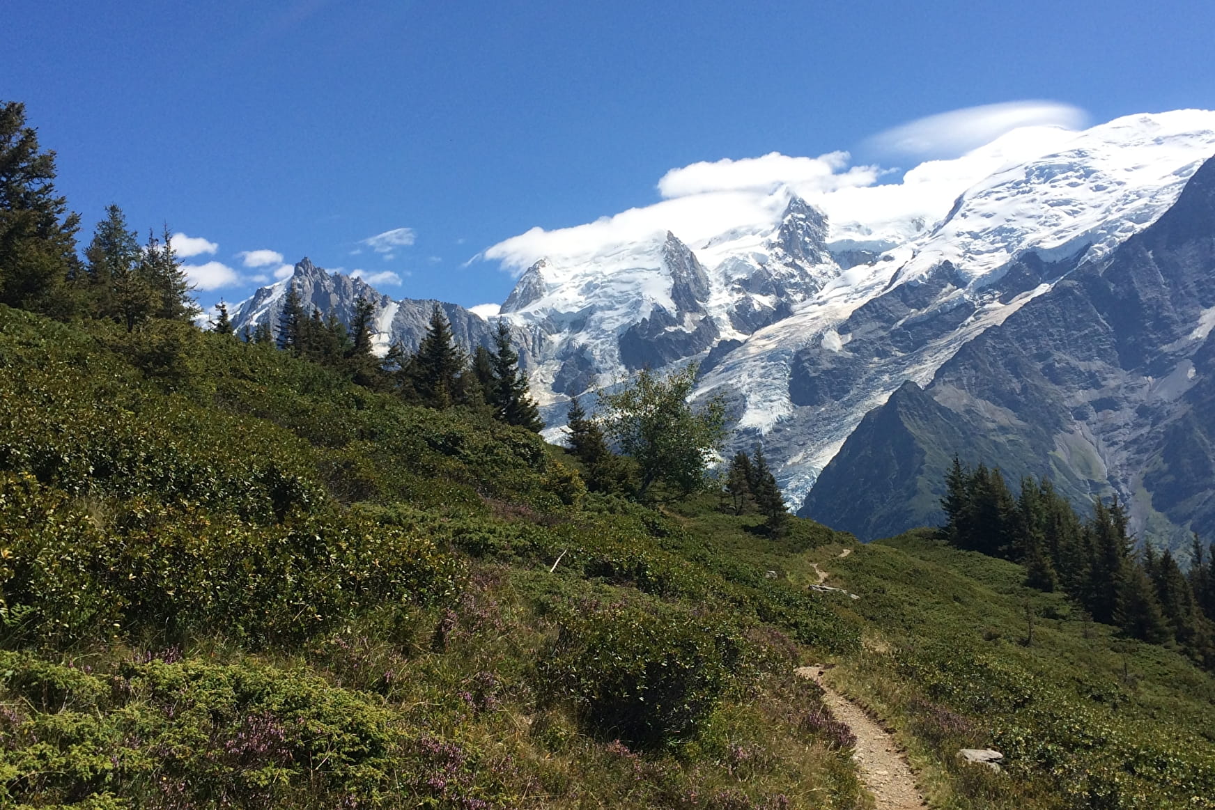
A steep walk taking you into the Carlaveyron Nature Reserve. Wonderful
sweeping views.
Sport Aiguillette des Houches par Alpages de Chailloux Les Houches
About

Signs
Follow the signs, Chalets de Chailloux and Aiguillette des Houches
Further informations
Stone, Ground
1 6


Prices
Free of charge.
Reception
Period of practice
From 31/05 to 15/10.
Subject to favorable snow and weather conditions.
Services
- Pets welcome
- Restaurant
Contacts
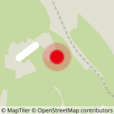
Access
Closest train stop : Les Houches train station
Closest parking : Merlet Animal Park car park


